Types of Fog

Types of Fog

Did you know that there are many different types of fog?

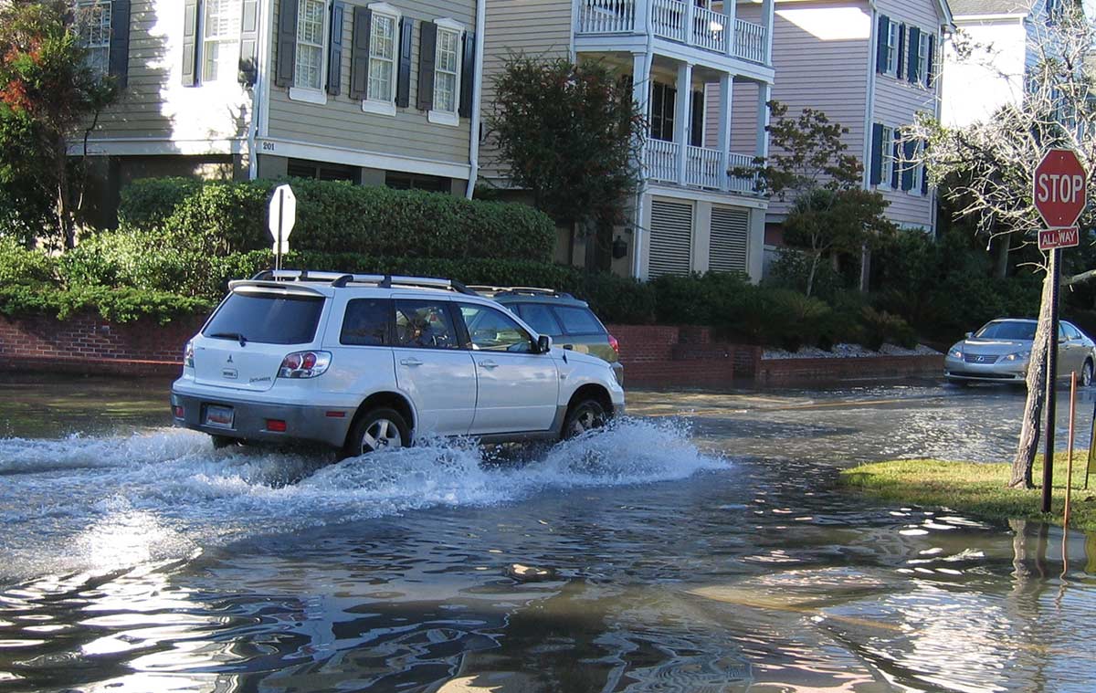
Fog can certainly spoil an otherwise perfect day on the water but even more important, it can be dangerous. Fog reduces your visibility, sometimes to near zero. Navigating without visual clues is difficult at best, and collisions with other vessels become a real possibility. If you’re close to shore, running aground is a risk.

Fog is defined as a cloud that touches the earth’s surface. If you’ve flown on an airplane through a cloud, it looks like fog outside your window. What you’re looking at are condensed water droplets—ice crystals if it’s very cold. The moisture that’s always present in the air (water vapor) has condensed, typically on microscopic particles in the air, but the droplets are so small and light that they are supported by air currents and do not fall to the ground.

The air can only “hold” so much water vapor (the gaseous form). The dew point number you often hear meteorologists refer to represents this and is the temperature air must cool to produce saturation (when the relative humidity is 100 percent). Cooler air can’t hold as much water vapor, so when cooled further, condensation (the liquid form) forms and produces some type of fog or cloud. You can also get the same effect by adding moisture to the air, which effectively increases the air’s dew point and relative humidity. Fog can form in a variety of situations and has different names depending on the circumstances.
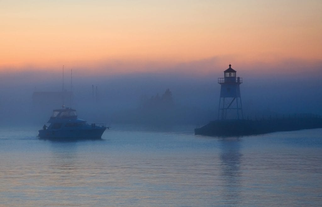
Sea fog

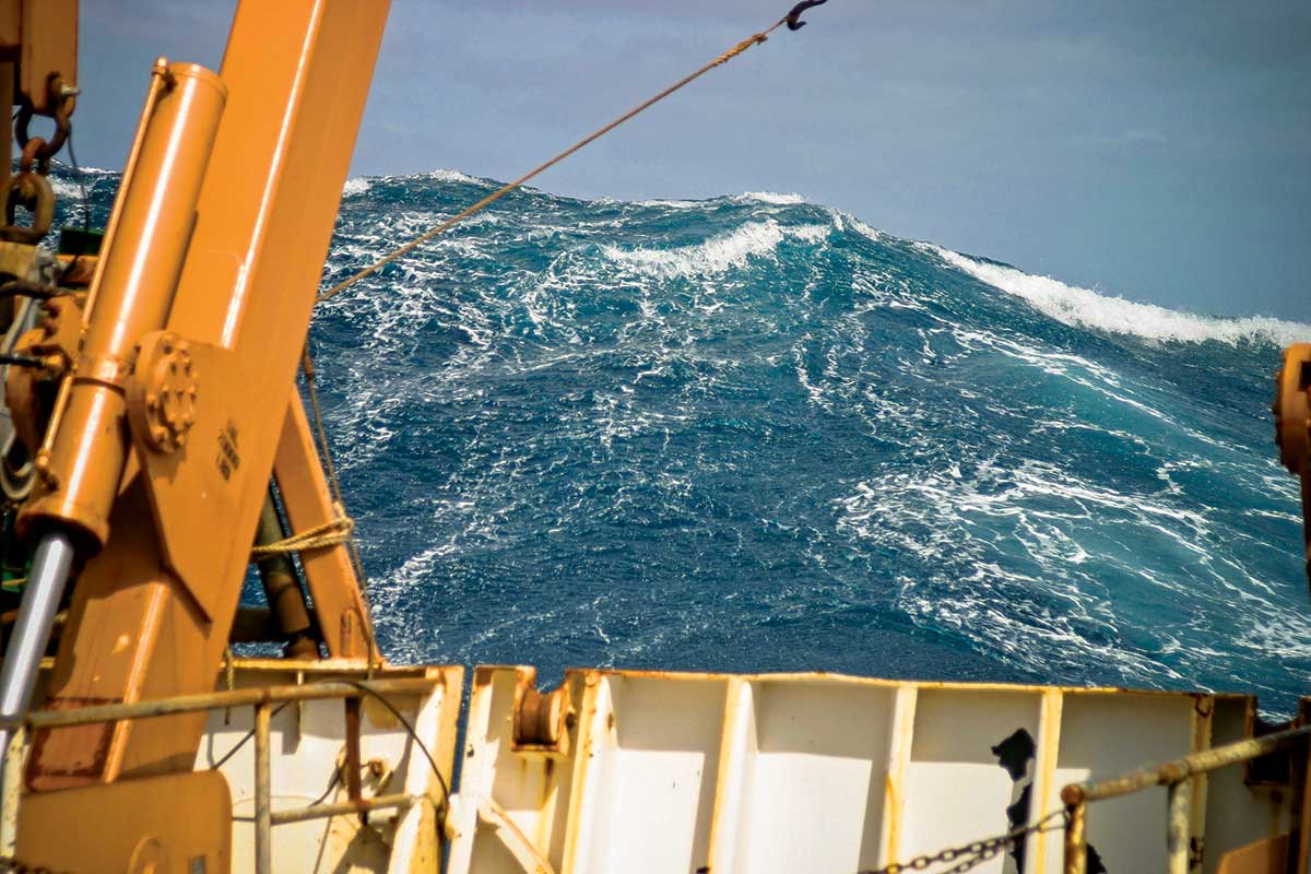
One of the types of fog boaters must often deal with sea fog, which occurs when relatively warmer air passes over a cooler water surface. The air is cooled from below and if the dew point is reached, fog forms. San Francisco is a great example of this because of the cold current off shore.

In the southeast U.S., winter and early spring are prime times for sea fog to form over coastal waters. The shallow waters near the coast are cooled by the occasional cold outbreaks from the north. The deeper waters of the central Gulf and of the Gulf Stream in the Atlantic remain warm. The air above them is very warm and moist. If the wind direction is such to move this air toward the coast (south or west in the Gulf, east in the Atlantic), it is a perfect situation for sea fog to form. However, if the wind is too strong (above 10 mph), mixing would dissipate any fog. If not, the fog can continue until the wind changes direction.
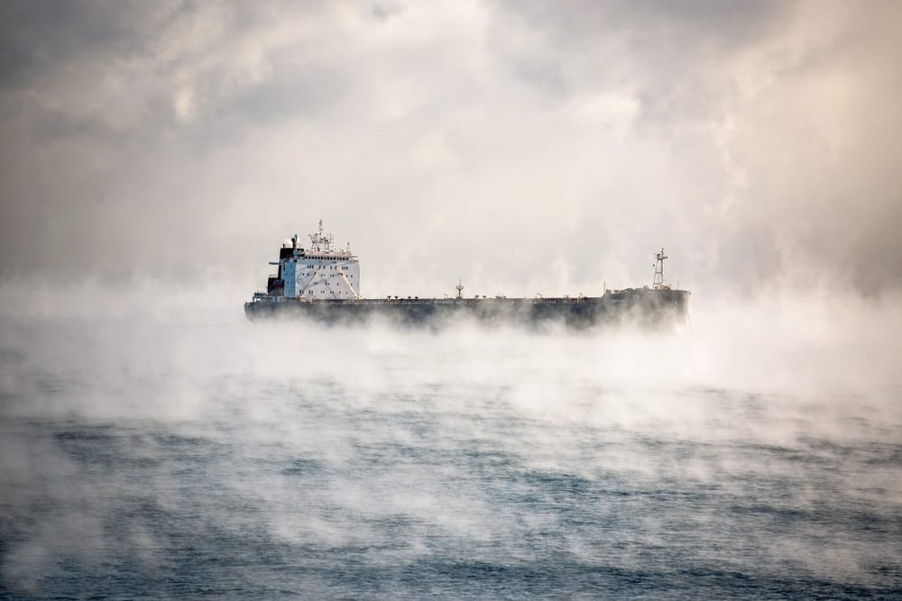
Steam fog

Sometimes in the winter, when extremely cold air moves over relatively warmer water, steam fog (aka sea smoke) forms. Water vapor evaporating from the water surface quickly condenses into streamers of fog in the cold air. Steam fog typically isn’t as deep or persistent as sea fog.

Frontal fog

Also in the winter, fog can develop with fronts, particularly warm fronts. This “frontal fog” occurs north of the surface warm front in the cold air. Frontal fog is widespread (it can cover hundreds of miles) and can occur over land or water. It will not “burn off” during the day and only moves out when the front itself moves.
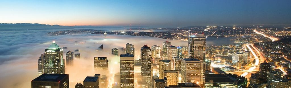
Ground fog

Usually not a problem for boaters, ground fog can be an annoyance for those living or visiting the coastal areas. Ground fog forms over land at night. On clear, calm nights, the ground surface radiates heat out into space and quickly cools. The ground cools the lowest layer of air from below, cools the air to its dew point, and fog is formed. This type of fog typically “burns off” later in the morning as the sun warms the ground. Also keep in mind that whenever there is precipitation, some fog will form. Additional moisture and cooling from falling rain or snow can make the air saturated. The fog and the precipitation itself can limit visibility.

Fog advisory

It is always prudent to check the latest marine weather forecast before heading out in your boat. A “Dense Fog Advisory” means you may run into areas of fog that can reduce visibility to one nautical mile or less. As for equipment, make sure you have a way to check the latest weather conditions and forecast. For navigation, GPS or nautical
charts can help determine your exact location and course when visible cues aren’t distinguishable. A compass will help you plot a heading. Shipboard radar is certainly useful in seeing other vessels, but keep in mind that even weather radar can’t detect fog. Make sure your navigation/running lights are working. They must be turned on when visibility is restricted by fog.

In addition, all vessels must be equipped with sound-making devices or equipment. For vessels larger than 39.4 feet (12 meters), this must be a sound signaling appliance capable of producing an efficient sound signal that’s audible for a mile with a 4- to 6-second duration. Smaller boats can use whistles or horns. Once you’re on the water, keep track of the weather because fog can form quickly over water. Also, a change in wind direction can bring an existing fog bank into your path.

If you encounter fog, don’t panic. Just follow some basic rules. First, slow down. Turn on your running lights even if it’s daytime. Start making sounds with the appropriate equipment. Listen for sounds from other boats. If your boat is equipped with radar, check it often for other vessels or obstacles. Use passengers as lookouts, particularly at the bow, especially on larger boats.

Underwater hazards like sandbars or reefs also pose a risk, more so if you’re running close to the shore. Determine your location and heading. If you are lost, stop and drop anchor, but continue to produce clearly audible sounds. In time, the fog should lift or move out.

By Ed Brotak, Southern Boating February 2019

Red Tide Updates

Red Tide is a menace with no simple solution

The infamous red tide algae on Florida’s southwest coast has died or moved offshore, so beaches are open to visitors again.

Data gathered during the 2018 event is showing why those blooms originate offshore, when they form and their routes to the shoreline. Researchers dispatched and steered a robotic minisubmarine with sensors that picked up the red tide scent way offshore and then tracked it to the coast. Computer simulations with the new data showed that the spring or summer timing of ocean currents make a big difference.

Typically, offshore loop currents and eddies push up against the West Florida continental shelf in the spring. This causes an upwelling which moves nutrients to the surface. In most years, the red tide algae (Karenia brevis) remains offshore on the bottom and, without a supply of nutrients, remains quiescent.

In 2018, however, Gulf loop currents pushed up against the shelf later than usual, in mid-July, but by then K. brevis cells were already gorging on nutrients and blooming. Ocean
currents and winds then brought the algae to the shoreline. A team led by Dr. Robert Weisberg at the College of Marine Science at the University of South Florida in St. Petersburg has published the findings in the Journal of Geophysical Research.

But below the surface, marine life took a big hit. Snook and redfish, two nearshore gamefishes, are of major concern. Recently, new initiatives were announced to help the cause.

One is Adopt a Snook, a collaboration of Coastal Conservation Association-Florida,
Mote Marine and the Florida Fish and Wildlife Conservation Commission (FWC).
The plan is to raise and release 10,000 juvenile snook into brackish tidal creeks in
2019 and 2020.

To protect stocks and to maximize future spawning success, FWC has extended the
catch-and-release calendar for snook and redfish from Pasco County south to Gordon
Pass near Naples. Until May 11th, anglers in that zone must release all snook and
redfish. After May 11th, redfish regulations return to normal and anglers may keep one
redfish between 18 and 27 inches. The regular fall snook season starts September 1st.
Anglers may keep one snook between 28 and 33 inches until the end of November.

Another initiative directly tackles water quality to benefit all marine life. Sarasota
Bay Watch (SBW) is more than doubling down on planting native clams to help filter out
unwanted nutrients that make algae blooms worse. In 2017 and 2018, SBW volunteers
planted close to 250,000 native clams in Sarasota Bay. Those clams survived the 2018
red tide bloom, giving the nonprofit a green light to proceed with a new, long-term
plan to raise funds, enlist volunteers and plant another one million clams to filter out
unwanted nutrients.

What Happened?

So far, a million pounds of decaying marine life have been disposed of, including hundreds of sea turtles, dozens of dolphins, over 100 manatees, and even a whale shark. A noticeable stench was often present, and many beach-goers fell victim to respiratory stress including breathing difficulties and coughing. And we have red tide to blame for it.

Sludgy blue-green algae invades the shores of Martin County.

What is it?

What exactly is red tide? It’s one-celled algae called Karenia brevis commonly found in the Gulf, and typical blooms (rapid increases in numbers) cause little problem. In high concentrations, however, the algae turn the water a reddish-brown color (hence the name). But because this event has nothing to do with tides, scientists prefer to call it a harmful algal bloom (HAB). Similar situations occur in other areas around the world with a variety of algal species. But this particular HAB is especially noted along the Gulf shores of Florida and Texas and can be extremely harmful.

K. brevis emits a toxin called brevetoxin, and excessive blooms can fill coastal waters with it. Shellfish are immune, but they accumulate the brevetoxin in their bodies, which makes them hazardous to eat. Other aquatic life succumb to the poisonous waters. For people, problems arise through skin irritation and rashes after swimming in it or when, according to Kristie Anders, education director of the Sanibel-Captiva Conservation Foundation, “Crashing waves turn the toxin into an aerosol which people breathe in.” Those already with chronic respiratory issues are at particular risk. There may even be long-term health effects.

To put numbers on the problem, background concentrations of K. brevis are 1,000 cells per liter of water or less. At concentrations of 5,000, shellfish, if eaten, can cause illness, and harvesting beds are closed. Fish kills and human respiratory problems can start when concentrations of this algae reach 10,000 (still classified as “Low”). This year, levels surpassed one million (“High”) at the coastline. Concentrations some distance offshore are even worse with readings in the tens of millions.

What do the experts say?

Marc Suddleson, program manager of NOAA’s National Centers for Coastal Ocean Science Monitoring and Event Response for Harmful Algal Blooms Research Program, says that the red tide algal blooms typically start in late July, often 10 to 40 miles off the coast. K. brevis can actually move, primarily with the wind and currents. Patches of the algal bloom then drift toward the shoreline where concentrations increase due to the shallower water’s lower salinity and increased nutrient levels, notes Dr. Robert Weisberg, professor and director of the University of South Florida’s Ocean Circulation Group. Occasionally, the blooms “explode,” and that’s when problems occur.

The current event actually began in October 2017. Anders points out that rainfall from Hurricane Irma in September caused nutrient-rich runoff water to flow into the estuaries and mix with offshore waters enough to stimulate a K. brevis bloom. This moved ashore and intensified and by the end of the year, dead fish were reported in Charlotte, Lee and Sarasota counties. Later in the winter, cooler water temperatures blunted the bloom, but with the warmer temperatures of summer, it came back with a vengeance.

The major questions are: What causes the explosive K. brevis blooms, and what can we do to stop them? It is widely believed that the culprit is nutrient pollution from inland agricultural runoff. There is a major push to do something about this.

What does it mean for today?

From anecdotal evidence, we know that red tide events that produce fish kills have been occurring in the Gulf for hundreds of years, even as far back as the 1700s. With limited data, we have no way to compare those events to today. In any case, Suddleson claims that red tide events now seem to start earlier, last longer, occur more frequently, and are more intense. He also adds that nutrient pollution may be a contributing factor but is not a significant factor. In fact, a long-term research project sponsored by NOAA concluded in 2014 that there is no direct link between nutrient pollution and the initiation of red tide.

So, what is the cause?

Algae are very simple, mainly aquatic plants that need sunlight, nutrients in the water and a proper water temperature and salinity, all of which vary with species. Variance in any of these factors can affect algal growth. Clouds of dust which have traveled across the Atlantic from the Sahara Desert can block some light.

Also, if one species of algae blooms earlier, it can block the sunlight from other, slower developing species. Nutrients in the water come from a variety of sources. Anders points out that large phosphate deposits and mines have existed for years in the area around the Peace River, which empties into Charlotte Harbor located north of Ft. Myers, Florida. She also notes that in this rapidly developing region, there are many sources of nutrient pollution, including lawn fertilizers.

Dr. Weisberg has his own theory on red tide events. He believes the Loop Current, which dominates the circulation of the Gulf, varies in exact location. At times, the circulation produces strong upwelling off Florida’s west coast. If this happens in the spring or summer, these nutrient-rich bottom waters feed other types of algae which can then suppress K. brevis. Red tide events occur when K. brevis outcompetes other algae. Using past data on Loop Current position and red tide events, Dr. Weisberg noted a near perfect correlation, and the model is used to predict future outbreaks. Once an event is ongoing, Weisberg’s group sends out forecasts of movement going out for several days

How will we know what’s going on?

In terms of the water itself, one lab-based study showed that the K. brevis algae had an increased growth rate when both the water temperature and carbon dioxide level in the water increased. We know that both of these are occurring. However, Suddleson points out that there is a limit to this and if water temperatures continue to increase, K. brevis may not fare well.

Red tide is monitored closely. NOAA uses satellite observations to detect K. brevis blooms while they are still far offshore. Water samples along the coast are analyzed for the algae’s presence. When an event has developed, NOAA will issue forecasts twice weekly which include actual conditions and expected impacts. The Florida Fish and Wildlife Conservation Commission sends out a weekly Red Tide Status update which includes a forecast done in conjunction with USF.

Although scientists may disagree about the impact of agricultural runoff for red tide but can agree that red tide causes additional problems. Blue-green algae outbreaks and red tide should be controlled. Red tide is an extremely complex problem still being studied for both its cause and the solution, neither of which offers simple answers.

By Ed Brotak, Southern Boating October 2018

Hurricane Lessons Learned

The 2017 hurricane season brought larger and more frequent storms that caused significantly more damage than anyone thought possible. It also brought some hurricane lessons.

The latter days of summer still bring warm temperatures and typically good weather to enjoy being near, on or in the water. But they can also bring great storms in the form of hurricanes. In fact, although the official hurricane season is from June 1st to November 30th, the peak of the season is from mid-August to mid-September, when ocean temperatures are at their highest—fuel for hurricane development. What can we learn from the hurricane lessons of 2017?

What’s in a name?

A hurricane is a type of tropical cyclone, i.e., a low-pressure area that only forms over warm water. It contains bands of showers and thunderstorms that rotate counterclockwise around a center (the eye) and extend outward for as much as several hundred miles.

Actually, the term “hurricane” indicates the strength of the storm. Hurricanes have sustained winds greater than 73 mph. Systems with winds between 39 and 73 mph are classified as tropical storms, and those with winds less than 39 mph are called tropical depressions. Hurricanes themselves are also ranked in terms of strength according to the Saffir-Simpson Scale—categories of one at the low end to five at the high end with sustained winds exceeding 156 mph. (Gusts can approach 200 mph.)


The greatest threat to ships at sea comes from the strong winds and the high waves they can generate. Stronger and larger storms will produce the highest waves. In fact, measured waves have exceeded 50 feet and, theoretically, a rogue wave in that environment could exceed 100 feet. In those conditions, a boat can easily capsize and sink, and keep in mind that rescue efforts are nearly impossible.

Skip the beach

For beachgoers, even if the storm is far off, swells can make for dangerous surf conditions. As the storm nears, waves become higher and more frequent, and strong rip currents can be expected. Along the coast, the greatest threat comes from the strong winds and, especially, storm-induced high tides. “Storm surge” is an inland rush of water caused by strong onshore winds. High waves on top of this surge can literally smash structures. Storm surge is highest with stronger and larger storms and maximum where the center crosses the coast. Hurricane Katrina produced a storm surge of nearly 28 feet at Pass Christian on the Mississippi Gulf coast, and the surge pushed inland at least six miles.

Even boats at a dock face risks. The risk magnifies with the strength of the storm and the proximity of the eye. Strong winds and high waves can batter a boat against the dock itself, and restraining ropes can break under great stress. A significant storm surge can drive a vessel far inland and as the storm moves by, the wind direction will change by as much as 180 degrees. A more sheltered, inland port is a better alternative.

As you move away from the immediate coast, wind can still do damage. In particular, trees are broken or uprooted, which can take out power lines. That was the case in Puerto Rico with Hurricane Maria. In addition, there is also a significant concern with the heavy rain that can produce inland flooding. Hurricane Harvey, for example, dumped over 60 inches of rain in the Houston, Texas, area last September causing the catastrophic flooding there. If this wasn’t enough, tropical cyclones, when they start affecting land, can generate tornadoes and are most likely to occur in the right front quadrant of the storm. Hurricane Harvey produced 57 tornadoes.

Be in the Know

There is only one official source of hurricane information: The National Hurricane Center (NHC) in Miami, Florida. Media outlets and even private weather companies get their information from the NHC. The Center will send out storm bulletins every six hours or every three hours if the storm is endangering land. The Tropical Cyclone Public Advisory gives a plain language account of the storm, including current strength and location and forecasts for future strength and movement out to five days. This information is also provided in map form. The Forecast Advisory adds marine information for areas predicted to be in the path of 64-, 50-, and 34-knot winds and 12-foot seas.

The NHC will issue specific watches or warnings as needed. Watches mean dangerous conditions are possible within 48 hours and to take necessary precautions. Warnings mean a more definite and immediate threat (within 36 hours); seek shelter or evacuate if ordered. Besides tropical storm or hurricane watches and warnings, a storm surge watch or warning is for “life-threatening inundation from rising water,” and an extreme wind warning is for winds in excess of 114 mph. All of this information is also provided by local National Weather Service (NWS) offices. For marine interests, consult the marine forecasts issued by the NWS.

Flagged as Dangerous

There is a more traditional warning system used at select small boat stations along the coast: the U.S. Coast Guard’s warning display flags. Tropical storm warnings are indicated by a single red flag with a black rectangle in the middle. Hurricane warnings are represented by two of those flags. For more information on Marine Safety during hurricane season, go to nhc.noaa.gov/prepare/marine.php

By Ed Brotak Southern Boating August 2018

Sargassum Weed

It ensnares fishing lines, can stop props and makes for unsightly and seriously smelly beachfront. In recent years, huge quantities of sargassum weed have floated into the Caribbean creating problems for the region’s visitors and residents alike both on sea and shore.

This year’s sargassum bloom is especially massive, perhaps the heaviest on record, leading everyone from island tourist boards to marine researchers to seek out a solution to this problem.

“We knew the sargassum was going to be especially thick this year when we saw large patches in Dominica in February,” says Joan Conover, the Hampton, VA-based cruising station coordinator for the Seven Seas Cruising Association, who sails the Caribbean each winter with her husband, Greg, and sons aboard their Morgan 51, Growltiger.

The weed does have a positive side. One is serving as a nursery habitat for endangered species, such as sea turtles, but on the downside, sargassum is a navigational hazard to vessels.

“Sail when there is wind, which breaks up the mats of sargassum,” Conover says. “Back up to clear props. Don’t use reverse-osmosis systems in weed-filled bays because the hydrogen sulfide gas emitted by the weed can destroy membranes and filters. Finally, go carefully through big mats. We found nylon rope in one.”

Conover and many other cruisers are helping researchers learn more about sargassum to ultimately aid in its control. To assist, cruisers can report sightings to the University of Southern Mississippi’s Gulf Coast Research Lab.

In the meantime, plot the most weed-free route by checking out the University of South Florida’s Optical Oceanography Laboratory’s satellite-based Sargassum Watch System, which provides satellite images of weed plumes in near-real time.

By Carol Bareuther, Southern Boating August 2018

More Caribbean Updates:

Carriacou Regatta

USVI Open 

Tiny Giants of the Sea

Nearly invisible marine microbes play a vital role in life at sea and on land.

Stories of mysterious creatures lurking deep in the sea have long captivated our imaginations and stirred our curiosity. Bigelow Laboratory for Ocean Sciences in East Boothbay, Maine, is on a mission to show that truth is stranger than fiction—in a big way.

Looks can be deceiving: Pteropods are actually sea snails.

Tiny Giants: Marine Microbes Revealed on a Grand Scale is a photographic adventure featuring colorized and enlarged images of nearly invisible plants and animals that dominate the ocean. Their beauty will leave you awestruck. “Our idea behind the Tiny Giants images was to pique people’s imaginations about the invisible creatures that we study that are vital to our very existence,” says Dr. Benjamin Twining, director of research and education at Bigelow Laboratory.

Ostracods–tiny shrimplike crustaceans are also known as sea fireflies–give off a bright blue light.

But how do you stir up interest and raise awareness about organisms so small that hundreds of thousands can live in just a single drop of seawater? You make the invisible visible. Dr. Peter Countway, Laura Lubelczyk and other Bigelow Laboratory researchers used three types of microscopes—compound-light, confocal and scanning electron—to capture 18 incredible images of marine microbes. Each of the high-powered microscopes provides a unique perspective and allows us to peer into this invisible world, but it takes a skilled and practiced hand to create the magical images seen in Tiny Giants. The incredible magnifications—some of the images are as big as four feet wide by five feet tall—offer a unique glimpse at the intricacies of these marine-dwelling microbes; their exquisite shapes and patterns appear otherworldly.

Copepods make up more than 21,000 species. Photo credit: Dr. Peter Countway, Bigelow Laboratory for Ocean Sciences with funding provided by the National Science Foundation.

Marine microbes are the foundation of life on Earth. They produce half of the oxygen we breathe and are the base of the food chain. In fact, 98 percent of the ocean’s biomass is made up of microbial life. Given their vital role in planetary processes and balance, it is important that we understand how ocean health issues such as ocean acidification and rising sea temperatures affect these organisms. In addition, marine microbes may lead to new advances in pharmaceuticals, fuel sources and nutritional supplements. Bigelow Laboratory is the only independent basic research institution in the world that focuses on microbial oceanography, and its researchers want to spread the word about the world-class discoveries taking place at their state-of-the-art campus.

Tiny Giants has been making the rounds throughout the northeast U.S. since January 2015. The exhibit has been featured in libraries, schools and art galleries. The response has been as impressive as the images themselves. “It was delightful to wander amongst the crowd and hear people exclaim about the beauty and wonder of marine microbes,” said Darlene Trew Crist, Director of Communications at Bigelow Laboratory, at the sold-out showing at District Hall in Boston, Massachusetts. Tiny Giants had a full summer schedule in 2016 including a World Oceans Day Summit on June 8th in Newport, Rhode Island, presented by Sailors for the Sea and Bigelow Laboratory for Ocean Sciences.

Diatoms–single-celled algae–are giants of the microbial world. Photo credit: Dr. Peter Countway, Bigelow Laboratory for Ocean Sciences with funding provided by the National Science Foundation

To promote unique, exciting ways to teach and learn, the Tiny Giants exhibit resided at Colby College in Waterville, Maine, throughout the 2015 fall semester. This innovative collaboration was used not only in biology and environmental science departments but also in theater, dance, art, and humanities. Educators used the exhibit to connect concepts of invisible marine microbes to their coursework. “We were excited to show the images in the Tiny Giants exhibition on campus last fall,” said Lori G. Kletzer, Colby Provost and Dean of Faculty. “Colby’s strategic partnership with Bigelow Laboratory provides world-class opportunities in marine science and climate science for our students—we knew that. The unique aesthetic for examining the natural microbial world through these photos completely reinforced the interdisciplinary approach that both our institutions value so highly.”

The wonders of the microscopic world aren’t reserved for scientists. With Tiny Giants, Bigelow Laboratory is making the mysterious marine underworld accessible to everybody. Next time you are out on the water, take a moment to think about the organized and diverse communities of tiny sea creatures that make our life possible. Check out the Tiny Giants schedule to see if there is an event or exhibit in your area at tinygiants.bigelow.org/schedule.html. Learn more about marine microbes and the cutting-edge research going on at Bigelow Laboratory for Ocean Sciences at bigelow.org.

— By Jaime Blair, Communications Consultant at Bigelow Laboratory — Article courtesy of Sailors for the SeaSouthern Boating Magazine April 2017

Exploring the Unexplored Oceans

It is estimated that 95 percent of the earth’s oceans remain unexplored. No wonder since the ocean covers 140 million square miles of the earth’s surface with an average depth of 12,000 feet.

The ocean floor’s deepest point is 36,000 feet below the water’s surface in the western Pacific Ocean and is called the Challenger Deep section of the Mariana Trench. It is extremely inhospitable down there. There’s virtually no light, water temperatures are near freezing and the pressure is a crushing 1,000 times what it is at sea level. But, in order to manage and protect ocean resources, we must learn what’s far below the surface.

The U.S. government agency that does much of the basic research for both the atmosphere and the oceans is the National Oceanic and Atmospheric Administration (NOAA) under the Department of Commerce. One branch of NOAA is the Office of Ocean Exploration and Research (OER), which is touted as “the only federal organization dedicated to exploring the unknown reaches of our ocean”. To support these endeavors, the Office of Marine and Aviation Operations (OMAO) supplies the ships and aircraft needed as well as the personnel to run them (omao.noaa.gov/).

OMAO is staffed by civilians and also has an enlisted contingent. The NOAA Commissioned Officer Corps—simply known as NOAA Corps—is one of the nation’s seven uniformed services. Prior to admission, candidates must possess a baccalaureate degree preferably in math, science or engineering. Basic training in seamanship is held in conjunction with the Coast Guard’s officer training program. After successful basic training and commissioning, officers receive their first ship assignment based on their qualifications and service needs. The 321 officers of the NOAA Corps are seamen and scientists and support NOAA’s wide variety of oceanic research efforts.

One of the primary duties of NOAA Corps officers is to operate NOAA’s research aircraft and ships. NOAA has nine manned aircraft which are stationed at MacDill AFB in Tampa, Florida. Two Lockheed WP-3D aircraft are designated “Hurricane Hunters” and fly into these great storms to gather vital data. Other smaller aircraft fly a variety of scientific missions across the country. NOAA also has drones it uses for monitoring wildlife.

NOAA has a fleet of 16 ships, the nation’s largest fleet of oceanographic research and survey ships, which are administered by the OMAO. These ships are engaged in fisheries surveys, hydrographic surveys and oceanographic research. Operations centers are located in Norfolk, Virginia, Newport, Oregon, and Honolulu, Hawaii. The ships are run by NOAA Corps officers with some civilian seamen completing the crew.

The pride of the NOAA fleet is the NOAA ship Okeanos Explorer, dubbed “America’s ship for ocean exploration”. A former U.S. Navy ship, Okeanos was refitted for oceanographic exploration and commissioned in 2008. The name was actually the winning entry in NOAA’s nationwide ship-naming contest and according to Greek cosmology, Okeanos was the river/ocean that encircled the world. The 224-foot Okeanos Explorer has a crew of 27 and typically sails with 19 scientists on board. These are OER research missions, and NOAA wants to involve as many experts as possible. Interested scientists can apply for the limited number of positions actually on board the ship. But much of the expert input on missions comes from teams of scientists at various Exploration Command Centers with the Inner Space Center at the University of Rhode Island Bay Campus being the primary one.

Okeanos Explorer is equipped with a high-bandwidth satellite communications system (the large satellite dome on the ship) which allows rapid data transmission. Scientists on shore can then have “telepresence”, which enables them to view Okeanos’ findings almost instantaneously and communicate back to the ship as necessary while helping to direct the mission.

Exploration missions often take the vessel to remote ocean areas. With high-powered sonar equipment, a major objective of the research cruises is to map previously unknown sections of the sea floor. For a closer examination of deep water sites, Okeanos has two remotely operated vehicles (ROVs), Deep Discoverer (D2) and its sister vehicle Seirios. With 20 LED lights and 9 video cameras, the ROVs can plunge to depths of nearly four miles and send back high-definition video, which is live-streamed to scientists on the ship and back on shore.

In 2016, the Okeanos Explorer explored the Northern Marianas Islands, Guam and the Marianas Trench Marine National Monument. Scientists on board and connected remotely could view previously unexplored areas of the seafloor. They observed a number of new animal species and unusual geological features. This year, the Okeanos Explorer will again be involved with Project CAPSTONE, a multi-year scientific investigation of deep-water, U.S.-protected marine areas in the central and western Pacific Ocean. These include national marine sanctuaries and marine national monuments, the underwater equivalents of national parks. Again, the goal will be undersea mapping and further explorations of biological and geological features with the ROVs.

When a mission is ongoing, the video is live streamed and broadcast through standard Internet connections.

If you’d like take part in an ongoing mission, go to the NOAA Ocean Explorer website oceanexplorer.noaa.gov. The live video feeds on the last mission generated a record-breaking 3.1 million views over the course of the expedition.

— By Ed Brotak, Southern Boating Magazine March 2017

Sea Levels Rise

Sea levels are rising across the globe, leading to increased concern for the safety of coastal communities and wildlife populations.

Sea levels are rising as a direct result of the earth’s warming. Due to this warming, the permanent ice sheets over Greenland and Antarctica are melting, which means less sea ice (ice floating in the polar ocean areas) is being formed each winter. Further complicating the matter, the warmer the water the more it expands, which also takes up an increased amount of space. The melting and loss of sea ice has accelerated over the last decade and is now believed to be one of main causes of increasing sea levels. This is irrefutable evidence of global warming, which isn’t limited to one incident but marks a trend of increasing ocean temperatures and levels.

Global average absolute sea level change from 1880 to 2015. Photo: CSIRO / NOAA

According to the National Atmospheric and Oceanic Agency’s (NOAA) State of the Climate Report (ncdc.noaa.gov/sotc), 2015 was the second warmest year on record for the U.S. The report stated that it was “the 19th consecutive year the annual average temperature exceeded the 20th century average”. Not only were global temperatures measured at the highest level ever recorded, but they also broke the previous temperature records by an unprecedented margin. And after the data points for 2016 temperatures are finalized, we may find that 2016 was even warmer than 2015. Overall, the earth has been warming since comprehensive temperature records have been kept in 1880, and this warming rate has increased in recent decades. Global warming has been attributed to the actions of humanity, particularly those that have increased the global quantities of greenhouse gases such as carbon dioxide. For example, prior to the Industrial Revolution in the 18th century, atmospheric carbon dioxide levels were about 280 ppm (parts per million). Today, that level rests at about 400 ppm.

Global warming is an issue for both the Northern and Southern Hemispheres. The Arctic region is facing the harshest increases in temperature. In 2006, NOAA started issuing an annual Arctic Report Card documenting observed weather conditions. The 2016 report is particularly disturbing. The average annual air temperature over land areas was the highest on record with a 6 degrees F increase since 1900, while the Arctic Ocean temperatures were 9 degrees F above average in August. Spring snow cover was at a record low in the North American Arctic, as was sea ice in the fall. On December 22, 2016, a weather buoy just 90 miles south of the North Pole registered a temperature of 32 degrees F, nearly 50 degrees above normal. Even more disturbing, one study suggests that the Greenland ice sheet lost one trillion tons of ice between 2011 and 2014 alone.

There are two ways to accurately measure sea level. Tide gauges have recorded local sea levels for more than a century. However, the old ruler-type gauges are giving way to modern microwave sensor stations. And in the past 20 years, satellite measurements have been available that use laser altimeters. According to NOAA, the sea level has been rising for the last 100 years (corresponding to an increase in the earth’s temperature), and the rate of rise has been increasing in recent decades. Globally, the overall rise in sea level is eight inches, which may not sound like much, so for reference consider that nearly 70 percent of the earth’s surface is covered by water—an estimated 3.5 x 10²⁰ gallons. Also keep in mind that the surface of the ocean isn’t simply flat since the moon’s gravitation causes a significant bulge that moves with the earth’s rotation and causes the tides. Local currents and winds also distort sea level.

Why should we be worried about rising sea levels? About 40 percent of the U.S. population lives in coastal areas, all of which are at risk of flooding. According to NOAA, “Flooding increased on all three U.S. coasts between 300 and 925 percent since the 1960s, with the biggest increases in the Mid-Atlantic.” Naturally, we expect the damaging high tides and storm surges of hurricanes or other coastal storms, but the danger is intensified by higher sea levels, which allow these storm-induced tides to reach further inland and produce even more destruction.

One of the most pressing problems related to rising sea levels is the increased occurrence of “nuisance floods,” which are typically not storm related but rather occur with unusually high astronomical tides. Perigean spring tides or “king tides” occur several times a year when the moon is closest to the earth. Normally, the flooding caused by perigean spring tides is usually minor in low-lying areas and at their worst produce road closures and minor damage. However, in recent years, this tidal flooding has gotten progressively worse and is far beyond just being a nuisance. Roads are frequently becoming submerged under deeper water for increasingly longer periods of time. Homes and businesses have also experienced flooding in their basements. Some king tides rank with major storm tides as the highest on record. South Florida was hit particularly hard by these tides in the fall of 2016.

Wildlife is also severely impacted by rising seas and the resulting loss of coastal habitats. Warmer water temperatures have a negative impact on animal and fish populations that are already adapted to cooler water temperatures. Furthermore, algae blooms occur more frequently in warmer water temperatures, bringing about an increasing number of “red tides”.

What does the future hold? Scientists agree that sea levels will continue to rise as the earth’s temperature rises. Estimates predict that by 2100, sea levels will likely be at least a foot higher than they are today, but this is assuming we don’t have a rapid collapse of the major ice sheets, which could lead to water level rises of 20 to 30 feet.

Is there anything we can do as global citizens to mitigate the impact of global warming? Certainly, we need to cut greenhouse gas emissions around the world, but we also have to prepare for rising sea levels. The infrastructure of coastal cities and communities will need adaptations to prepare for rising sea levels, and ultimately some may need to be abandoned. But rising sea levels impact the entire planet and each of us should take steps to reduce our global footprint. For more information visit arctic.noaa.gov/report-card or climate.gov.

By Ed Brotak, Southern Boating February 2017

Watch Out– Rogue Waves Ahead!

Scientists have yet to determine how to forecast where and when rogue waves will strike.

The 1972 blockbuster movie The Poseidon Adventure depicts a large ocean liner that’s capsized by a huge wave. Although fictional, the movie was inspired by an actual incident. The R.M.S. Queen Mary was almost capsized by a 70-foot wave while carrying thousands of U.S. troops in 1942, which would have been a far worse disaster than the Titanic sinking. For hundreds of years, mariners have talked about monster waves, and Christopher Columbus wrote of an experience with one in 1498. It is even speculated that a “freak wave” on Lake Superior was what sank the Edmund Fitzgerald during a storm in November 1975.

Scientists, however, have been skeptical of the occurrence of such great waves. Other than personal accounts of those who survived an encounter, there was no hard evidence of their existence and no scientific explanation of how they could occur. Waves of 40 or even 50 feet were seen as possible but not waves approaching 100 feet. That changed in January 1995 when the Draupner—an oil-drilling platform in the North Sea—was hit by a wave accurately measured at 86 feet. The “Draupner Wave” was twice as tall as surrounding waves and fell well outside the range of scientific predictions.

A “rogue wave” is significantly higher and steeper than other waves that are occurring at the time, typically defined as twice as high as surrounding waves. It may even approach from a different direction than other waves. Rogue waves can occur in turbulent conditions as an exceptionally high wave amongst other high waves, or they can occur with much calmer seas.

Now with definitive proof of the existence of rogue waves, scientists sought to determine their frequency. With newly developed methods of analyzing satellite data, they found that rogue waves are common in all of the oceans of the world, particularly in the North Pacific and especially the North Atlantic.

There are several theories describing the formation of rogue waves. If waves are coming in from different directions, two waves may physically join up. The newly formed wave could have a crest approaching the additive height of the two component waves. Another possibility is that when waves are travelling in the opposite direction of a prevailing current, the wave length shortens and one wave may actually catch up to another and build. In this case, regions with strong currents such as the Gulf Stream would be more prone to rogue wave occurrence.

Forecasting the occurrence of individual rogue waves is beyond science today, but the standard National Weather Service marine forecast allows for their possibility with the following caution: “Individual waves may be more than twice the significant wave height.”

In addition to rogue waves—as if that’s not enough—coastal areas have another phenomenon to deal with. On January 17, 2016, a tidal surge 5.5 feet above normal struck the Naples, Florida, area in the early morning hours. It had the characteristics of a tsunami, but no seismic activity had been reported. Meteorologists announced that it was a meteotsunami, a tidal surge consisting of a series of waves. Unlike typical tsunamis, which are caused by geologic events such as earthquakes, this phenomenon is produced by a marine weather system. This is different from a storm surge—the high tide that accompanies hurricanes and strong winter storms, which are wind driven. Meteotsunamis are caused by changes in atmospheric pressure which can in turn affect sea-level height. Often the culprit is an area of strong thunderstorms such as an intense squall line, which was the case in Naples. Development of a meteotsunami depends on several factors including the intensity, direction, and speed of movement of the weather system as it travels over water. Over open water, these changes may hardly be noticeable, but just like other tsunamis, it can become dangerous when it hits the shallow water near the coast as this causes it to slow down and increase in height and intensity. Even greater magnification can occur in semi-enclosed water bodies such as harbors, inlets, and bays. Damaging waves, flooding and strong currents can last from several hours to a day.

The NOAA vessel Fairweather approaches one of many data buoys, which provide real-time information critical for understanding and predicting El Niño and La Niña events, ocean currents, rogue waves, and more. photo courtesy of NOAA

Although not as potent as a typical tsunami, meteotsunamis can be destructive and even deadly. On July 3, 1992, a particularly destructive one occurred on Daytona Beach, Florida. A 10-foot wave came crashing ashore, injuring 75 people and damaging 100 vehicles as well as other property. On June 13, 2013, despite clear skies and calm weather, a meteotsunami caused injuries and damage from southern Massachusetts to New Jersey.

The largest meteotsunami ever recorded occurred in Croatia in June 1978, when waves up to 19.5 feet battered the coast for several hours, significantly damaging boats and port infrastructure. Meteotsunamis can also strike large inland waters. In 1954, a deadly meteotsunami hit Chicago’s Lake Michigan waterfront and swept people into the cold water, which resulted in seven drownings.

Recent research has shown that meteotsunamis are more common than previously thought especially along the Atlantic Coast and the Gulf of Mexico. Some estimates attribute up to 13 percent of all tsunamis to them. Meteorologists are trying to develop a system to forecast them in advance, but for now they remain unpredictable.

By Ed Brotak, Southern Boating Magazine January 2017

Eyes on U: Keep an eye on UMiami’s Marine Biology Programs

With outstanding programs in marine biology, two University of Miami campuses have become focal points for environmental studies.

From its humble beginnings in 1925, the University of Miami’s Coral Gables campus has weathered many storms, both natural and manmade, and has come out on the other side as a major institution for higher learning. Respected for its exceptional staff of educators, the accomplishments of its student body and its Division One athletic program among many other notable accomplishments, Miami has set a course in both academia as well as having a broad view of the world.

The “U”, as it’s affectionately known, can boast of yet another achievement: its undergraduate Marine Biology curriculum and its advanced degree syllabus at the Rosenstiel School of Marine and Atmospheric Science (RSMAS) located on nearby Virginia Key. Known globally for its outstanding scientific studies, Rosenstiel is committed to being the steward of the health and wellbeing of Florida’s waters—whether ocean, Gulf, rivers, or lakes—and its wildlife, both marine and terrestrial, including coral reefs, mangrove areas, and the environment. Rosenstiel also contributes to the global initiatives, study, and efforts to solve our planet’s environmental ills.

“Since I became dean of the school, we have worked quite energetically to improve our infrastructure and to implement transformative changes,” says Dr. Roni Avissar, Ph.D. and RSMAS Dean. “This to poise the school as a leader in research, education, and services to the community, as an integral part of the University of Miami, which is to be the next great American research university.” To that end, Dean Avissar’s vision has already become a reality. One merely has to look at Dr. Emily Shuckburgh, a past recipient of the Rosenstiel Award for her Open Oceans study with the British Antarctic Survey in understanding the role polar seas play in the global climate system. Then there’s marine ecologist and Research Assistant Professor of Ecosystem Science & Policy, Dr. Neil Hammerschlag, who also serves as the director of the University’s world-renowned Shark Research & Conversation Program.

Given its strategic location on Biscayne Bay, RSMAS now presents its latest acquisition, the Hurricane Lab. The new building houses the largest wind wave facility in the world and is capable of generating a Category 5 storm in its 75-foot, 40,000-gallon seawater tank. Overseen by Dr. Brian Haus, the respected director of the school’s Department of Ocean Sciences, the facility studies potentially catastrophic effects such as storm surge and why some hurricanes cause calamitous damage while others huff and puff themselves to death when coming ashore.

Docked outside the Virginia Key campus is the 96-foot R/V F. G. Walton Smith. Named after the school’s founder, the vessel is a state-of-the-art power catamaran packed with 800 square feet of laboratory space, a nitrox dive center and accommodations for 20 people. She is also equipped with dynamic positioning for exact station keeping, a transducer suite for measuring ocean currents, a dedicated space between the hulls for drilling and coring operations, and a notched stern area for maneuvering equipment into place. To that end, when the environmental disaster caused by the Deepwater Horizon oil well blowout occurred, the Smith participated in aftermath operations.

But as much as these things are what one would expect from a major research center, it’s the experiences students carry forward that’s going to make the difference in the future. “I knew at an early age that I wanted my life’s work to be involved with ocean conversation,” says Justine Zoe Gapayao, recent U/RSMAS graduate with a Bachelor of Science in Marine Science and Biology and a minor in Chemistry. “It was well worth all the effort to become part of the U family and with both my stateside studies and those abroad, I was able to set a solid path on which to build my career.”

While she had an inspiring study abroad semester at James Cook University in Queensland, Australia, her most fulfilling experience through RSMAS was a yearlong internship at Dr. Baker’s Coral Conservation Laboratory. “I learned field work and genetic techniques to analyze coral larvae and their susceptibility to nutrient and climate change.” Since graduating, Zoe has been involved with conservation organizations in the Gulf of Mexico and Philippines. Her current endeavors involve attaining her PADI Divemaster and volunteering with the Hawaiian Marine Mammal Alliance while applying to graduate school.

Samantha Kreisler recalls her fascination with living things, especially those ocean dwellers and ecosystems she was exposed to at a very early age. “After spending a semester abroad at the Cape Eleuthera Island School in The Bahamas during my sophomore year in high school, where I received my open ocean diver’s certification and studied the local coral reefs, as well as the effects of non-endemic species such as lionfish, it was a natural progression to make Miami and RSMAS the place at which to launch my career.” She studied Marine Affairs and Policy and continued on to a Masters of Professional Science in Coastal Zone Management.

“Besides having incredible and prestigious professors, I was given many opportunities to take classes abroad such as water resources and policy in Hanoi, Vietnam, and Kunming, China, where I was exposed to knowledge that not only allowed me to gain specific information about overseas hydrological systems, but also provided me with new insights into national-based policy.” Samantha currently works at the nonprofit Clean Water Action, whose efforts to protect New Jersey’s environment and public health is done through lobbying and legislation. “I know I can make a difference,” she says. The University of Miami’s programs in this endeavor are the kind that sends its students out into the world prepared to take on the big problems and solve them one at a time. It’s what the world needs.

— By Ken Kreisler, Southern Boating Magazine December 2016

Exit mobile version