The Coimbra’s Oil Issue

The Coimbra’s Oil Issue

The Coimbra make have sunk, but it created a haven for fish.

The early morning hours of January 15, 1942, were fateful for the British supply ship Coimbra, a 423-foot tanker with a 60-foot beam and 81,000 barrels of fuel oil on board. At 3AM, in the fog, she took a torpedo amidships from U-boat 123, igniting her cargo before a second explosion broke her in three and sealed her fate. Capt. J.P. Barnard and 34 crew members perished in the strike; only six survived.

The attack, in 180 feet of water roughly 30 miles southeast of Long Island’s Shinnecock Inlet, was the second successful World War II U-boat ambush off the eastern seaboard.
More than 300 attempts would follow through 1945 with 255 ships sent to the bottom and 30 U-boats meeting their demise as well.

Most who endured the second war to end all wars are gone now, but many of the sunken ships remain as testament to the hardships suffered. Roughly 75 years beneath the seas
allowed them to integrate into the marine environment as hosts to coral, lobsters and various bottom-fish species as they slowly deteriorate. The Coimbra, in particular, is a favorite of northeast anglers and scuba divers being a relatively short run from New York and New Jersey ports.

She is also leaking oil.

Slick Rick

“We’ve seen indications of oil slicks on satellite images since 2015,” says Coast Guard Chief Warrant Officer Allyson Conroy. “Recent assessment confirms a pinhole leak allowing seepage from at least one of the oil tanks that remain intact within the wreck. The leak is inconsistent, and we estimate only five to ten gallons are escaping at a time. It’s not an environmental catastrophe, but it does need to be addressed.”

Oil slick leaking from the Coimbra.

To that end, the Coast Guard, working with contractors, began removing the remaining oil from the wreck using pumps. While they aren’t sure how much oil is still on the ship, dive teams have sampled at least some oil in eight different tanks. The assessment and removal process started in late May and should be completed sometime this summer.
Until then, boaters are required to stay at least 500 yards from the operation at all times.

Other Issues

So, then, what about the other 255 vessels that were lost along the East Coast during the U-boat campaign and additional ships that met unfortunate ends through unintentional means? Is it logical to expect they might begin to leak any remaining oil after three-quarters of a century below the surface?

“We don’t know of any other shipwrecks in the New York/New Jersey area leaking oil,” says Conroy. “Since most now serve as marine habitats in addition to memorials to their crews, we have no immediate plans to check them individually. We will address new concerns as they arrive.”

“Responding as necessary rather than pre-emptively seems like a good idea in this case,” says renowned scuba diver, PADI Master Instructor and retired USCG Merchant Marine Officer Capt. Steve Belinda of Miller Place, New York. “Heating oil is a diesel fuel which should rise to the surface and mostly burn off. It’s not crude oil which can form a sludge and slowly spill out across the bottom.”

Other Wrecks

Belinda, who has dived on numerous northeast wrecks, says he knows of only two others, besides the Coimbra, with slight oil leaks. One is the Ayuruoca, aka the “Oil Wreck,” in the Mud Hole off New Jersey. “The other is the ocean liner Andrea Doria,” he reveals. “She sank after a collision with the MS Stockholm in 1956, about fifty miles south of Nantucket,  Massachusetts. Her leak appears to be diesel, too. When we come up from diving there, the top twenty feet or so of anchor line is sometimes black, and you can see a bit of oil reflecting on the surface. It’s been that way for many years.”

By Tom Schlichter, Southern Boating July 2019

Waterspouts: spectacular but dangerous

What do you know about waterspouts?

A mesmerizing vortex that spins down from a cloud to the surface of the ocean is one description of a waterspout. A starker definition is that it’s a tornado over water. Waterspouts may beguile you with their ephemeral beauty, but they pose a serious hazard for boats and a threat to anyone in their path if they come ashore. From a scientific viewpoint, there are differences between tornadoes and waterspouts. Waterspouts can be broken down into two categories: the weaker and more common fair weather waterspouts, and the much stronger, but far less common, tornadic waterspouts.

Fair weather waterspouts

Fair weather waterspouts can occur without a “parent” thunderstorm. They can develop underneath tall cumulus clouds that are very common in the warmer months. Usually, they are relatively small, typically a few hundred feet across or less with average wind speeds near 50 miles per hour. They may only last a few minutes, but the largest ones can go on for an hour. They also often move slowly or are stationary for a time.

The first indication of a circulation is a dark spot on the water surface. This is a low-level circulation that will develop vertically under the updraft of a growing cumulus cloud. The upper part of the funnel will become visible when water droplets condense as the vortex further develops (it isn’t water droplets being sucked up from below). This visible funnel may or may not reach all the way down to the ocean surface and even if it doesn’t, one should assume a surface circulation exists.

Waterspouts can occur virtually anywhere. They are not uncommon over the Great Lakes. They even occur over the offshore waters of Alaska. Spouts can occur anywhere along the Atlantic and Gulf coasts, especially in the summer. A number of research projects have indicated that the area surrounding the Florida Keys has the highest concentration of waterspouts in the world. During the southern rainy season, typically from late May into September, hundreds can occur. Even though these waterspouts are weaker, they can certainly damage a boat and, if they come ashore, can cause damage to property and injuries to beachgoers. Fortunately, fair weather waterspouts almost always dissipate quickly over land.

Tornadic waterspouts

Like tornadoes, tornadic waterspouts are produced by severe thunderstorms. These can be vortices that form over land and then move over water, or they can develop from strong thunderstorms over water, typically near the coast. They tend to be more common in the spring, but can occur at other times. These waterspouts are much more akin to their overland counterparts. Very strong winds with speeds of more than 100 miles per hour are certainly possible, and the waves they can generate could capsize even larger vessels.

If they move over land, damage can be extreme and even fatalities can occur. A recent example occurred this past April when a tornadic waterspout moved over Okaloosa Island, across Santa Rosa Sound and into Fort Walton Beach, Florida. With estimated winds between 100-105 miles per hour, the storm tore the roof off a home on Okaloosa Island injuring two people and damaged parts of Fort Walton Beach.

The conditions that form the two different types vary considerably. Tornadic waterspouts (and tornadic thunderstorms in general) develop in a very unstable atmosphere with significant temperature changes through its height. Ambient winds tend to be strong and change with height (causing wind shear). Often synoptic scale systems, such as fronts or low-pressure areas, are involved. Fair weather spouts develop in a more benign atmospheric environment with weaker winds and a consistently warm and moist atmosphere. Typically, there are no larger scale weather systems associated with their occurrence; however, smaller scale features or boundaries where winds change direction (land breeze fronts, outflow boundaries from previous convection) are often involved. Typically, a line of developing cumulus clouds rather than single clouds is noted. If conditions are ripe for fair weather waterspout development, they will often occur on successive days.

What to Do

Before you head out, check the latest National Weather Service (NWS) forecasts for the beach and offshore waters. If waterspout occurrence is possible, it will be highlighted. Tornadic waterspouts are somewhat easier to forecast because the atmospheric situation is more pronounced. Fair weather waterspouts are more difficult to anticipate, although meteorologists in places like Key West have developed forecasting schemes that help. When you are out on the water, continue to monitor weather sources for changes in the forecast. If a waterspout is seen or detected by Doppler radar (and many can’t be detected by radar), the NWS will issue a Special Marine Warning.

The same is true when severe thunderstorms are over water. Then the warning would read “Severe thunderstorms capable of producing waterspouts.” Frequently check sky conditions for cumulus cloud development. If you see a waterspout, head at a 90-degree angle away from its apparent motion. Never try to navigate through a waterspout. If caught in one, make sure that all on board are in secure locations and wearing life jackets. Additionally, if a waterspout comes ashore (and officially becomes a tornado), the NWS will issue a Severe Weather Statement. A Tornado Warning will be issued if a waterspout comes ashore.

WATERSPOUT RESOURCES

NOAA Waterspout Video: oceantoday.noaa.gov/waterspouts

NWS Miami’s “About Waterspouts”: weather.gov/mfl/waterspouts

NWS Miami’s “South Florida Waterspout Forecasting”: weather.gov/mfl/waterspout_fcsting

By Ed Brotak, Southern Boating July 2018

Photos: SHUTTERSTOCK © ELLEPISTOCK,© NOAA/MELODY OVARD, NOAA/TIM OSBORN

Want more? Check out our Sea Watch archive.

Rip Currents

Rip Currents: Life or Death

If you’ve heard warnings of possible rip currents, take them seriously!

Last year in the United States, 62 people perished due to rip currents. That’s more deaths than caused by hurricanes, tornadoes or lightning. Furthermore, tens of thousands of people require rescue by lifeguards from these extremely dangerous situations each year. In fact, 80 percent of rescues performed by lifeguards are in rip current events according to the U.S. Lifesaving Association.

What causes a rip current?

When waves continuously come ashore along a beach, circulations are created in the water. Some of the water will move parallel to the coastline, and some of it will move back out to sea in a return flow. In calmer conditions, this return flow is fairly weak and inconsequential, but if waves are higher and the period between waves decreases (typically, but not always, related to a stronger onshore wind), this return flow can become concentrated like a jet stream in the atmosphere and produce a rip current.

Why they’re dangerous

Rip currents are more common where there is an obstruction to the water flow along the shore such as a pier, jetty, groin, or reef. One of the worst situations occurs when there is a sandbar just off and parallel to the shoreline, which will block the return flow of water. If a breach or break occurs in the sandbar, returning water channels through it, accelerating as it goes.

Rip current speeds are typically in the 1 to 2 feet-per-second range (.7 to 1.4 mph) but have been measured as fast as 8 feet per second (5.5 mph)—faster than Olympic swimmers. Rip currents vary in width from as narrow as 10 to 20 feet to several hundred feet across. They will extend out from the beach past where the waves are breaking, anywhere from a few hundred to a few thousand feet where they will dissipate. Rip currents can and do occur on any beach where there are breaking waves, even along the shores of the Great Lakes.

The summer months see the most rip current incidents because of increased beach usage and the significant majority of victims are young men. With miles of inviting beaches and temperatures that promote outdoor activities much of the year, Florida leads the country in rip current fatalities with an average of nearly 20 drownings per year. The states of North Carolina and Texas follow. Puerto Rico also had 11 victims in 2017, according to statistics from the National Weather Service (NWS). The NWS acknowledges that rip current fatalities may be underestimated.

Check before diving in

If you’re cruising in the U.S., check the rip current status in your area via the NWS, which includes a beach forecast on weather.gov as well as surf forecasts on ripcurrents.noaa.gov/forecasts.shtml. Local media outlets also typically carry beach forecasts and include the rip current risk forecast. Rip current forecasts are shown as Low (unlikely), Moderate (possible), or High (Life-threatening rip currents likely). Going to a beach area with lifeguards present offers the most protection; check with them to learn if rip currents are occurring or expected.

When visiting beaches without lifeguards, take extra time to assess for rip currents. For example, anything floating, such as seaweed or debris is moving quickly out to sea. That  is an indicator that rip currents may be present. Another indicator is an area where the water color is decidedly different from its surroundings, such as a break in a sandbar, a break in the incoming waves or a noticeable channel where the water is churning or choppy. Unfortunately, these indicators may not be readily apparent from the beach or water level. Dangerous rip currents can go undetected by a swimmer, especially when they’re not looking for them.

What to do

If you are caught in a rip current, don’t panic. The danger of rip currents is not that they will pull you under, which is what undertow does. Rip currents will pull non-swimmers and weak swimmers out to sea and into deeper water where they will tire quickly. Even strong swimmers will be in danger if they try to swim against the flow. The key is to swim parallel to the shoreline. Rip currents aren’t that wide, and even if you are swept out beyond the breakers, rip currents don’t extend much further. A caught swimmer will eventually break free as long as they remain calm and just float or tread water while calling for help. (This is one reason to swim where a lifeguard is on duty.)

If you see someone in trouble, get help from a lifeguard. When possible, get a flotation device to the person. If nothing else, try talking to them to calm them down while giving instructions for reaching safety. Never attempt to rescue someone unless properly trained. Numerous people have drowned while attempting to save someone else. Most of all, remain calm and swim on.

By Ed Brotak, Southern Boating June 2018

The Delicacy Dilemma: Stone Crabs and Ocean Acidification

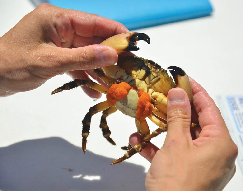
Stone crabs may face challenges from ocean acidification.

The first study on Florida stone crabs and ocean acidification was published this month by a Mote Marine Laboratory scientist and offers clues for relieving environmental stress on these tasty and economically valuable crabs. The study in the peer-reviewed Journal of Marine Biology ad Ecology provides the first evidence the stone crab embryos develop more slowly and fewer eggs hatch to larvae (babies) in controlled laboratory systems mimicking ocean acidification.

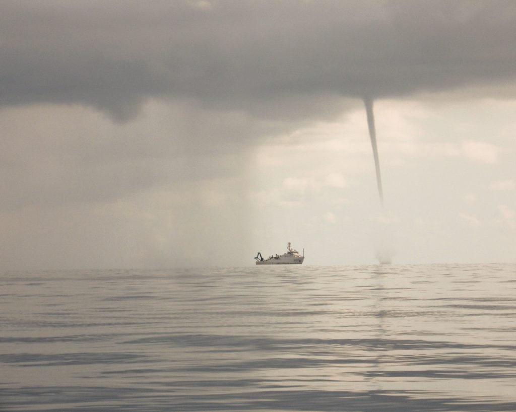
Ocean Acidification (OA) is a chemically induced decrease in ocean water pH at global to local levels that is being driven by increased levels of carbon dioxide in the atmosphere. The impact of OA on marine and estuarine species and habitats is worsened when combined with the impacts of nutrient-rich coastal runoff, sewage water inputs and loss of wetlands due to coastal development. Some coastal habitats in Florida are experiencing seasonal declines in pH three times faster than the rate of OA anticipated for global oceans by the end of the century.
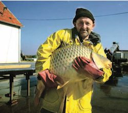
Stone Crabs

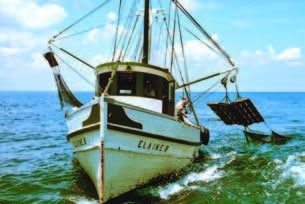
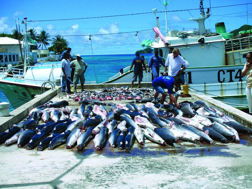
Most stone crab fishing occurs in coastal habitats susceptible to Ocean Acidification along with other potential stressors, including reduced oxygen levels and harmful algal blooms. The stone crab industry centered along West Florida was valued in 2015 at $36.7 million, but since 2000, the average annual commercial harvest has declined by about 25 percent.

Mote scientists are studying stone crabs under various environmental conditions, starting with acidified water, to help resource managers sustain this critical fishery. “By identifying stone crabs’ susceptibility to ocean acidification throughout their embryonic and larval development, we can better understand whether the species will be able to tolerate and eventually adapt to the levels of ocean acidification projected for our coastal oceans in the future,” says Mote Postdoctoral Research Fellow Dr. Philip Gravinese, who authored the new paper to disseminate his doctoral research, which was conducted through the Florida Institute of Technology in 2012 at Mote’s campus on Summerland Key, Florida.
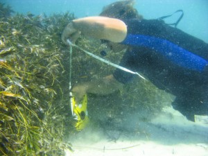
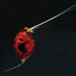
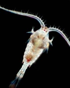
Tracking the Crabs

“Stone crabs brood their eggs in coastal habitats [where] their larvae hatch and develop into juvenile crabs—essential steps toward producing the next generation of adult crabs whose claws will be harvested. These early life stages are sometimes more sensitive to changing environmental conditions.”

Gravinese conducted the first-ever laboratory study on Ocean Acidification and stone crabs with funding support from the Protect Our Reefs license plate grant program administered by Mote ND the Department of Biological  Sciences at Florida Institute of Technology.

With assistance from the Florida Fish and Wildlife Conservation Commission, Gravinese obtained 16 egg-bearing stone crabs from commercial traps within 10.5 miles of Florida’s coast. He used only females carrying orange eggs—rich in yolk not yet consumed by the early-stage embryo. He placed eight crabs into tanks with acidified seawater mimicking pH conditions forecasted by some models for the ocean’s future and eight into tanks with present-day pH seawater.

What happened?

Each day, Gravinese sampled 20 eggs from each female’s brood which contain hundreds of thousands of eggs. He determined each embryo’s stage of development by examining the eggs’ yolk content, eyespot size, and egg volume. Gravinese also examined about 100 larvae from each brood to document how many hatched successfully, and he sampled 20 hatched larvae per brood to document any deformities using digital photos magnified 25 times.

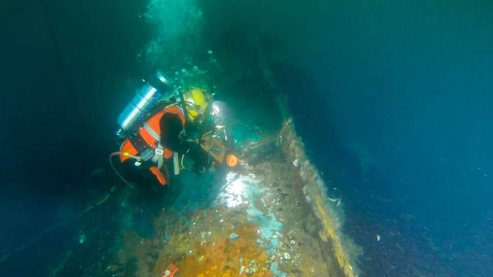
Throughout the experiment, Mote scientists monitored and tested the water temperature and chemistry features to maintain stable, controlled conditions in the Ocean Acidification Flow-Thru Experimental Raceway Units at Mote’s Summerland Key campus.

The results revealed that young stone crabs may struggle as the oceans acidify. “The stone crabs’ embryonic development slowed by 24 percent and hatching success decreased by 28 percent with exposure to lower pH in this study,” says Gravinese. “This could represent a reduction in the supply of larvae (baby stone crabs) and a potential bottleneck for new recruits into the fishery.”

Larvae from both study groups appeared normal in size and shape, but it remains to be seen whether longer exposure to low pH water would cause changes over time.

While broods in acidified water had fewer eggs hatch on average, their hatch success varied more widely than that of broods in the present-day pH water.

“The fact that some individual females’ broods showed variability could suggest that there’s a genetic component that may help some crabs be more tolerant than others of ocean acidification,” suggests Gravinese.

The question remains, could OA relate to Florida’s long-term decline in stone crab catches?

“It’s hard to say because no one has correlated pH in larval habitats with their abundance,” says Gravinese, noting an option for future research. “We do know coastal areas are changing, some with pH dropping significantly, but there are also other environmental changes that may be playing a role, including hypoxia, or low oxygen levels, elevated seawater temperature, and Florida red tide.”

This year, Gravinese expects to publish the first-ever research investigating how Florida red tide algae (Karenia brevis) affects sub-legal-size stone crabs, which represent the next generation of individuals to enter the fishery. He also expects to publish expanded doctoral research on how acidification and increased water temperature jointly and independently affect stone crab larvae.

At Mote’s City Island research campus in Sarasota, Florida, Gravinese’s recent lab studies have involved monitoring female crabs throughout their entire process of producing and fertilizing eggs in acidified water to check for “generational carry-over effects” (from mother to larvae) on larval development, hatching success and larval survival. This study could identify a potentially greater resilience to future acidification. Gravinese and colleagues have also been examining juvenile crabs’ ability to forage for food under low oxygen and elevated temperature scenarios.

In late 2017 to early 2018, a number of Florida’s commercial fishers anecdotally reported fewer stone crabs in their traps. The specific reasons remain unclear, as stone crabs not only face mounting threats, but harvests naturally vary from year to year, and it’s challenging to gauge the impacts of storms, cold fronts, octopus predation and other environmental variables. “The fishery has good and bad years, in what appears to be a repeating pattern, but the overall trend in the annual harvest seems to be negative,” Gravinese says.

However, he notes that research on different life-history stages may allow for better strategies to reduce pressure on stone crabs. For example, communities can strengthen efforts to reduce nutrient-rich runoff and sewage water inputs that will likely exacerbate ocean acidification.

Tips to Reduce Runoff: 

In your landscape, use native and Florida-friendly plants and porous surfaces: mulch, shell, brick pavers and others that allow water to sink into soil, reducing runoff.

Pick up pet waste and dispose of it with your trash. Dispose of hazardous substances at County-approved sites and do not pour pollutants down storm drains.

Follow laws and ordinances on fertilizer use in your area.

For more information on Ocean Acidification? See our article on OA and coral disease. 


By Hayley Rutger, Mote Marine Laboratory & Aquarium

Photo courtesy of Hayley Rutger, Mote Marine Laboratory & Aquarium


The Tsunami Threat

Due to its sheer magnitude and velocity, the tsunami is one of the most destructive forces in nature. From the Japanese words for “harbor wave”, tsunamis are actually a series of waves whose crests can be tens or even hundreds of miles apart. When this huge mass of water hits a coast, it can plow inland for miles like a raging river that can be over 100 feet high, and it can destroy everything in its path.

Unlike wind-driven waves or astronomically driven tides, tsunamis are the result of geological activity under the ocean floor, some movement that will cause a displacement
of a large amount of water, such as underwater landslides or volcanic eruptions. But the most significant tsunamis are caused by sudden movements of the sea floor associated
with earthquakes.

In the deep open ocean, a surface tsunami wave may only be a few inches high. But unlike other ocean waves, a tsunami wave extends downward to the ocean floor. This is
a tremendous mass of water, and the wave can be traveling at remarkable speeds of up to 500 mph. As it approaches a coastline and the water gets shallower, the wave slows to 20 or 30 mph; the water piles up, causing a significant rise in ocean level. When it reaches the coast, a tsunami seldom appears as a towering wave but rather like a fast-rising flood.

On average, locally damaging tsunamis occur twice a year, but major tsunami events that can affect areas hundreds or even thousands of miles away from the origin point only
occur about twice per decade. Since 1900, the seismically active Pacific basin has seen nearly three-quarters of all tsunami events. Less than 10 percent occurred in the Atlantic
and Caribbean.

In this millennium, there have been two historic tsunami events. In December 2004, a 9.1-magnitude earthquake off the Indonesia coast initiated tsunamis that killed 250,000 people some as far away as the east coast of Africa. Japan suffered devastating tsunamis that killed 18,000 people after a 9.0 earthquake hit in March 2011. The water traveled as much as six miles inland.

The US Tsunami Warning System run by the National Weather Service protects the citizens of the United States and its territories. There are two Tsunami Warning Centers. The one in Palmer, Alaska, serves the continental U.S., Alaska and Canada. The other in Honolulu, Hawaii, serves not only the Hawaiian Islands and U.S.-owned territories in the Pacific but also on the Atlantic side, Puerto Rico and the Virgin Islands.

To detect actual tsunamis as they are moving through the ocean, NOAA developed the Deep-ocean Assessment and Reporting of Tsunami (DART®) station which consists of a bottom pressure recorder anchored to the sea floor and a moored surface buoy with a transmitter to send information via satellite back to the Centers. The pressure sensor can convert a measured reading to the height of the ocean surface above, and if the system detects an unusual height, it will start sending readings every 15 seconds.

With the greatest tsunami risk in the Pacific region, the DART network of stations runs the length of the Aleutian Islands and southern Alaska as well as along the West Coast and Hawaii. Although the Atlantic is much less prone to tsunamis, there are stations off the East Coast, in the Gulf and off Puerto Rico where meteotsunamis tend to occur. With accelerated development along many coastlines and rising sea levels, future tsunami events could be catastrophic.

When seismic data indicate that a significant earthquake has occurred somewhere around the world, an Information Statement is issued immediately by the appropriate Warning
Center. Next, the nearest sea level gauges are closely monitored to see if a tsunami has been generated and its magnitude. The DART network will activate if a tsunami is approaching. If a tsunami has the potential to affect a covered area, there are three levels of alerts that can be issued by the appropriate Center:

  • Tsunami Watch: an event has occurred but the threat is yet to be determined. The public is advised to stay tuned for more information and be prepared to act.
  • Tsunami Advisory: implies strong currents and dangerous waves near the water and that people should vacate the beaches.
  • Tsunami Warning: dangerous coastal flooding and powerful currents exist. People are urged to seek higher ground and/or move inland. Warnings are typically issued within five minutes of the initiating earthquake. The official tsunami alerts are disseminated by local NWS offices.

Tsunami warnings are just one part of the National Tsunami Hazard Mitigation Program which includes agencies of the Federal government and 28 U.S. states and territories. Another component, Mapping and Modeling, uses computer analysis of possible tsunami events in conjunction with local topography to forecast the magnitude of potential flooding. The Mitigation and Education component is the public outreach to inform citizens of the tsunami risk in their area and what actions should be taken in response to the various advisories. To lessen property damage, land use policy and planning are also advocated.

By Ed Brotak, Southern Boating February 2018

ALL PHOTOS: COURTESY OF NOAA

Sustainable Seafood

Sustainable seafood supports a healthy marine ecosystem with better food options.

Many of us flock to the coasts during the summer to enjoy swimming, boating, fishing, a break from the heat, and delicious seafood. In today’s globalized world, even those who live far from the coast have access to a plethora of seafood choices in our local restaurants and grocery stores. As you peruse your options, you may wonder which seafoods are best to eat, not just in terms of taste but also if they are sustainable.

But what does it really mean for seafood to be sustainable? By the simplest definition, a seafood product can be considered sustainable if it is captured in quantities small enough to prevent negative impacts to its population and is caught in a way that does not harm other species or marine habitats. Sustainability is all about the future productivity of marine ecosystems. But without a crystal ball, how can we know how the actions we take today will influence tomorrow’s ocean?

How do you know if you’re choosing the most sustainable option?

Since fisheries scientists and managers are not fortune-tellers, they rely on several different metrics to determine if fish are harvested in a manner that promotes healthy marine ecosystems in the future. Our seafood choices consist of various species caught with many diverse methods from all corners of the globe, so there is no single metric that can be used to figure out if a given type of seafood is or is not sustainable. There are, however, a few key questions commonly asked to assess sustainability:

• What type of gear was used to catch this fish or shellfish?
• How much bycatch does this gear usually cause?
• Does this gear type damage marine habitats?
• Where on the food chain does this species fall?
• Is it wild or farm-raised?

Fishing gear
Gear type is one of the most important aspects of seafood sustainability because it has a major impact on other species and on marine habitats. There are three very basic generalizations about the relationship between gear type and seafood sustainability:

• Indiscriminate gear, such as purse seines, gill nets and trawls, usually results in more bycatch compared to selective gear, such as hooks, traps and harpoons. Yes, you can buy seafood caught by harpoon!
• Gear that touches the seafloor (such as bottom trawls and dredges) is more likely to damage marine habitats than those that avoid it.
• Ask your seafood dealer how and where the fi sh was caught. (You may also be able to verify this by doing some Internet research.)

Discarded fish
“Bycatch” refers to fish that are caught incidentally by fishermen who are usually targeting one or two species. In the U.S., fishermen are permitted to fi sh on a species-by-species basis and are subject to regulations on when and where they can cast a line and on the size and number of the fi sh they are allowed to keep. Bycatch can include a species that a fisherman is not permitted to harvest, such as one caught out of season or that is smaller or larger than the legal size. Sometimes fishermen accidentally catch too many fish of a particular species, and they have to throw some back. This is also considered bycatch. Fishery regulations in the U.S. require that most bycatch be discarded at sea. Because it is usually dead, bycatch can have a major negative impact on marine ecosystems.

Habitat Damage


Trawlers, like the one pictured here, can wreak havoc on the seafloor and damage the ecosystem.

If fishing gear touches the seafloor, it can damage marine habitats. This causes major impacts on other species and on the overall health of marine ecosystems. Bottom trawls are the most notorious example of fishing-induced habitat destruction. They catch fish by dragging heavy gear along the bottom and are particularly harmful to rocky habitats, sponges and corals. Pole-caught, handline, troll, or trap-caught seafoods are better options because they cause very little habitat destruction.

Food Chain
Fish that are low on the food chain are generally sustainable options because they are, for the most part, more abundant than fish that are higher on the food chain. They also reproduce at a younger age, which helps them recover relatively quickly from low to moderate levels of overfishing. In the U.S., we tend to prefer long-lived, predatory fish, such as cod, tuna, swordfish, salmon, and halibut. By expanding your tastes to include species lower on the food chain, you can support healthy marine ecosystems by reducing pressure on the larger groups, several of which are overfished.

Some tasty options that are low on the food chain include mackerel, tilapia, catfi sh, mussels, clams, and oysters. There are some exceptions to this rule, which is why it is important to do a bit of research when considering seafood options. For example, shrimp are low on the food chain, but most that are available in the U.S. were farm-raised in ways that cause significant habitat damage. Americans consume more than one billion pounds of shrimp every year, and 90 percent of that is imported from overseas aquaculture facilities. Shrimp aquaculture operations in some developing countries have a particularly bad track record for habitat destruction and human rights violations.

Wild vs. farm-raised
Most of the seafood consumed in the U.S. is harvested from wild populations. However, the amount of farm-raised fish and shellfish in American seafood markets is rapidly expanding. There are several benefi ts associated with aquaculture, but also many environmental costs. Aquaculture tends to generate strong opinions, and some argue that it is necessary to feed a growing human population while also supporting the health of marine ecosystems by taking pressure off wild stocks. Others argue that aquaculture relies too heavily on wild-caught fish to create feed for farm-raised fish, that it pollutes the environment with fish waste and antibiotics, and that escapees can harm wild populations by introducing diseases or altering the wild gene pool.

Farm-raised mussels, clams and oysters are generally beneficial to marine ecosystems because they feed by filtering seawater and do not require artificial feeds. They also improve water quality in the surrounding region. By purchasing these farm-raised species, you can assure that you are supporting healthy marine ecosystems. For others, speak with your seafood dealer and decide if they are sustainable options or not. In general, it is best to avoid seafood from aquaculture operations in developing countries because they tend to have fewer regulations compared to the U.S.

Take action
First, to see which types of seafood are sustainable, go to seafoodwatch.org or fishwatch.gov. Another great way to learn more about seafood sustainability is to buy it locally and talk with fishermen and dealers specializing in seafood.

You may be able to find it at your local farmers’ market or join a Community Supported Fishery (CSF), where you can feel confident that it is sustainable (communityfisheriesnetwork.org, localcatch.org). CSFs follow the model of Community Supported Agriculture in that they bring fresh, seasonally available, locally caught seafood directly to consumers. They also offer a great way to support both healthy marine ecosystems and coastal economies.

By Julia Beaty, fisheries social scientist
Courtesy of Sailors for the Sea

Seagrass Struggling Years After Heatwave

Seagrass Struggling to Revive

Massive seagrass beds in Western Australia’s Shark Bay—a UNESCO World Heritage Site—haven’t recovered much from the devastating heat wave of 2011, according to a new study demonstrating how certain vital ecosystems may change drastically in a warming climate.

The peer-reviewed research, recently published in Marine Ecology Progress Series, was led by Dr. Rob Nowicki, a Mote Marine Laboratory postdoctoral research fellow, who conducted the fieldwork while earning his doctorate from Florida International University (FIU). Dr. Michael Heithaus, dean of FIU’s College of Arts & Sciences, and colleagues from multiple institutions have examined Shark Bay’s ecosystem for more than 20 years. The current study included partners from FIU, Deakin University in Australia and Nova Southeastern University in Fort Lauderdale, Florida.

Shark Bay earned its World Heritage status, in part, because of its 1,853 square miles of seagrass beds, which UNESCO’s website calls the “richest in the world.” This vast, subtropical ecosystem hosts thousands of large sharks, other fish, sea turtles, bottlenose dolphins, and a critical population of dugongs, plant-eating mammals related to manatees.

“We were studying a relatively pristine ecosystem, but in summer 2011, we had the hottest water temperatures on record at the time, and we saw 70 to 90 percent losses of seagrasses at our study sites; no one expected it to be that bad,” Nowicki said. “After our colleagues documented the losses, we wanted to know how much the ecosystem might recover over a few years. If you take a punch and get up quickly, you’re ready for the next punch. But our study has suggested this system took a punch, and in the short term, it has not gotten back up.”

The researchers surveyed 63 sites in Shark Bay four times between 2012 and 2014 to assess seagrass recovery and changes. Before the heat wave, many sites were dominated by the temperate seagrass known as “wireweed” (Amphibolis antarctica), whose dense and tall thickets provide ample food and shelter for numerous species. The heat wave drastically thinned many wireweed beds, and in many places their
rhizomes (underground stems) blackened and died, leaving bare sand.

The new study showed that surviving A. antarctica beds appeared stable but didn’t reclaim much turf. Instead, the tropical seagrass Halodule uninervis, a close relative of the shoalgrass native to Florida, began filling the gaps. H. uninervis was spotted at 2 percent of sites in 2012 but had expanded to almost 30 percent of them by 2014.

“The seagrass hit hard was the most common species—and was dense like a mini forest,” said Heithaus, doctoral advisor to Nowicki and co-author of the study. “Losing that cover is really huge; it’s like going from a bushland in Africa to a well-mowed lawn.”

The loss of that much structure has consequences. “After the die-off, we also saw water clarity go down a ton,” Nowicki said. Fewer seagrasses were available to trap sediments, and decaying seagrass may have nourished a bloom of microscopic algae observed in 2014. Study authors say these ramifications aren’t surprising given the valuable ecosystem services healthy seagrass beds provide.

A scientist measures the growth of seagrass that is in the process of recovery from a 2011 heat wave.

Seagrass beds stabilize sediments, preventing erosion and clarifying water. More seagrass biomass can store more carbon dioxide, decreasing its availability to harm ecosystems through climate change and ocean acidification. Dense seagrass beds are also critical for economically important fisheries. Seagrass meadows are valued at $1.9 trillion worldwide just for their role in cycling nutrients, according to a 2009 study by others in Proceedings of the National Academy of Sciences. However, major seagrass ecosystems around the world have declined by about 7 percent per year since 1990, reminiscent of the drop in coral reefs and other vital ecosystems.

In Shark Bay, beds of slow-growing A. antarctica seagrass may struggle to recover further, the study suggests. Shark Bay, located where temperate and tropical ecosystems overlap, is among the warmest areas that A. antarctica can occupy, and hotter temperatures are predicted to become more common with climate change.

Because of its temperate-tropical overlap, Shark Bay has a diverse group of about 12 seagrass species—roughly twice as many as the entire state of Florida. Its diversity survives, along with other key features that helped earn the site’s World Heritage status.

It’s imperative to continue investigating how the recent loss of some seagrass, a basis of the marine food web, will affect plant-eating animals and their predators in Shark Bay.

Some take-home messages are clear: It’s critical to monitor ecosystems well after a disturbance; they’re not guaranteed to bounce back. “It shows the importance of these long-term, comprehensive, ecosystem-level studies,” said Heithaus, referring to team efforts to examine Shark Bay. “If we hadn’t been doing this since 1997, we wouldn’t have had the baseline data to know that the declines were a big deal.”

Also, if relatively pristine seagrass beds of Shark Bay are vulnerable to extreme weather, then it’s unclear how seagrass beds damaged by human activity will fare in the coming decades. This seagrass struggling is an indicator that humans need to be aware of these occurances.

Nowicki said that minimizing local stressors, such as nutrient pollution from fertilizer runoff into bays and estuaries, may give seagrasses better odds amid climate change and other global stressors. “If Shark Bay had poorer water quality, we might have lost a lot more.”

By Mote Marine Laboratory and Aquarium for Southern Boating Magazine June 2017

SeaKeepers Bermuda 2017

The International SeaKeepers Society will host SeaKeepers Bermuda 2017 on Thursday, June 22nd at the Bermuda Underwater Exploration Institute (BUEI) and Harbourfront Restaurant in Hamilton, Bermuda. The event will honor Wendy Schmidt as the 2017 SeaKeeper of the Year for her outstanding leadership and support of the environment and ocean conservation.

Also recognized as part of the evening’s program will be the SeaKeepers of Bermuda: Philippe Max Rouja, Judy Clee, Chris Flook, and John Paul Skinner as a part of the SeaKeepers of the World Program. This effort identifies individuals who demonstrate a commitment to ocean research and conservation in their local communities.

The event chair is Dr. Stefano Tositti, CEO of BWA Yachting, and the reception sponsor is Caroline Bay Bermuda. The evening will highlight the work of the International SeaKeepers Society in partnership with the yachting community through the DISCOVERY Yachts Program.

Wendy Schmidt is President of The Schmidt Family Foundation, which works to advance the wiser use of energy and natural resources and to support efforts worldwide that empower communities to build resilient systems for water, food, and human resources. The foundation houses its grant-making operation in The 11th Hour Project, which supports more than 150 non-profit organizations in areas including climate and energy, human rights, ecological agriculture, environmentally conscious sailing, and the vitality of the island of Nantucket, Massachusetts.

Schmidt is also Founder and Vice President of the Schmidt Ocean Institute – established in 2009 to advance oceanographic research, knowledge, and discovery, and catalyze sharing of information about the oceans. The Institute is devoted to the inspiring vision of its Founders on how the advancement of technology and open sharing of information is vital to expanding the understanding of the world’s oceans.

To extend her commitment on ocean health issues, Schmidt partnered with XPRIZE in 2010 to sponsor the Wendy Schmidt Oil Cleanup XCHALLENGE, a $1.4 million competition designed to identify effective and innovative resolutions to address oil spillage from ocean tankers, platforms, and other sources. The 18-month-long competition was prompted by The Deepwater Horizon disaster and resulted in a solution that produced a fourfold improvement over existing cleanup capabilities.

Schmidt partnered again with XPRIZE In 2012 to create the Wendy Schmidt Ocean Health XPRIZE, a prize that responds to the global need for better information about the process of ocean acidification, one of the indicators of climate change. 

Schmidt serves on the boards of The Natural Resources Defense Council, The California Academy of Sciences, Climate Central, XPRIZE, The Cradle to Cradle Products Innovation Institute, GRIST, Maiyet, The Nantucket Dreamland Foundation, and The America’s Cup Organizing Committee.

Wendy Schmidt joins an elite and influential group of leaders in marine conservation including: Jean-Michel Cousteau; Monaco’s own H.S.H. Prince Rainier III and H.S.H. Prince Albert II; Canadian film director/producer and deep-sea explorer, James Cameron; American marine biologist, author, lecturer and National Geographic explorer-in-residence, Dr. Sylvia Earle; French fashion tycoon, agnès b.; Sargasso Sea Alliance (SSA), a partnership to protect the Sargasso Sea, led by SSA Board Chair, David Shaw and the Government of Bermuda; Fabien Cousteau; and yachting community pioneer, Alexander W. Dreyfoos.

SeaKeepers would like to thank our generous event sponsors: BWA Yachting, Caroline Bay Bermuda, Insetta Boatworks, Isotropic Networks, and MetOcean Telematics. We would also like to thank our annual sponsors: World Fuel Services | Yacht Solutions, and BWA Yachting. Event media partners are:  Charterworld.com, ECO Magazine, MACO Magazine, MegayachtNews.com, SailBrasil Miami, SEVENSEAS Magazine, SoFlaNights.com, South Florida Luxury Guide, Southern Boating Magazine, SuperYacht Industry, Venü Magazine, and Yachts International.

For more information visit http://www.seakeepers.org.

Global Fishing Watch

Private citizens now have the means to take action against illegal fishing.

Our oceans are under siege from a variety of threats, including the excessive extraction of wild fish. Most fisheries in the world are fished beyond their limits— indiscriminate bycatch is decimating populations of marine wildlife, and bottom trawling and other destructive practices are destroying nursery and spawning habitat. This results in rapidly declining fish stocks and population crashes that ripple throughout the ocean food web.

The good news is that oceans are resilient and can regain their former abundance, but for that to happen we must manage our fisheries responsibly. More and more countries are putting in place catch limits and habitat protections that are necessary to rebuild ocean resources. But for these efforts to be successful, the rules set to protect our most precious ocean resources must be vigorously enforced.

Sailors understand what is at stake. And more than others, they are in a position to help monitor the conduct of the global fishing fleet to hold it accountable. Global Fishing Watch is the first technology platform that allows anyone with an Internet connection to see global fishing activity in near real-time, for free. Global Fishing Watch—built by a partnership between Oceana, the search engine giant Google and the technology nonprofit SkyTruth—is free, easy to use, global in scale, and open source, which means as more users access the technology and create additional applications over time, the tool will become even more powerful.

Global Fishing Watch uses the Automatic Identification System (AIS), a tracking system employed by more than 200,000 vessels around the world for safety purposes. Large fishing vessels, including the ones that catch the most fish globally, are required to utilize AIS to prevent collisions at sea. Global Fishing Watch can access AIS data, which typically includes vessel identification information, and plug it into algorithms built to use vessel movement and location to identify apparent fishing activity. It then makes information on where fishing is occurring available.

This map depicts the Phoenix Islands Protected Area (PIPA). These historically productive fishing grounds were severely depleted, leading Kiribati’s President Tong to ban all commercial fishing within the reserve starting in January 2015. Oceana discovered through Global Fishing Watch that the government’s ban was effective and gave fish stocks a chance to recover.

This is where sailors come in. Imagine being out on the water and you see a passing fishing vessel. Perhaps it seems suspicious indicate whether the ship has been fishing, where and when it fished, whether it fished in a protected area, and where and when it returned to port.

Your “eyes on the ocean” might also identify odd behavior like a vessel meeting up with another ship at sea for a potential transshipment or a vessel that does not have its AIS activated. If you are sailing in or near a marine protected area and see a vessel fishing, you may be able to determine whether that ship was fishing in a “no-take” area. In all cases, reports can be made through Global Fishing Watch, and your report will be sent to the relevant enforcement agency.

When citizens show governments that laws are not being enforced, it will put pressure on those governments to act. Global Fishing Watch will help sailors, fishermen and everyday citizens hold governments accountable to enforce fishery laws.

Global Fishing Watch is especially powerful in the hands of sailors around the world, who can match eyewitness accounts with recorded satellite data. Imagine if every sailor in the world could give evidence to authorities enabling them to determine which fishing vessels are following the law and those that are not.

Global Fishing Watch can also be used by seafood retailers to identify the source of the seafood they purchase for sale, by seafood certifiers to strengthen the certification process, by companies that insure fishing vessels to track their policy-holders, and by honest fishermen who want to ensure the rules are enforced so that they can compete on an even playing field. The project is brand new and will reap the benefits of combining technology with illegal, unreported and unregulated fishing in an effort to curb those practices.

Global Fishing Watch uses the Automatic Identification System (AIS), a tracking system employed by more than 200,000 vessels around the world for safety purposes.

– Jacqueline Savitz

Most importantly, Global Fishing Watch allows fishing vessel operators to show the world they are fishing legally. By consistently using an AIS transponder, they might be able to fetch a higher price for their catch or get access to markets that in the future could be closed to any fishing vessel that doesn’t meet this basic transparency standard. In the meantime, it will put the bad actors on notice, essentially telling them, “We’ve got our eyes on you.”

Currently, sailors traveling to more remote areas of the ocean will be able to provide the most beneficial information to Global Fishing Watch because they are more likely to be traveling through no-take marine-protected areas and regions that are managed by small countries and have limited resources. Additionally, sailors may be able to help identify types of gear that are not allowed in certain places. For example, some areas of the Mediterranean have banned drift nets since they create a large amount of bycatch.

Both Oceana and Sailors for the Sea strive to preserve the richness and biodiversity of the ocean for future generations. Now, with Global Fishing Watch, we all have a powerful new tool to deter illegal fishing.

Article courtesy of Sailors for the Sea

Tiny Giants of the Sea

Nearly invisible marine microbes play a vital role in life at sea and on land.

Stories of mysterious creatures lurking deep in the sea have long captivated our imaginations and stirred our curiosity. Bigelow Laboratory for Ocean Sciences in East Boothbay, Maine, is on a mission to show that truth is stranger than fiction—in a big way.

Looks can be deceiving: Pteropods are actually sea snails.

Tiny Giants: Marine Microbes Revealed on a Grand Scale is a photographic adventure featuring colorized and enlarged images of nearly invisible plants and animals that dominate the ocean. Their beauty will leave you awestruck. “Our idea behind the Tiny Giants images was to pique people’s imaginations about the invisible creatures that we study that are vital to our very existence,” says Dr. Benjamin Twining, director of research and education at Bigelow Laboratory.

Ostracods–tiny shrimplike crustaceans are also known as sea fireflies–give off a bright blue light.

But how do you stir up interest and raise awareness about organisms so small that hundreds of thousands can live in just a single drop of seawater? You make the invisible visible. Dr. Peter Countway, Laura Lubelczyk and other Bigelow Laboratory researchers used three types of microscopes—compound-light, confocal and scanning electron—to capture 18 incredible images of marine microbes. Each of the high-powered microscopes provides a unique perspective and allows us to peer into this invisible world, but it takes a skilled and practiced hand to create the magical images seen in Tiny Giants. The incredible magnifications—some of the images are as big as four feet wide by five feet tall—offer a unique glimpse at the intricacies of these marine-dwelling microbes; their exquisite shapes and patterns appear otherworldly.

Copepods make up more than 21,000 species. Photo credit: Dr. Peter Countway, Bigelow Laboratory for Ocean Sciences with funding provided by the National Science Foundation.

Marine microbes are the foundation of life on Earth. They produce half of the oxygen we breathe and are the base of the food chain. In fact, 98 percent of the ocean’s biomass is made up of microbial life. Given their vital role in planetary processes and balance, it is important that we understand how ocean health issues such as ocean acidification and rising sea temperatures affect these organisms. In addition, marine microbes may lead to new advances in pharmaceuticals, fuel sources and nutritional supplements. Bigelow Laboratory is the only independent basic research institution in the world that focuses on microbial oceanography, and its researchers want to spread the word about the world-class discoveries taking place at their state-of-the-art campus.

Tiny Giants has been making the rounds throughout the northeast U.S. since January 2015. The exhibit has been featured in libraries, schools and art galleries. The response has been as impressive as the images themselves. “It was delightful to wander amongst the crowd and hear people exclaim about the beauty and wonder of marine microbes,” said Darlene Trew Crist, Director of Communications at Bigelow Laboratory, at the sold-out showing at District Hall in Boston, Massachusetts. Tiny Giants had a full summer schedule in 2016 including a World Oceans Day Summit on June 8th in Newport, Rhode Island, presented by Sailors for the Sea and Bigelow Laboratory for Ocean Sciences.

Diatoms–single-celled algae–are giants of the microbial world. Photo credit: Dr. Peter Countway, Bigelow Laboratory for Ocean Sciences with funding provided by the National Science Foundation

To promote unique, exciting ways to teach and learn, the Tiny Giants exhibit resided at Colby College in Waterville, Maine, throughout the 2015 fall semester. This innovative collaboration was used not only in biology and environmental science departments but also in theater, dance, art, and humanities. Educators used the exhibit to connect concepts of invisible marine microbes to their coursework. “We were excited to show the images in the Tiny Giants exhibition on campus last fall,” said Lori G. Kletzer, Colby Provost and Dean of Faculty. “Colby’s strategic partnership with Bigelow Laboratory provides world-class opportunities in marine science and climate science for our students—we knew that. The unique aesthetic for examining the natural microbial world through these photos completely reinforced the interdisciplinary approach that both our institutions value so highly.”

The wonders of the microscopic world aren’t reserved for scientists. With Tiny Giants, Bigelow Laboratory is making the mysterious marine underworld accessible to everybody. Next time you are out on the water, take a moment to think about the organized and diverse communities of tiny sea creatures that make our life possible. Check out the Tiny Giants schedule to see if there is an event or exhibit in your area at tinygiants.bigelow.org/schedule.html. Learn more about marine microbes and the cutting-edge research going on at Bigelow Laboratory for Ocean Sciences at bigelow.org.

— By Jaime Blair, Communications Consultant at Bigelow Laboratory — Article courtesy of Sailors for the SeaSouthern Boating Magazine April 2017

Watch Out– Rogue Waves Ahead!

Scientists have yet to determine how to forecast where and when rogue waves will strike.

The 1972 blockbuster movie The Poseidon Adventure depicts a large ocean liner that’s capsized by a huge wave. Although fictional, the movie was inspired by an actual incident. The R.M.S. Queen Mary was almost capsized by a 70-foot wave while carrying thousands of U.S. troops in 1942, which would have been a far worse disaster than the Titanic sinking. For hundreds of years, mariners have talked about monster waves, and Christopher Columbus wrote of an experience with one in 1498. It is even speculated that a “freak wave” on Lake Superior was what sank the Edmund Fitzgerald during a storm in November 1975.

Scientists, however, have been skeptical of the occurrence of such great waves. Other than personal accounts of those who survived an encounter, there was no hard evidence of their existence and no scientific explanation of how they could occur. Waves of 40 or even 50 feet were seen as possible but not waves approaching 100 feet. That changed in January 1995 when the Draupner—an oil-drilling platform in the North Sea—was hit by a wave accurately measured at 86 feet. The “Draupner Wave” was twice as tall as surrounding waves and fell well outside the range of scientific predictions.

A “rogue wave” is significantly higher and steeper than other waves that are occurring at the time, typically defined as twice as high as surrounding waves. It may even approach from a different direction than other waves. Rogue waves can occur in turbulent conditions as an exceptionally high wave amongst other high waves, or they can occur with much calmer seas.

Now with definitive proof of the existence of rogue waves, scientists sought to determine their frequency. With newly developed methods of analyzing satellite data, they found that rogue waves are common in all of the oceans of the world, particularly in the North Pacific and especially the North Atlantic.

There are several theories describing the formation of rogue waves. If waves are coming in from different directions, two waves may physically join up. The newly formed wave could have a crest approaching the additive height of the two component waves. Another possibility is that when waves are travelling in the opposite direction of a prevailing current, the wave length shortens and one wave may actually catch up to another and build. In this case, regions with strong currents such as the Gulf Stream would be more prone to rogue wave occurrence.

Forecasting the occurrence of individual rogue waves is beyond science today, but the standard National Weather Service marine forecast allows for their possibility with the following caution: “Individual waves may be more than twice the significant wave height.”

In addition to rogue waves—as if that’s not enough—coastal areas have another phenomenon to deal with. On January 17, 2016, a tidal surge 5.5 feet above normal struck the Naples, Florida, area in the early morning hours. It had the characteristics of a tsunami, but no seismic activity had been reported. Meteorologists announced that it was a meteotsunami, a tidal surge consisting of a series of waves. Unlike typical tsunamis, which are caused by geologic events such as earthquakes, this phenomenon is produced by a marine weather system. This is different from a storm surge—the high tide that accompanies hurricanes and strong winter storms, which are wind driven. Meteotsunamis are caused by changes in atmospheric pressure which can in turn affect sea-level height. Often the culprit is an area of strong thunderstorms such as an intense squall line, which was the case in Naples. Development of a meteotsunami depends on several factors including the intensity, direction, and speed of movement of the weather system as it travels over water. Over open water, these changes may hardly be noticeable, but just like other tsunamis, it can become dangerous when it hits the shallow water near the coast as this causes it to slow down and increase in height and intensity. Even greater magnification can occur in semi-enclosed water bodies such as harbors, inlets, and bays. Damaging waves, flooding and strong currents can last from several hours to a day.

The NOAA vessel Fairweather approaches one of many data buoys, which provide real-time information critical for understanding and predicting El Niño and La Niña events, ocean currents, rogue waves, and more. photo courtesy of NOAA

Although not as potent as a typical tsunami, meteotsunamis can be destructive and even deadly. On July 3, 1992, a particularly destructive one occurred on Daytona Beach, Florida. A 10-foot wave came crashing ashore, injuring 75 people and damaging 100 vehicles as well as other property. On June 13, 2013, despite clear skies and calm weather, a meteotsunami caused injuries and damage from southern Massachusetts to New Jersey.

The largest meteotsunami ever recorded occurred in Croatia in June 1978, when waves up to 19.5 feet battered the coast for several hours, significantly damaging boats and port infrastructure. Meteotsunamis can also strike large inland waters. In 1954, a deadly meteotsunami hit Chicago’s Lake Michigan waterfront and swept people into the cold water, which resulted in seven drownings.

Recent research has shown that meteotsunamis are more common than previously thought especially along the Atlantic Coast and the Gulf of Mexico. Some estimates attribute up to 13 percent of all tsunamis to them. Meteorologists are trying to develop a system to forecast them in advance, but for now they remain unpredictable.

By Ed Brotak, Southern Boating Magazine January 2017

Exit mobile version