

Scientists have yet to determine how to forecast where and when rogue waves will strike.
The 1972 blockbuster movie The Poseidon Adventure depicts a large ocean liner that’s capsized by a huge wave. Although fictional, the movie was inspired by an actual incident. The R.M.S. Queen Mary was almost capsized by a 70-foot wave while carrying thousands of U.S. troops in 1942, which would have been a far worse disaster than the Titanic sinking. For hundreds of years, mariners have talked about monster waves, and Christopher Columbus wrote of an experience with one in 1498. It is even speculated that a “freak wave” on Lake Superior was what sank the Edmund Fitzgerald during a storm in November 1975.
Scientists, however, have been skeptical of the occurrence of such great waves. Other than personal accounts of those who survived an encounter, there was no hard evidence of their existence and no scientific explanation of how they could occur. Waves of 40 or even 50 feet were seen as possible but not waves approaching 100 feet. That changed in January 1995 when the Draupner—an oil-drilling platform in the North Sea—was hit by a wave accurately measured at 86 feet. The “Draupner Wave” was twice as tall as surrounding waves and fell well outside the range of scientific predictions.
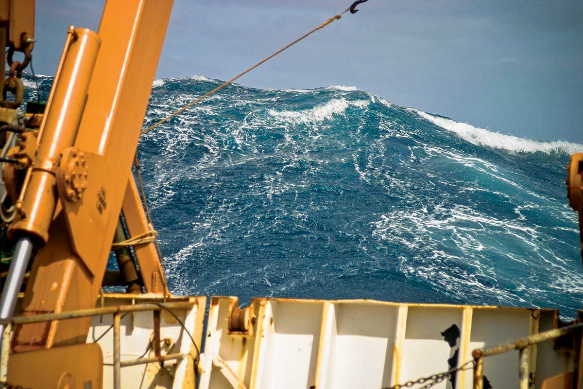
A “rogue wave” is significantly higher and steeper than other waves that are occurring at the time, typically defined as twice as high as surrounding waves. It may even approach from a different direction than other waves. Rogue waves can occur in turbulent conditions as an exceptionally high wave amongst other high waves, or they can occur with much calmer seas.
Now with definitive proof of the existence of rogue waves, scientists sought to determine their frequency. With newly developed methods of analyzing satellite data, they found that rogue waves are common in all of the oceans of the world, particularly in the North Pacific and especially the North Atlantic.
There are several theories describing the formation of rogue waves. If waves are coming in from different directions, two waves may physically join up. The newly formed wave could have a crest approaching the additive height of the two component waves. Another possibility is that when waves are travelling in the opposite direction of a prevailing current, the wave length shortens and one wave may actually catch up to another and build. In this case, regions with strong currents such as the Gulf Stream would be more prone to rogue wave occurrence.
Forecasting the occurrence of individual rogue waves is beyond science today, but the standard National Weather Service marine forecast allows for their possibility with the following caution: “Individual waves may be more than twice the significant wave height.”
In addition to rogue waves—as if that’s not enough—coastal areas have another phenomenon to deal with. On January 17, 2016, a tidal surge 5.5 feet above normal struck the Naples, Florida, area in the early morning hours. It had the characteristics of a tsunami, but no seismic activity had been reported. Meteorologists announced that it was a meteotsunami, a tidal surge consisting of a series of waves. Unlike typical tsunamis, which are caused by geologic events such as earthquakes, this phenomenon is produced by a marine weather system. This is different from a storm surge—the high tide that accompanies hurricanes and strong winter storms, which are wind driven. Meteotsunamis are caused by changes in atmospheric pressure which can in turn affect sea-level height. Often the culprit is an area of strong thunderstorms such as an intense squall line, which was the case in Naples. Development of a meteotsunami depends on several factors including the intensity, direction, and speed of movement of the weather system as it travels over water. Over open water, these changes may hardly be noticeable, but just like other tsunamis, it can become dangerous when it hits the shallow water near the coast as this causes it to slow down and increase in height and intensity. Even greater magnification can occur in semi-enclosed water bodies such as harbors, inlets, and bays. Damaging waves, flooding and strong currents can last from several hours to a day.

Although not as potent as a typical tsunami, meteotsunamis can be destructive and even deadly. On July 3, 1992, a particularly destructive one occurred on Daytona Beach, Florida. A 10-foot wave came crashing ashore, injuring 75 people and damaging 100 vehicles as well as other property. On June 13, 2013, despite clear skies and calm weather, a meteotsunami caused injuries and damage from southern Massachusetts to New Jersey.
The largest meteotsunami ever recorded occurred in Croatia in June 1978, when waves up to 19.5 feet battered the coast for several hours, significantly damaging boats and port infrastructure. Meteotsunamis can also strike large inland waters. In 1954, a deadly meteotsunami hit Chicago’s Lake Michigan waterfront and swept people into the cold water, which resulted in seven drownings.
Recent research has shown that meteotsunamis are more common than previously thought especially along the Atlantic Coast and the Gulf of Mexico. Some estimates attribute up to 13 percent of all tsunamis to them. Meteorologists are trying to develop a system to forecast them in advance, but for now they remain unpredictable.
By Ed Brotak, Southern Boating Magazine January 2017