Our Rising Seas: Coastal Resilience

Rising seas are more than a threat. They’re a reality.

It’s been a little more than a year since I first wrote about rising sea level and the problems it is causing. In this time, a considerable amount of data has come out on rising seas.

Unfortunately, most of it is not good news. A recent study of the Antarctic ice sheet concluded that the ice loss rate—which has amounted to 3 trillion tons in the last 25 years—as tripled in the past 10 years, adding to the rise in sea level. Another group of researchers noted that if the glaciers that hold back ice sheets on top of Antarctica and Greenland were to collapse, this could lead to extremely rapid rising seas around the world.

In this scenario, it’s predicted locations like South Florida could see a sea level increase of 10 to 30 feet by 2100. Another study on global mean sea level using satellite altimetry shows not only is sea level rising, but the rate of rise is too. This means that actual sea levels by 2100 could be twice as high as currently predicted using the observed rate of increase.

Significant Shifts

In an article published in July, a group of scientists compared future climate forecasts with past climates of a similar temperature. A warming of 1.5˚C (well below the 2˚C goal of the Paris Climate Agreement) could bring about “significant shifts in climate zones and the spatial distribution of land and ocean ecosystems.” The scientists said, “The changes we see today are much faster than anything encountered in Earth’s history. We can expect that sea level rise could become unstoppable for millennia.”

In my previous article, I noted that there has been a significant increase in “fair weather” flooding or flooding that occurs with non storm-related high tides. Although seas are rising everywhere, the amount of increase is not consistent around the world. The southeast coast of the U.S. has been particularly hard hit. A slowing of the Gulf Steam which transports water away from the East Coast and changes in atmospheric circulations seem to be the causes. In Miami, fair weather flooding events now occur 20 times per year. Charleston had 50 such events in 2016.

In a study released by the National Oceanographic and Atmospheric Administration (NOAA) in February, it was noted that the rate of such flooding was also increasing particularly along the southeast Atlantic coasts. Scientists concluded: “With continued sea level rise, high tide flood frequencies will continue to rapidly increase.”

Their forecast is even more startling. By 2100, even with conservative estimates of sea level, “high tide flooding will occur every other day or more.” Furthermore, with a higher sea level, “high tide flooding will become daily flooding.”

Coastal Resilience

The question is, “If we’re already at this point, can anything be done to protect our vulnerable coastlines?”

In 2007, the Coastal Resilience program was initiated by The Nature Conservancy (TNC), NOAA, the Association of State Floodplain Managers, several universities and private companies, and various international organizations. “Coastal Resilience” is defined by NOAA as “building the ability of a community to bounce back after hazardous events, such as hurricanes, coastal storms, and flooding, rather than reacting to impacts.

A community that is more informed and prepared will have a greater opportunity to rebound quickly from weather and climate-related events, including adapting to sea level rise.” From TNC’s viewpoint, “Coastal Resilience is a program to examine nature’s role in reducing coastal flood risk. The program integrates community engagement with maps. It’s delivered through a network of practitioners around the world supporting hazard mitigation, climate adaptation, and conservation planning.”

The first step is to define the problem. There are two aspects which must be considered: the threat and the threatened area. Threats include coastal storms, hurricanes, tsunamis, and high tide flooding. All are aggravated by the continuous sea level rise. The area threatened varies depending on the situation and coastal features.

What can be done to minimize flooding?

Coastal areas include natural habitats and man-made structures and infrastructure. Both must be considered when determining the risk and the ability to lower that risk. Solutions can also incorporate both. Nature has its own way of protecting coastal areas. Sand dunes can block damaging waves and, to a certain extent, the water level rises. Coastal wetlands and forests can similarly protect inhabited areas that are somewhat inland. Natural protection systems have been called Green Infrastructure. Where they’ve been damaged or destroyed, they can be brought back. Existing natural areas need to be protected.

In terms of human development, regulations, land use planning, building codes, and flood preparedness are tools. Structural features, such as sea walls, groins and breakwaters can be built. Natural habitats can be protected and maintained. Man can even mimic nature with artificial reefs, etc.

According to NOAA, “Decision-makers in coastal communities around the country need actionable information to make informed choices. The National Ocean Service provides a suite of services and expertise to help communities identify risks and vulnerabilities to apply sustainable solutions that increase resilience to the impacts of climate change, extreme weather and coastal inundation. This is about ensuring that coastal citizens, planners, emergency managers, and other decision-makers have the reliable information they need when they need it.”

See for Yourself

To help planners fully understand the critical issue they are actually facing, the Coastal Resilience Mapping Portal was developed. This web tool includes past and future flood risk models, FEMA Flood Zones, wetlands area, and land cover. By clicking on a map, users can also see what projects are already in progress.

One NOAA tool that is particularly striking is the “Sea Level Rise Viewer”. For selected coastal areas, you can see the predicted results of various amounts of sea level rise. If this isn’t enough, they have included recognizable landmarks and show how water will engulf them. To help communities plan for the future, NOAA Coastal Resilience Grants are available. NOAA will also provide educational materials and even courses on the subject.

By Ed Brotak, Southern Boating August 2018

Sea Levels Rise

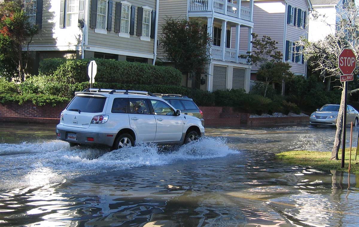
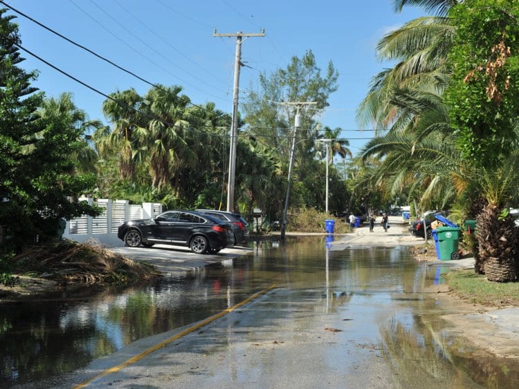
Sea levels are rising across the globe, leading to increased concern for the safety of coastal communities and wildlife populations.

Sea levels are rising as a direct result of the earth’s warming. Due to this warming, the permanent ice sheets over Greenland and Antarctica are melting, which means less sea ice (ice floating in the polar ocean areas) is being formed each winter. Further complicating the matter, the warmer the water the more it expands, which also takes up an increased amount of space. The melting and loss of sea ice has accelerated over the last decade and is now believed to be one of main causes of increasing sea levels. This is irrefutable evidence of global warming, which isn’t limited to one incident but marks a trend of increasing ocean temperatures and levels.

Global average absolute sea level change from 1880 to 2015. Photo: CSIRO / NOAA

According to the National Atmospheric and Oceanic Agency’s (NOAA) State of the Climate Report (ncdc.noaa.gov/sotc), 2015 was the second warmest year on record for the U.S. The report stated that it was “the 19th consecutive year the annual average temperature exceeded the 20th century average”. Not only were global temperatures measured at the highest level ever recorded, but they also broke the previous temperature records by an unprecedented margin. And after the data points for 2016 temperatures are finalized, we may find that 2016 was even warmer than 2015. Overall, the earth has been warming since comprehensive temperature records have been kept in 1880, and this warming rate has increased in recent decades. Global warming has been attributed to the actions of humanity, particularly those that have increased the global quantities of greenhouse gases such as carbon dioxide. For example, prior to the Industrial Revolution in the 18th century, atmospheric carbon dioxide levels were about 280 ppm (parts per million). Today, that level rests at about 400 ppm.

Global warming is an issue for both the Northern and Southern Hemispheres. The Arctic region is facing the harshest increases in temperature. In 2006, NOAA started issuing an annual Arctic Report Card documenting observed weather conditions. The 2016 report is particularly disturbing. The average annual air temperature over land areas was the highest on record with a 6 degrees F increase since 1900, while the Arctic Ocean temperatures were 9 degrees F above average in August. Spring snow cover was at a record low in the North American Arctic, as was sea ice in the fall. On December 22, 2016, a weather buoy just 90 miles south of the North Pole registered a temperature of 32 degrees F, nearly 50 degrees above normal. Even more disturbing, one study suggests that the Greenland ice sheet lost one trillion tons of ice between 2011 and 2014 alone.

There are two ways to accurately measure sea level. Tide gauges have recorded local sea levels for more than a century. However, the old ruler-type gauges are giving way to modern microwave sensor stations. And in the past 20 years, satellite measurements have been available that use laser altimeters. According to NOAA, the sea level has been rising for the last 100 years (corresponding to an increase in the earth’s temperature), and the rate of rise has been increasing in recent decades. Globally, the overall rise in sea level is eight inches, which may not sound like much, so for reference consider that nearly 70 percent of the earth’s surface is covered by water—an estimated 3.5 x 10²⁰ gallons. Also keep in mind that the surface of the ocean isn’t simply flat since the moon’s gravitation causes a significant bulge that moves with the earth’s rotation and causes the tides. Local currents and winds also distort sea level.

Why should we be worried about rising sea levels? About 40 percent of the U.S. population lives in coastal areas, all of which are at risk of flooding. According to NOAA, “Flooding increased on all three U.S. coasts between 300 and 925 percent since the 1960s, with the biggest increases in the Mid-Atlantic.” Naturally, we expect the damaging high tides and storm surges of hurricanes or other coastal storms, but the danger is intensified by higher sea levels, which allow these storm-induced tides to reach further inland and produce even more destruction.

One of the most pressing problems related to rising sea levels is the increased occurrence of “nuisance floods,” which are typically not storm related but rather occur with unusually high astronomical tides. Perigean spring tides or “king tides” occur several times a year when the moon is closest to the earth. Normally, the flooding caused by perigean spring tides is usually minor in low-lying areas and at their worst produce road closures and minor damage. However, in recent years, this tidal flooding has gotten progressively worse and is far beyond just being a nuisance. Roads are frequently becoming submerged under deeper water for increasingly longer periods of time. Homes and businesses have also experienced flooding in their basements. Some king tides rank with major storm tides as the highest on record. South Florida was hit particularly hard by these tides in the fall of 2016.

Wildlife is also severely impacted by rising seas and the resulting loss of coastal habitats. Warmer water temperatures have a negative impact on animal and fish populations that are already adapted to cooler water temperatures. Furthermore, algae blooms occur more frequently in warmer water temperatures, bringing about an increasing number of “red tides”.

What does the future hold? Scientists agree that sea levels will continue to rise as the earth’s temperature rises. Estimates predict that by 2100, sea levels will likely be at least a foot higher than they are today, but this is assuming we don’t have a rapid collapse of the major ice sheets, which could lead to water level rises of 20 to 30 feet.

Is there anything we can do as global citizens to mitigate the impact of global warming? Certainly, we need to cut greenhouse gas emissions around the world, but we also have to prepare for rising sea levels. The infrastructure of coastal cities and communities will need adaptations to prepare for rising sea levels, and ultimately some may need to be abandoned. But rising sea levels impact the entire planet and each of us should take steps to reduce our global footprint. For more information visit arctic.noaa.gov/report-card or climate.gov.

By Ed Brotak, Southern Boating February 2017

Exit mobile version