Exploring the Unexplored Oceans

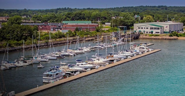
It is estimated that 95 percent of the earth’s oceans remain unexplored. No wonder since the ocean covers 140 million square miles of the earth’s surface with an average depth of 12,000 feet.

The ocean floor’s deepest point is 36,000 feet below the water’s surface in the western Pacific Ocean and is called the Challenger Deep section of the Mariana Trench. It is extremely inhospitable down there. There’s virtually no light, water temperatures are near freezing and the pressure is a crushing 1,000 times what it is at sea level. But, in order to manage and protect ocean resources, we must learn what’s far below the surface.

The U.S. government agency that does much of the basic research for both the atmosphere and the oceans is the National Oceanic and Atmospheric Administration (NOAA) under the Department of Commerce. One branch of NOAA is the Office of Ocean Exploration and Research (OER), which is touted as “the only federal organization dedicated to exploring the unknown reaches of our ocean”. To support these endeavors, the Office of Marine and Aviation Operations (OMAO) supplies the ships and aircraft needed as well as the personnel to run them (omao.noaa.gov/).

OMAO is staffed by civilians and also has an enlisted contingent. The NOAA Commissioned Officer Corps—simply known as NOAA Corps—is one of the nation’s seven uniformed services. Prior to admission, candidates must possess a baccalaureate degree preferably in math, science or engineering. Basic training in seamanship is held in conjunction with the Coast Guard’s officer training program. After successful basic training and commissioning, officers receive their first ship assignment based on their qualifications and service needs. The 321 officers of the NOAA Corps are seamen and scientists and support NOAA’s wide variety of oceanic research efforts.

One of the primary duties of NOAA Corps officers is to operate NOAA’s research aircraft and ships. NOAA has nine manned aircraft which are stationed at MacDill AFB in Tampa, Florida. Two Lockheed WP-3D aircraft are designated “Hurricane Hunters” and fly into these great storms to gather vital data. Other smaller aircraft fly a variety of scientific missions across the country. NOAA also has drones it uses for monitoring wildlife.

NOAA has a fleet of 16 ships, the nation’s largest fleet of oceanographic research and survey ships, which are administered by the OMAO. These ships are engaged in fisheries surveys, hydrographic surveys and oceanographic research. Operations centers are located in Norfolk, Virginia, Newport, Oregon, and Honolulu, Hawaii. The ships are run by NOAA Corps officers with some civilian seamen completing the crew.

The pride of the NOAA fleet is the NOAA ship Okeanos Explorer, dubbed “America’s ship for ocean exploration”. A former U.S. Navy ship, Okeanos was refitted for oceanographic exploration and commissioned in 2008. The name was actually the winning entry in NOAA’s nationwide ship-naming contest and according to Greek cosmology, Okeanos was the river/ocean that encircled the world. The 224-foot Okeanos Explorer has a crew of 27 and typically sails with 19 scientists on board. These are OER research missions, and NOAA wants to involve as many experts as possible. Interested scientists can apply for the limited number of positions actually on board the ship. But much of the expert input on missions comes from teams of scientists at various Exploration Command Centers with the Inner Space Center at the University of Rhode Island Bay Campus being the primary one.

Okeanos Explorer is equipped with a high-bandwidth satellite communications system (the large satellite dome on the ship) which allows rapid data transmission. Scientists on shore can then have “telepresence”, which enables them to view Okeanos’ findings almost instantaneously and communicate back to the ship as necessary while helping to direct the mission.

Exploration missions often take the vessel to remote ocean areas. With high-powered sonar equipment, a major objective of the research cruises is to map previously unknown sections of the sea floor. For a closer examination of deep water sites, Okeanos has two remotely operated vehicles (ROVs), Deep Discoverer (D2) and its sister vehicle Seirios. With 20 LED lights and 9 video cameras, the ROVs can plunge to depths of nearly four miles and send back high-definition video, which is live-streamed to scientists on the ship and back on shore.

In 2016, the Okeanos Explorer explored the Northern Marianas Islands, Guam and the Marianas Trench Marine National Monument. Scientists on board and connected remotely could view previously unexplored areas of the seafloor. They observed a number of new animal species and unusual geological features. This year, the Okeanos Explorer will again be involved with Project CAPSTONE, a multi-year scientific investigation of deep-water, U.S.-protected marine areas in the central and western Pacific Ocean. These include national marine sanctuaries and marine national monuments, the underwater equivalents of national parks. Again, the goal will be undersea mapping and further explorations of biological and geological features with the ROVs.

When a mission is ongoing, the video is live streamed and broadcast through standard Internet connections.

If you’d like take part in an ongoing mission, go to the NOAA Ocean Explorer website oceanexplorer.noaa.gov. The live video feeds on the last mission generated a record-breaking 3.1 million views over the course of the expedition.

— By Ed Brotak, Southern Boating Magazine March 2017

Sea Levels Rise

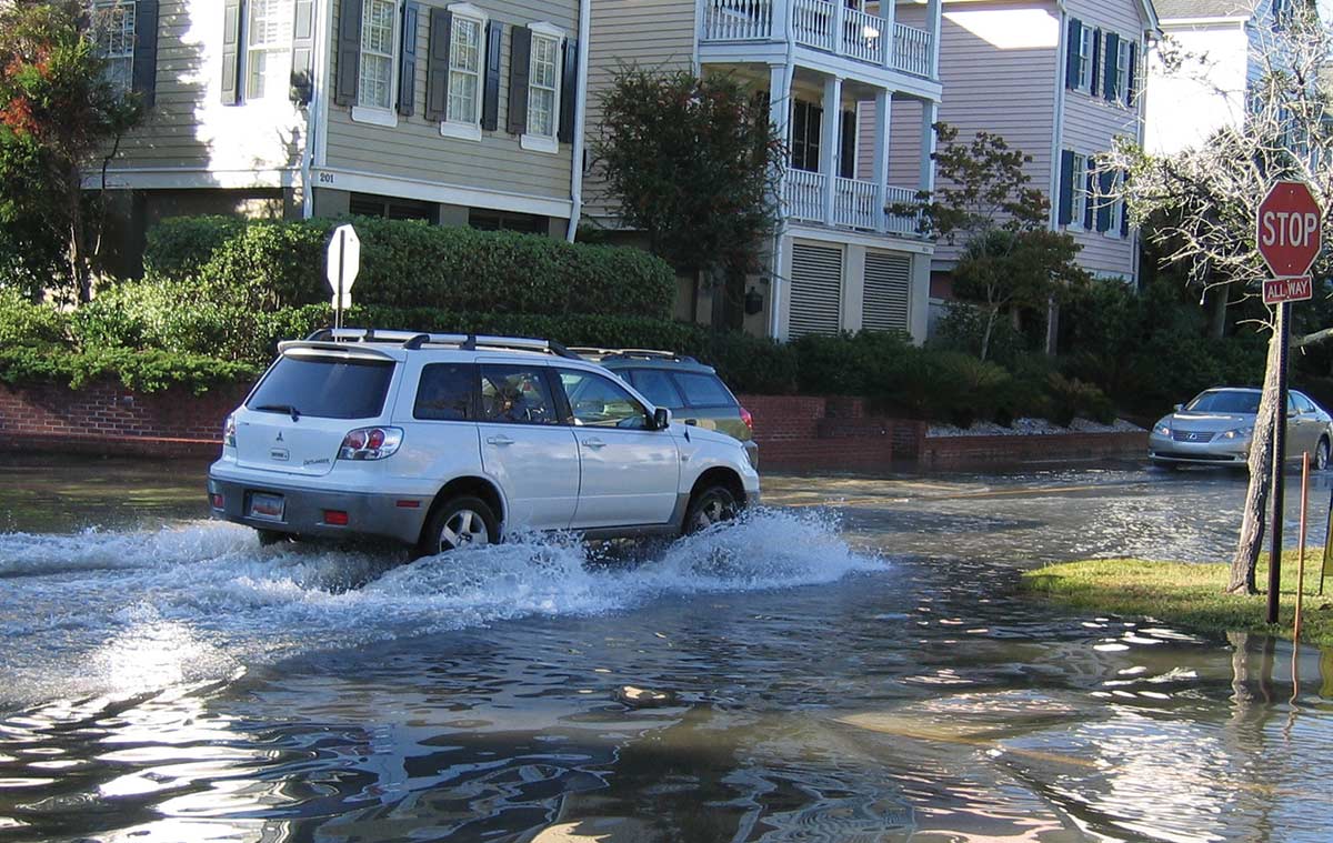
Sea levels are rising across the globe, leading to increased concern for the safety of coastal communities and wildlife populations.

Sea levels are rising as a direct result of the earth’s warming. Due to this warming, the permanent ice sheets over Greenland and Antarctica are melting, which means less sea ice (ice floating in the polar ocean areas) is being formed each winter. Further complicating the matter, the warmer the water the more it expands, which also takes up an increased amount of space. The melting and loss of sea ice has accelerated over the last decade and is now believed to be one of main causes of increasing sea levels. This is irrefutable evidence of global warming, which isn’t limited to one incident but marks a trend of increasing ocean temperatures and levels.

Global average absolute sea level change from 1880 to 2015. Photo: CSIRO / NOAA

According to the National Atmospheric and Oceanic Agency’s (NOAA) State of the Climate Report (ncdc.noaa.gov/sotc), 2015 was the second warmest year on record for the U.S. The report stated that it was “the 19th consecutive year the annual average temperature exceeded the 20th century average”. Not only were global temperatures measured at the highest level ever recorded, but they also broke the previous temperature records by an unprecedented margin. And after the data points for 2016 temperatures are finalized, we may find that 2016 was even warmer than 2015. Overall, the earth has been warming since comprehensive temperature records have been kept in 1880, and this warming rate has increased in recent decades. Global warming has been attributed to the actions of humanity, particularly those that have increased the global quantities of greenhouse gases such as carbon dioxide. For example, prior to the Industrial Revolution in the 18th century, atmospheric carbon dioxide levels were about 280 ppm (parts per million). Today, that level rests at about 400 ppm.

Global warming is an issue for both the Northern and Southern Hemispheres. The Arctic region is facing the harshest increases in temperature. In 2006, NOAA started issuing an annual Arctic Report Card documenting observed weather conditions. The 2016 report is particularly disturbing. The average annual air temperature over land areas was the highest on record with a 6 degrees F increase since 1900, while the Arctic Ocean temperatures were 9 degrees F above average in August. Spring snow cover was at a record low in the North American Arctic, as was sea ice in the fall. On December 22, 2016, a weather buoy just 90 miles south of the North Pole registered a temperature of 32 degrees F, nearly 50 degrees above normal. Even more disturbing, one study suggests that the Greenland ice sheet lost one trillion tons of ice between 2011 and 2014 alone.

There are two ways to accurately measure sea level. Tide gauges have recorded local sea levels for more than a century. However, the old ruler-type gauges are giving way to modern microwave sensor stations. And in the past 20 years, satellite measurements have been available that use laser altimeters. According to NOAA, the sea level has been rising for the last 100 years (corresponding to an increase in the earth’s temperature), and the rate of rise has been increasing in recent decades. Globally, the overall rise in sea level is eight inches, which may not sound like much, so for reference consider that nearly 70 percent of the earth’s surface is covered by water—an estimated 3.5 x 10²⁰ gallons. Also keep in mind that the surface of the ocean isn’t simply flat since the moon’s gravitation causes a significant bulge that moves with the earth’s rotation and causes the tides. Local currents and winds also distort sea level.

Why should we be worried about rising sea levels? About 40 percent of the U.S. population lives in coastal areas, all of which are at risk of flooding. According to NOAA, “Flooding increased on all three U.S. coasts between 300 and 925 percent since the 1960s, with the biggest increases in the Mid-Atlantic.” Naturally, we expect the damaging high tides and storm surges of hurricanes or other coastal storms, but the danger is intensified by higher sea levels, which allow these storm-induced tides to reach further inland and produce even more destruction.

One of the most pressing problems related to rising sea levels is the increased occurrence of “nuisance floods,” which are typically not storm related but rather occur with unusually high astronomical tides. Perigean spring tides or “king tides” occur several times a year when the moon is closest to the earth. Normally, the flooding caused by perigean spring tides is usually minor in low-lying areas and at their worst produce road closures and minor damage. However, in recent years, this tidal flooding has gotten progressively worse and is far beyond just being a nuisance. Roads are frequently becoming submerged under deeper water for increasingly longer periods of time. Homes and businesses have also experienced flooding in their basements. Some king tides rank with major storm tides as the highest on record. South Florida was hit particularly hard by these tides in the fall of 2016.

Wildlife is also severely impacted by rising seas and the resulting loss of coastal habitats. Warmer water temperatures have a negative impact on animal and fish populations that are already adapted to cooler water temperatures. Furthermore, algae blooms occur more frequently in warmer water temperatures, bringing about an increasing number of “red tides”.

What does the future hold? Scientists agree that sea levels will continue to rise as the earth’s temperature rises. Estimates predict that by 2100, sea levels will likely be at least a foot higher than they are today, but this is assuming we don’t have a rapid collapse of the major ice sheets, which could lead to water level rises of 20 to 30 feet.

Is there anything we can do as global citizens to mitigate the impact of global warming? Certainly, we need to cut greenhouse gas emissions around the world, but we also have to prepare for rising sea levels. The infrastructure of coastal cities and communities will need adaptations to prepare for rising sea levels, and ultimately some may need to be abandoned. But rising sea levels impact the entire planet and each of us should take steps to reduce our global footprint. For more information visit arctic.noaa.gov/report-card or climate.gov.

By Ed Brotak, Southern Boating February 2017

Exit mobile version