Conception Island

REMARKABLE FOR ITS SMALL SIZE AND LOCATIONConception Island is an oasis of nature as it used to be throughout The Bahamas.

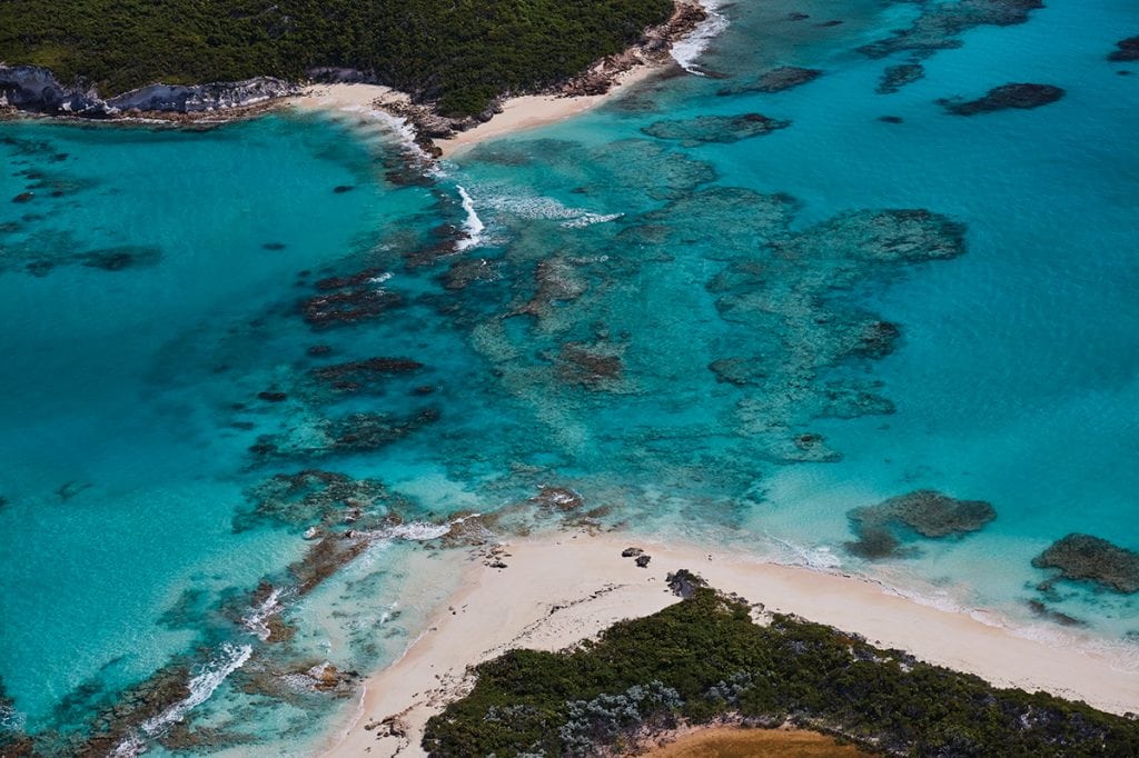
It sits on a limestone plateau that rises from surrounding depths of more than 7,000 feet just 18nm east of Cape Santa Maria at the northern tip of Long Island, but it seems a world apart from even that sparsely populated Out Island. Conception comprises approximately 4.5 square miles of land area, with some of the prettiest beaches and snorkeling to be found in these islands.

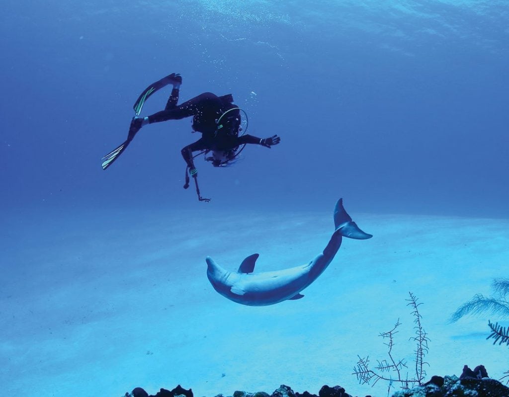
Extensive reef systems extend to the north, east and south for miles providing excellent diving and snorkeling, although it’s important to remember that this is open ocean and subject to swell even in calm conditions.

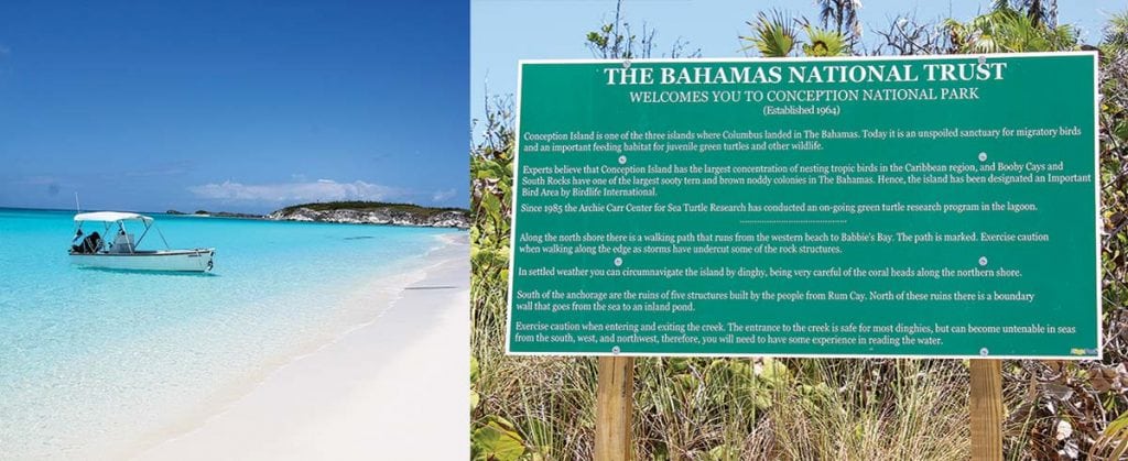
Conception, along with the adjacent Booby Cay and South Rocks, is part of the National Land and Sea Park system administered by the Bahamas National Trust. The entire area is protected; visitors are welcome but should take nothing and leave only footprints. The park here was established in 1964 and has not seen human habitation since the very early 1900s.

There is believed to have been a small fishing and farming community established here at that time, and you can see some remains of a stone wall and buildings near the south end of the West Bay anchorage.

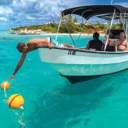
Most boats will approach from the west, from Cat Island, Long Island, or the Exumas. The primary anchorage is West Bay, a broad crescent near the northwest corner of the island and fronted by a perfect, white-sand beach.

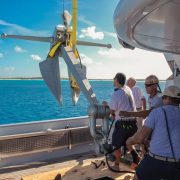
There are several small reef areas protecting the entrance to the bay and isolated coral heads inside, but there is ample area to anchor in clean sand with good holding. There are three moorings here that were donated to the Trust and installed for very large yachts to use. But if there is any west wind forecast, it is time to leave, and any northerly swell can make it pretty uncomfortable.

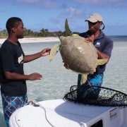
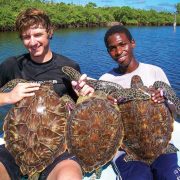
As a result of those long, isolated and uninhabited years, this is a pristine habitat for birds and marine life. There is a large concentration of tropic birds, and Booby Cay hosts nesting colonies of other sea birds. Most of the interior is mangrove fl ats and creeks that provide important nesting areas for green turtles, Nassau grouper and lobsters.

An entrance about halfway down the west coast south of West Bay provides access to the interior creeks. There is a shallow bar across the entrance, so plan to go an hour or so before high tide. Inside, there is plenty of depth for your dinghy or kayak, and you will see many kinds of marine life in the shallows. Behind the north end of the anchorage, hiking trails lead to the east side, more small beaches, and numerous tidal pools to explore. This is one of several islands believed to have been visited by Columbus on his first voyage.

You may feel a little like an explorer yourself as you wander its pristine shores.

By Rex Noel, Southern Boating December 2017

More Bahamas Updates

Island life and tings

The Bahamas National Trust installed new signs around Conception Island to help cruisers enjoy the island, stay safe and respect the wildlife. The three moorings in West Bay have been reset and inspected. Boats over 100 feet are strongly encouraged to use these moorings; the southernmost mooring is a 3,000-pound Danforth for vessels up to 200 feet.

Sea Turtle Network

Sea turtle nesting season runs roughly from April to September. Reports of nesting activity are especially important in The Bahamas because there are so many nesting beaches scattered throughout the islands and only a few people regularly monitor them. The Department of Marine Resources has partnered with several non-governmental organizations (NGO) to form the Sea Turtle Network, the purpose of which is to reduce the illegal harvest of sea turtles that continues despite the complete ban in 2009. The Network also provides an important means of disseminating information and receiving important sea turtle observations. All cruisers are asked to report sightings of mating or nesting turtles, injured turtles, turtles found with tags, and any violations of the ban on the harvest of turtles. Reports can be made on Facebook: Bahamas Sea Turtle Network.

The Island School

Parents and grandparents interested in a rewarding experience for high school students should visit the Island School in South Eleuthera. The school and its partner, the Cape Eleuthera Institute, are located within walking distance of the Cape Eleuthera Marina.
Founded by Chris Maxey, the Island School offers full semester programs for about 50 students and offers special scholarships for Bahamians. The organization also runs a middle school in Deep Creek for local children. Spend time investigating the school’s extraordinary opportunities at islandschool.org.
The Cape Eleuthera Institute is a research facility where senior scientists conduct important oceanographic research and involve the Island School students in their projects, including ongoing studies of sharks, rays, sea turtles, lionfish, conch, and bonefish.

Left to right: Maria Cartwright, Molly Dean and Hermie Cartwright talkin’ Bahamian at the Outer Edge in Clarence Town

Talkin’ Bahamian

The Bahamas’ linguistic treasures are part of a rich culture. Here are a few of our island-lingo favorites we’ve learned over the years:
• Day clean: first light, dawn
• Me-one/you-one: by myself. “Who sailed here with you?” “Nobody. Just me-one.”
• I ain’ know, you know: answer to any question with an unknown answer.
• God spare life: answer to remarks like “See you tomorrow.”
• Done reach: has arrived, “The mailboat done reach.”
• One time ago: sometime in the past
• Tief: steal, “Someone done tief ma boat last night.”
• Owned: used with the name of the owner, “That Pam-owned car.”
• Next: another, “You want a next beer?”
• Tingum: all-purpose designation of an object the listener is supposed to know. “Fetch me another tingum.”
More Talkin’ Bahamian by Patricia Glinton-Meicholas has an excellent collection of words and phrases with good explanations of meanings and usage. Glinton-Meicholas’ How to Be a True-True Bahamian explains much of the context of these gems.

Stolen dinghies

Dinghy theft continues to rise throughout The Bahamas. There is no absolute way to prevent your dinghy from being stolen, but basic seaman’s preparedness may surely help especially as the season of thunderstorms and hurricanes is upon us. At the end of the day’s activities it is good practice to secure the boat for the night and ensure that all equipment is stowed, anchor is holding, dinghy is on deck, and so on. Be ready to react quickly to surprises that may come in the night. If you tow a larger center console boat, invest in an alarm/tracking system such as the SeaTrax II from AtlasTrax (atlastrax.com). To report theft and other crimes to the Bahamian Police, dial 911 or 919.

Dean’s Blue Hole

Dean’s Blue Hole just north of Clarence Town, Long Island, is one of the most exciting natural features in The Bahamas and is now a major location for freediving training and competition. At the annual Vertical Blue competition on Saturday, April 30th, William Trubridge broke the world record in the free immersion category of freediving. More incredible is that on Monday he went down again and added another 2 meters to his record; he reached 124 meters on a single breath lasting 4 minutes 34 seconds.
NOTE: Freediving to extraordinary depths is dangerous and should not be practiced without considerable instruction and extensive safety precautions. verticalblue.net

Navigation and safety

As everyone knows we are now well into hurricane season and the season of severe thunderstorms and water spouts. Be extra careful when selecting your anchorages as sudden squalls with shifting winds can ruin more than a good night’s sleep. Choose marinas that have good protection, always keep a short list of hurricane holes on hand, and make sure that you pay close attention to forecasts to access one of these holes in plenty of time if need be. Be sure to call these protected marinas well in advance as many marinas do not allow boats at their docks if there is a hurricane threat.
Remember how much trouble it was for meteorologists to predict Hurricane Joaquin last year? That hurricane was expected to be a category 1-2 but quickly became a category 3-5 and caused as much or more devastation than many memorable hurricanes. As the English proverb goes, “Prepare for the worst and hope for the best.”

By Stephen Connett, Southern Boating Magazine July 2016

Hurricane Season in The Bahamas

Hurricane season is upon us again, but summer and early fall are great times to cruise in The Bahamas as long as you have a good hurricane strategy. (Southern Boating readers know they need a hurricane strategy any time they’re in the hurricane zone no matter where they’re cruising.) If you look carefully at the charts and read the yachting guides you will discover that there are some excellent hurricane holes throughout the north and central islands. With good planning and a close eye on the weather forecasts you can keep yourself within reach of one of these harbors and ensure you’ll be securely moored in plenty of time. Make sure that space is available in your haven of choice and that your tanks are always topped off. The choices will depend on the size and draft of your vessel, where you want to cruise and whether you plan to stay on board during the storm.

Generally you want to choose harbors that are enclosed and small enough to have little fetch. It is also good to be tucked in behind some land and not just a breakwater. If you plan to stay at anchor make very sure that the holding is perfect. A few good choices are:

• Grand Bahama: Bradford Marine in Freeport and Port Lucaya Marina in Lucaya,

• Abacos: Baker’s Bay Marina

• Berry Islands: Great Harbour Cay and Chub Cay

• North Eleuthera: Spanish Wells Yacht Haven

• Nassau: Atlantis and Hurricane Hole

• Cat Island: Hawksnest Marina

• Exumas: Compass Cay Marina and Crab Cay

The southern islands have very few natural harbors. Fast powerboats can cruise these islands with greater safety because they can run back to Hawksnest or down to the Turks and Caicos in a few hours.

If you are new in The Bahamas local knowledge is strongly advised. Inexperienced cruisers will quickly learn that Bahamians have a very healthy respect for hurricanes and are more than willing to help anyone on the water.

Dancing with Dolphin in Conception

Be sure that you have communications systems on board that will provide you with up-to-date hurricane warnings and tracking. The Miami Hurricane Center (nhc.noaa.gov) is available on the Internet, and Chris Parker’s Marine Weather Center is available by email or single side band (mwxc.com). Be extra careful to maintain your float plan with a reliable friend or relative. We also suggest daily communications with at least one other boat cruising in your area.

San Salvador

San Salvador, the “Living Jewel” of The Bahamas, is a lovely destination with good facilities and some of the most abundant wildlife in the islands. Scuba divers swim with beautiful coral, reef fish, turtles, and sharks all along the southwestern shore. Birders find a variety of land and sea birds—Birds of San Salvador, Bahamas by R. Hays Cummins et al. is available from Kindle—and sport fishermen troll for pelagic fish on “The Hump” off the north end of the island. Bonefishermen work the flats in Pigeon Creek, and students and scientists are in residence at the Gerace Research Centre (geraceresearchcentre.com) year-round to study the island’s flora and fauna and geology. Historians still like to argue the evidence that the island was the place that Columbus first came ashore in the New World.

Best of all, the people of San Salvador know how fortunate they are and have worked relentlessly to preserve the island’s environment. For the last 10 years citizens have worked with the Bahamas National Trust, BREEF, the Gerace Research Centre, the Nature Conservancy, and the Bahamian government to achieve permanent protection for important habitats on the island and in its coastal waters.

At a ceremony in Cockburn on April 23rd the Deputy Prime Minister, Phillip “Brave” Davis, announced the establishment of five new national parks in San Salvador. The parks will be managed by the Bahamas National Trust. Most important to cruisers are the protected area on the west side, Graham’s Harbour and Pigeon Creek. These parks are part of the growing number of no-take marine protected areas that will protect at least 20 percent of Bahamian near-coastal waters by 2020 as part of the Caribbean Challenge.


By Stephen Connett, Southern Boating Magazine July, 2015

Conception Island National Park adds convenient new yacht moorings.

To ensure that large yachts can safely moor in Conception Island National Park without damaging coral, the Bahamas National Trust (BNT) installed three moorings in West Bay. The outermost mooring is a 3,000-pound Navy Danforth-type anchor with 90′ of 11/8″ chain and a 2″ nylon pennant for vessels up to 200 feet LOA. The other two moorings are 1,000-pound Navy stockless anchors with 90′ of 11/8″ chain and 11⁄4″ nylon pennants for vessels up to 150 feet LOA. All moorings have large red buoys and small red pickup buoys. Vessels will need to run their own lines through the large thimbles on the ends of the pennants.

These moorings and their installation and maintenance are the generous gift of Mr. and Mrs. Thomas Bagwell, longtime annual visitors and advocates of Conception Island. Jim Holman, Captain of the Bagwells’ 152-foot yacht CHANTAL MA VIE, and his crew made a special trip to Conception Island to set the moorings with a representative of BNT. Yachts are encouraged to use the moorings but to vacate mooring #1 if CHANTAL MA VIE arrives in Conception Island. GPS coordinates of the moorings:

#1 (3,000 lbs.): 23-51.091N/75-07.644W
#2 (1,000 lbs.): 23-51.109N/75-07.382W
#3 (1,000 lbs.): 23-51.099N/75-07.307W

[photomosaic ids=”5909,5910,5911,5912″ orderby=”rand”]

Bahamas Fisheries Regulations
Over the years there have been changes to Bahamian fisheries regulations but not as many changes as in unfounded rumors. Upon entering The Bahamas all foreign vessels should get a free fishing permit from Bahamian Customs. Customs should provide a copy of current regulations, but they usually do not have copies on hand. We recommend that you get the free fishrules app or go to breef.org for the latest fisheries regulations.

Fishrulesapp.com
This exciting free app is now available for Androids and iPhones. It provides fisheries regulations for the SoutheastU.S., the Gulf of Mexico and The Bahamas. This app also includes fishing guides and by using the GPS in your phone will tell you if you are in a marine protected area.

U.S., the Gulf of Mexico and The Bahamas. This app also includes fishing guides and by using the GPS in your phone will tell you if you are in a marine protected area.

The bag limits for foreign vessels are generous, so the penalty for exceeding the limits can be severe. Remember that the fisheries resources belong to the citizens of The Bahamas who work hard to ensure they maintain sustainable fisheries. Do not exceed the bag limits!

The current limits for foreign vessels with fisheries permits:
• Migratory species such as kingfish, dolphin (mahi mahi), tuna, and wahoo: 18 fish total per vessel at any time
• Conch: 6 per vessel at any time
• Crawfish (spiny lobster): 10 per vessel at any time
• Demersal species (grouper, snapper, etc.) 60 pounds or 20 fish per vessel at any time. The minimum size for grouper is 3 pounds.
• There is a total ban on sea turtles and sharks. All bonefish must be released in good condition.
• The closed season for Nassau Grouper is December, January and February and may be extended if necessary.

Bay Street Marina, Nassau
The Bay Street Marina is a major upgrade to yacht facilities and Nassau’s waterfront. Located just west of the western Paradise Island Bridge, the Bay Street Marina is a protected, full-service marina that is well managed and reasonably priced. There is 24-hour security with cameras, locked gates at the entry of each dock, and a guard dog at night. 

The marina has 82 slips and can accommodate vessels up to 200′ with a 12′ draft. Marina Manager Peter Maury and Assistant Dockmaster Jacqueline Callender have many years of experience. The marina is located in front of the Green Parrot, the Harbourfront Lounge, and Luciano’s of Chicago— three restaurants that offer a wonderful variety. Luciano’s is one of the best restaurants in Nassau, but if you aren’t careful eating out may cost more than your dockage.

Also enjoy the free shuttle to Solomon’s Fresh Market to stock up on fresh food and supplies. Expect to pay $2.50 per foot or less depending on your length of stay. baystreetmarina.com

Mann Island, North Eleuthera
Brilanders have long used Mann Island—a beautiful, uninhabited cay just north of Harbour Island—for picnics and camping on holidays, especially in the summer. The southern beach is well protected and perfect for couples or families with children.

Recently the southern third of the island was donated to the Bahamas National Trust (BNT) and has become a national park. The BNT has cut footpaths through the bush for better access to the interior and ocean side. Few yachts anchor near Mann Island, but if you are careful there are several sheltered places to anchor in eight feet over a sandy bottom. Mann can be a wonderful day trip or an anchorage that offers a quiet respite from the hustle, constant wake and expense of Harbour Island.

By Stephen Connett, Southern Boating February 2015

Bahamas websites, blogs and social networks keep cruisers connected.

.The Internet now offers safety, information and a sense of community to cruisers in The Bahamas. Many cruising websites provide timely maritime and local island information, as well as social announcements to keep cruisers in the know.

• Barometer Bob: barometerbob.org
• Bahamas Info Newsletter: bahamaislandsinfo.com
• I Love Hope Town: ilovehopetown.com
• Bahamas Chatter: chatter.explorercharts.com

There are also websites and blogs that enrich the Bahamian experience and make life more enjoyable, such as Rolling Harbour (rollingharbour.com). It features wildlife news and photos, a variety of useful links, lists of pertinent books, maps of Abaco, and more. The blog is informal and delightfully random, but it is a great place to gain a general knowledge of Bahamian wildlife on land and sea.

Cruisers will also want to check out the following websites and social media pages of these major conservation organizations to learn about their environment, educational programs, volunteer opportunities, and events. Cruisers are welcome to get involved in many activities.

• Bahamas National Trust: bnt.bs
• BREEF: breef.org
• Friends of the Environment: friendsoftheenvironment.org
• The Nature Conservancy: nature.org

[photomosaic ids=”5842,5843,5844″ orderby=”rand”]

Salvage support is something cruisers hope to never need, but if you or someone near you needs to be salvaged or towed I recommend calling Overseas Salvage at (242) 355-2140 (overseassalvage.com) or R&B Boatyard at (242) 333-4462 (rbboatyard.com). These companies are equipped with experienced personnel, impressive equipment and can respond effectively. They will discuss pricing with you before getting underway.

Rum Cay is one of the beautiful islands in the southeast Bahamas and an excellent stop for those headed or returning from further south. The anchorage in Port Nelson is tenable in winds from NW-SE, though there is usually considerable surge causing the “Rum Cay Roll.” Sumner Point Marina provides excellent protection from all weather. In 2011, Hurricane Irene caused considerable damage to the south coast of Rum Cay and altered the natural movement of the sand filling much of the channel into the marina, but things are looking up. Sumner Point Marina is now under new management and reconstruction is expected to start this winter. In the meantime, some slips and facilities are available. For questions about facilities and for help of any kind in Rum Cay, call Bobby Little at (242) 525-0184.

The Bahamas National Trust (BNT) has established new mooring and anchoring fees for the Exuma Land and Sea Park and created a new membership category: Support Fleet Membership. Price varies with the size of your vessel, but the membership includes priority on the waiting list for moorings at Warderick Wells, two complimentary mooring nights to be used within one year, a BNT membership card, BNT newsletters, and a variety of BNT membership benefits. Membership also keeps you informed about BNT events, educational programs and conservation initiatives. Be assured that you will be investing in the sustainability of one of the finest cruising areas in the world.

French Leave Eleuthera is a new resort in Governor’s Harbour, with Harbour Village on the east side of the harbor. Harbour Village has a new dock with slips for two megayachts (up to 180′) with full services. There are also five megayacht moorings. Yachts staying at the docks or tied to the moorings will have access to all the resort facilities, including the pink sand French Leave Beach half a mile away on the ocean side of Eleuthera. The 1648 Bar and Grill located just south of the megayacht slips is open to the public. Reservations for the docks and moorings are strongly recommended. Governor’s Harbour is an historic town with a vibrant community that offers a full range of supplies and services. Be sure to visit the Anglican Church and the Haynes Library. frenchleaveresort.com

By Stephen Connett, Southern Boating January 2015

Take care of sea grass and coral when you cruise and anchor in The Bahamas

The Bahamian government is currently drafting new regulations—that include severe penalties—to protect coral throughout the islands. All vessels, from yachts to cruise ships, will be liable for any damage they cause to sea grass beds when they anchor, run aground or discharge pollutants. Sea grass beds are more fragile than most people realize and are very important to benthic ecosystems. Turtle grass is the principal food for green turtles, and queen conch graze on algae that grow in the sea grass beds. Use moorings when available and anchor only in clear sand. Many national parks have moorings with more planned. The Elizabeth Harbour Conservation Partnership in Great Exuma is in the process of installing a number of snorkeling moorings in Elizabeth Harbour, and a few yacht owners have committed to installing large moorings in West Bay, Conception Island. elizabethharbourpartnership.org

Firearms

Cruisers in the Bahamas are allowed to retain firearms on board for their entire cruise, although Bahamas Customs insists that all firearms and ammunition be declared upon entry and listed on the vessel’s Cruising Permit. Failure to declare firearms is a serious breach of Bahamian law.

If cruisers plan to leave their boats unattended for more than a few days, it is a good idea to contact the local Customs or Police who can secure the firearms ashore in a locked government facility—a sensible precaution to prevent them from getting into the wrong hands. Cruisers can recover their firearms when they return.

Fuel in the Central Exumas

The increased number of boats and the closure of the fuel facilities in Samson Cay have made it difficult for the Staniel Cay Yacht Club to keep up with demand. This summer the club occasionally ran out of gas. As fuel shortages are not uncommon in the out-islands, it is prudent to stay topped off and call ahead to your next destination.

[photomosaic ids=”5592,5591,5590,5589″ orderby=”rand”]

Spanish Wells

Spanish Wells is becoming even more cruiser friendly. A new restaurant, The Shipyard, has one of the prime locations in The Bahamas—the very east end of Spanish Wells overlooking the water to Gun Point. The restaurant has a full-service bar and excellent food at fair prices. There is also a two-for-one drink special at Happy Hour. The restaurant is usually closed Monday and Tuesday.

Spanish Wells Yacht Haven marina is being completely rebuilt with a new restaurant and bar, and guesthouses scheduled to open in December. The marina remains open with good electrical power, water and Internet access at all slips. The docks are scheduled to be rebuilt in early 2015. Call Dockmaster Leroy Kelly on 16 VHF or (242) 333-4255.

These improvements make North Eleuthera even better as a cruising destination with a variety of places to visit, the peace and quiet of Royal Island, Meek’s Patch, and the anchorage off The Bluff, for example. Spanish Wells offers friendly citizens and full services and supplies, including mechanics, welders and R&B Boatyard (rbboatyard.com). Harbour Island is an easy run—a pilot is still very much advised—and is rightfully called the Nantucket of The Bahamas.


Conch

The queen conch (Strombus gigas) stocks in The Bahamas are in a dramatic decline. The Bahamas government, the Bahamas National Trust, commercial fishermen, and others are working hard to draft new regulations that will help rebuild the stocks throughout The Bahamas. Foreign cruisers are still allowed to take conch, but in respect of the conch’s decline cruisers might consider leaving the conch for the local fishermen and eating their conch at restaurants ashore. It’s a good way to support the local economy. (To learn more about this culturally important species, see Dee Carstarphen’s The Conch Book.)

Junkanoo

It’s not too late to consider celebrating Christmas and New Year’s in The Bahamas. Skip the usual presents and buy plane tickets for the family to join you. The beauty of The Bahamas, the friendship of the Bahamian people and the intimacy of your own boat will draw everyone in. Children from up north will be glad to know that Santa Claus puts pontoons on his sled when he heads for southern waters. 

By Stephen Connett Southern Boating November 2014
Stevie Connett has been sailing in The Bahamas for several decades. For the last ten years Stevie and Barbara Crouchley have been cruising throughout the islands aboard FOXY LADY tagging sea turtles and working with the Education Department of the Bahamas National Trust.

Exit mobile version