Changes and Island Hopping in Eleuthera

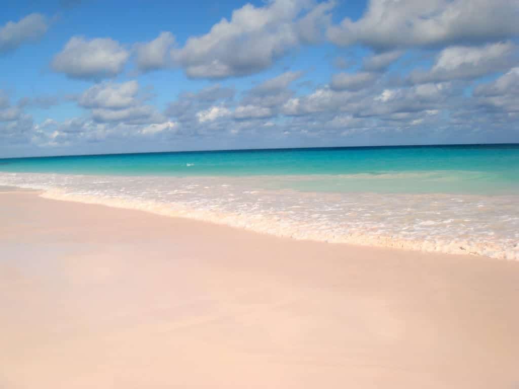
Island hopping in Eleuthera

Eleuthera and Harbour Island are surrounded by a handful of islands and cays: perfect for an island hopping adventure. Blue waters connect them, unique animal encounters fill them, and the many secrets of low tide lay between them.

But changes are coming to the islands.

The investment pipeline is looking strong in the remote Out Islands of The Bahamas as they are experiencing a resurgence due to a significant increase in annual visitor arrivals. Overall, stopover passengers grew by 16.7 percent in 2018, or 220,000 passengers.

For Eleuthera, the growth spurt was significantly higher than the national average.  Stopover visitors to Eleuthera— those who stay three to four nights arriving by air and sea—increased by 26.8 percent in 2018, or 13,000 passengers.

For cruise ship arrivals, the increase was 105 percent. While Eleuthera and its sister islands, Spanish Wells and Harbour Island, are not popular first ports of entry for boaters
because they are located southeast of Bimini, the Berry Islands, Grand Bahama, and Abaco, they are popular fishing destinations and have general appeal for leisure travelers.
Spanish Wells, known as the lobster capital, has the largest commercial fishing port in The Bahamas.

Fishing in South Eleuthera, from the Cape Eleuthera Resort & Marina, provides ample opportunities to hook sailfish, blue and white marlin, mahi-mahi, wahoo up to 95 pounds, and yellow and blackfin tuna.

Here’s a snapshot of tourism developments underway in Eleuthera that is expected to increase interest in the Bahamian island.

Jack’s Bay Club in Rock Sound

Work is ongoing at Jack’s Bay Club in Rock Sound, including the construction of the Salt Spray Cafe and the Tiger Woods-designed, 10-hole, par-3 golf course overlooking the ocean known as “The Playgrounds.” Jack’s Bay is expected to have three subdivisions of residential lots, a beach club with a luxurious spa, fitness center, resort-style pool, and other state-of-the-art amenities and services.

Harbour Island Club & Marina

A $45 million revitalization for the Harbour Island Club & Marina by real estate developer Michael Wiener will expand the marina from the original 32 slips to 55 and upgrade the property into a 28-room boutique hotel supplemented by 10 luxury villas and a swimming pool. The hotel will also include a waterfront restaurant and bar.

Other Eleuthera Developments

Last December, the Bahamas Investment Authority (BIA) approved the development of Philautia, a five-star, 20-room, health and wellness boutique resort in Governor’s  Harbour. The property will also include 15 villas as part of its accommodation offerings as well as restaurants serving food grown at an onsite organic farm.

New owners recently purchased Windermere Island, Rainbow Inn Resort
and Middle Cay Guest Cottage— all established properties that are considered long overdue for upgrades. The respective owners are currently planning renovations and expansions.

Island Hopping

Don’t despair– the natural wonders of the island and their unique attributes are still the main attraction. Here are four places to visit on your next trip.

Comfort Cay

Comfort Cay is a rocky outcropping in North Eleuthera, the fourth most populated island of The Bahamas. Approximately 11,000 residents either fish or farm the rolling acres of pineapple plantations. Eleuthera is a mixed bag of isolated communities, well-developed resorts. The landscape is quite varied with rocky bluffs, low-lying wetlands, and massive coral reefs.

Pink Sands Beach

The almost indescribable pale pink color of the sand comes from microscopic coral insects, known as Foraminifera, which has a bright pink or red shell. Easily snorkel or swim near outlying reefs, which provide large areas of calm, shallow water.

Royal Island

Royal Island is a 430-acre island estate in the Bahamas, offering families and groups a unique and exquisitely private experience of this Caribbean paradise. The island features five stand-alone villas and a central beach club with resort amenities for guests of all ages, set amid pristine beaches and crystalline waters stretching as far as the eye can see.

Harbour Island

Harbour Island is chock-full of history and natural wonders. For a little bit of history, visit Loyalist Cottage, a wonderful example of loyalist architecture, Commissioner’s Residence built in 1913, St. John’s Anglican Church built in 1768, as well as the Chapel Street cemetery containing ancient graves. Or see a hidden overgrown 17t17th-century battery built by the English to defend the island at the southern end of Bay Street.

By Erin Brennan and Noelle Nicolls, Southern Boating July 2019

Good Advice for Bad Weather

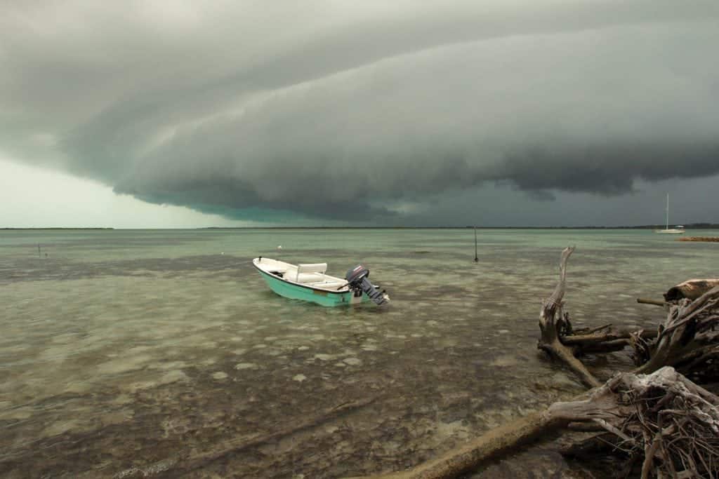
Between the Southern Tip of Eleuthera and Little San Salvador, there is a figurative bridge connecting the two islands: a seven-mile-long overpass of water running east to west, with depths of 50 feet, sometimes less. This relatively shallow body of water is significant because it straddles an otherwise extremely deep ocean channel. To the north and south of the bridge, the sea is 10,000 feet deep.

The upwelling from this deep channel pushes baitfish into the shallows, attracting lots of big fish and boaters. Anglers don’t just pass through this cut; they deep drop or troll for blue marlin. “It is an amazing fishing area, one of the best I’ve seen in my life,” says Chris Morris, general manager of Cape Eleuthera Resort and Marina.

But these same conditions also make for ferocious seas in bad weather, and the Cape Eleuthera Marina provides a safe harbor. “That is a risky area to let bad weather catch
you, no ifs, ands or buts,” says Capt. Shalako Moxey, a Bahamian boating veteran of 35 years. “You have on the northern shore those big seas rolling in, and coming in around that point, you have those tidal changes that create a big rip current. It is not comfortable at all.”

There are a few spots that even the most experienced Bahamian boaters dread when it comes to being stranded out at sea: the Tongue of the Ocean (a deep oceanic trench separating Andros and New Providence) and the Gulf Stream. “If you miss and break down in the Gulf Stream and a bad tide is flowing downwards, you’ll be in Honduras quick, and if you get caught drifting in the Tongue of the Ocean in bad weather, you might end up somewhere in Cuba,” explains Kenny Minnis, a local boater with personal
experience being adrift in international waters between The Bahamas and Cuba.

Jaronn Roberts, a Harbour Island boater and charter operator says his worst experience was fishing on the wall between the Great Bahama Bank and the Gulf Stream. They lost track of the weather forecast while crawfishing in their dinghies, and wicked weather caught them on the edge of the Bank. “It was a critical situation, and we were afraid. A few of the dinghies sank,” says Roberts. “We tried to come home and started to slowly ride the waves, but the waves were breaking over the boat. It was terrible. That’s when we decided to hunker down.” They ducked behind East Isaac Cay, a sliver of rock that gave them some protection to weather out the storm to the next day.

Captain Brian Turnquest, private charter operator and owner of Party Cat Cruises, recalls being caught wrangling 12-foot seas in the Gulf Stream. “The banks were only three to four feet. When we got in the Gulf, we had at least 12-foot seas all the way from Great Isaac Lighthouse to Palm Beach,” he says. “It was so bad [that] we took the six-man life raft out of the hole and put it between us so it was easily accessible.”

The Bahamas might be a traveler’s paradise, but the sea is still the sea, and no matter how pretty it looks over the aquamarine horizon, bad weather in The Bahamas is no
more forgiving than bad weather anywhere else.

And don’t let those friends and passengers with the sad eyes and frustrated scowls make you think otherwise when the sun is shining and the sea is calm. “A lot of people look
at first glance and go out, but they don’t get a forecast to see if it is going to look nice all day. The weather might be good in the morning, but it might be set to kick up in the
afternoon. That is how people get caught in a bad spot,” says Turnquest. If captains don’t do their due diligence, they’re liable to buck into bad weather unexpectedly and risk ending up in distress.

Bad Weather Advice from Captain Shalako Moxey of Yellowtail Fishing Charters:
  • During hurricane season, boaters usually have ample time to buckle down or head back home. However, in the peak season, with all its cold fronts, the weather is more unpredictable. Because of Nassau’s strategic position, there are some good fishing options on at least one side of the island. The northern shore is available for wahoo and mahi-mahi fishing when the southwest trade winds are blowing. The south side is available for yellowtail, amberjacks and barracuda when the cold fronts are blowing in from the north.
  • Dotham Cut, south of Cave Cay, is the preferred cut to exit the banks when heading to Georgetown, Great Exuma on the oceanside. This is a convenient route for large boats, as they can ride the ocean straight into Elizabeth Harbour. However, Dotham Cut can be rough even in calm weather. Southeast winds with an outgoing tide can create a river rapid effect but on a larger scale. In bad weather, Dotham Cut, along with neighboring Galliot Cay cut just north, are perhaps the two most dangerous in the Exumas, and can
    feel as though a real hurricane is blowing through.
Bad Weather Advice from Captain Chase Camacho of Chase ‘n Dreams Yacht Charters:
  • One of the big, bad weather risks in The Bahamas is running aground on the reefs and the Banks. If you anchor out overnight, you can easily get blown off your anchor and run aground while sleeping. One night during the summer, we anchored in by Chub Cay in calm weather. A storm came through that night and the anchor alarm, which we put on,
    rang. We started to slide towards the shallows. There was complete darkness, but with our experience, we were able to reposition the boat in the rain, with gusts and high seas, and anchor back up in safety. An inexperienced person could have been lost.
  • You don’t want to be caught in bad weather if you are inexperienced. Getting into Port Lucaya in rough weather when the waves are rolling over is difficult, for example. You can hit those rocks easily. You can’t just say, “It’s gonna get bad, let’s get back.” You have to plan properly because if you are not getting back to a place that is easy to get into, you could still have problems. In fact, there are a lot of places in The Bahamas where you simply need a pilot to [come] get you. Harbour Island’s Devil’s Backbone is one of those notorious places that even on a good day, if you are unfamiliar, can be treacherous.

By Noelle Nicolls, Southern Boating March 2018

PHOTO: ERIK LARSON

Spanish Wells

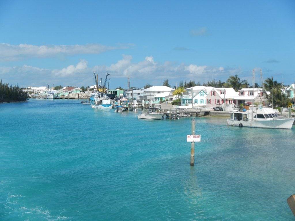
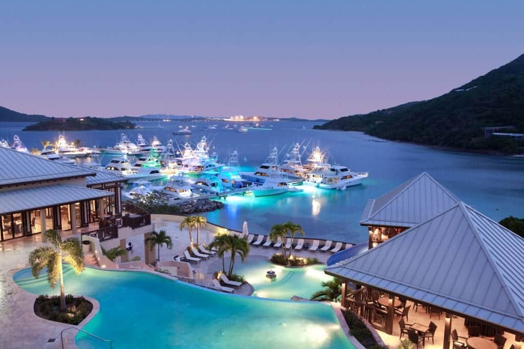
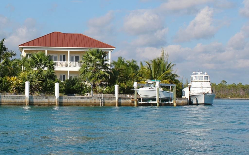
Spanish Wells: a cruising crossroads

For the cruising boat, Spanish Wells sits at the crossroads of the Abacos, Nassau, Exumas, and other Out Islands of The Bahamas. It has a long history of European
settlement, stretching to the 17th century, but seemingly hasn’t changed much in all that time. The name Spanish Wells really refers to the town itself and is usually applied to the general area. It is made up of three closely spaced islands separated only by the narrow harbor. St. George’s Cay is where the primary settlement lies, but it is connected by a low bridge to Russell Island just across from the waterfront, where many homes and fishing boats can be found. At the east end of the harbor, Charles Island is uninhabited but protects the town and harbor from strong south winds and seas. All of this lies just off the northwest tip of Eleuthera and at the north end of the Exumas section of the Great  Bahama Bank.

Fresh well water was discovered here during the period of European exploration, a precious commodity in those times, leading to the name of the settlement. The first European settlers were part of the Eleutheran Adventurers group shipwrecked on the Devil’s Backbone in 1647 who used a cave as shelter.

Coming from Bermuda seeking religious freedom, part of  the group ultimately  established themselves on St. George’s Cay. More settlers arrived as Loyalists from the newly independent United States in the late 1700s and sought refuge elsewhere in the British empire, but they were only allowed to come if they gave up their slaves. The result was an isolated, religious, independent community that remained so well into the 20th century. In the 1970s and ’80s, the town emerged from that solitude to become the premier commercial fishing port in The Bahamas, supplying “crawfish” (spiny lobster) to much of The Bahamas. Today, this is one of the wealthier towns in these islands, with well-maintained homes and businesses painted in bright pastel colors.

Spanish Wells is a popular and enjoyable stop for cruisers, with many attractions on land and in the water, a well-protected harbor, marine services, and numerous anchorages nearby among the surrounding islands. The primary entry is between Russell and Charles Islands, a narrow but well-marked and dredged cut with good depths. This entrance is used by freighters, large fishing boats and the fast ferry and is relatively straightforward.

Once through the gateway, turn sharply to port to reach Spanish Wells Yacht Haven, a full-service marina with excellent facilities, or turn to starboard to reach the small mooring field at the east end of the harbor. If you are arriving directly from the U.S. or elsewhere, you can clear customs at this Port of Entry. There is a second entrance to the harbor from the east side between Charles Island and St. George’s. It is also well charted with minimum depths of about six feet but is most often used when heading to or from Harbour Island. Fuel is readily available in the harbor, and great provisioning is right on the waterfront; given that this is a fishing town, seafood can be found easily.

The waters around Spanish Wells and east along Devil’s Backbone are well-known for fantastic SCUBA diving. The reefs have claimed many ships over the centuries, and a number of these wrecks are at accessible depths and still visible, some by snorkeling. About six miles away, Current Cut is often done as a drift dive in strong currents. In addition, locals have created multiple artificial reefs with everything from railroad cars to old automobiles. There are several dive companies in town and on nearby  Harbour Island, and some of the sportfishing operations also offer dive trips. About eight miles away over the banks to the southwest, Egg Island has good surfing in a north swell on the ocean side but behind a sheltering reef.

By Rex Noel, Southern Boating October 2017

See more Bahamas Updates with these Fall Events.

A bit of American History in Eleuthera

A little-known yet fascinating bit of 20th century United States history lies partially hidden in the steadily encroaching forest behind a beautiful Atlantic beach in central Eleuthera. Beginning in 1950, the U.S. Navy established a base here to house an experimental “Sound Surveillance System” (SOSUS) station. This technology used a set of hydrophones on the Atlantic Ocean floor east of the island, which were hardwired back to the base where any sounds could be profiled and matched in an effort to identify and track Soviet submarines. In those early days, the base was little more than a few small, wooden buildings and tents but would grow rapidly through the middle part of the decade.

By 1957, the base had grown into an official naval facility with a complement of 150 Navy personnel and several dozen civilian employees from RCA and Western Electric. At approximately the same time, the U.S. Air Force established an Auxiliary Air Base at the site. Their mission was to serve as one of several tracking stations for the USAF Atlantic Missile Range and track missiles and satellites launched from Cape Canaveral in Florida. Civilian Pan Am employees managed the Air Force side of the facility. At its peak, the facility also employed 45 Bahamians. The SOSUS system was fully operational in time to play a key role in the Cuban Missile Crisis. The Soviets attempted to use submarines to break the U.S. blockade of the island. But the SOSUS system enabled the American Navy to locate nearly all of the subs, force them to the surface and send them home. This effectively ended the crisis as Nikita Khrushchev abandoned his plan. The base was ultimately closed in 1980, and much of the equipment was abandoned in place and left to the ravages of the tropical climate. Today, it is a fascinating experience to wander through the ruins and ponder the history. Walking up the entrance road, a guard shack greets you with peeling blue and white paint. Just beyond is the base gas station, complete with the still visible 17¢ price! The left fork ultimately leads to a huge, sloping concrete pad, which was part of the system used to collect rainfall—the primary fresh water source for the base. Hidden in the surrounding trees you will find several huge water storage tanks and a pump house. Downhill from the base a gorgeous beach runs seemingly forever in both directions, and the offshore barrier reef provides great snorkeling. Back at the top of the hill, the remains of the main administration building still contain the office safe and the brig. There are barracks, maintenance areas and much more to explore. An excellent resource is projecteleuthera.org/ruins. The website includes an interactive Google map of the entire base and identifies many of the facilities you will see.

Alabaster Bay, just south of the Governor’s Harbour Airport, is an excellent anchorage in its own right and makes a perfect spot to visit the Navy base by boat. Anchor in a clean sand bottom just off the beach at Cocodimama Resort. Land your dinghy just south of the resort and walk past the resort to Queen’s Highway; turn right and then take a left on the first road and walk across the narrow island until you see the guard shack at the entrance to the base. Use caution when exploring since many of the remaining buildings may be unstable, and the forest contains poisonwood and thorn trees. Please take nothing but pictures from this haunting reminder of our past.

Kayak Fishing Tournament

The annual Extreme Kayak Fishing Battle in The Bahamas will be held at Flamingo Bay Resort on Grand Bahama Island April 20-23. With two days of fishing and a variety of entertainment through the weekend, this should be a fun event for serious kayak fishermen and their families. This is not flat, protected-water fishing. The competitors are after big game fish in open water, including wahoo, mahi, grouper, tuna, and even marlin. Packages are available with round-trip ferry transportation from Florida, including transport for your kayak and gear, Bahamian fishing license, accommodations, and much more. For more information and entry forms visit extremekayakfishingtournament.org/bahamas.

News Update

Chub Cay Marina in The Berry Islands remained closed at press time due to damage from Hurricane Matthew. Reopening is expected in 2017, but the timing has yet to be publicly announced.

The Bahamas Bureau of Standards and Quality recently reported that as many as half of all the gasoline pumps they surveyed dispensed inaccurate quantities of fuel. This wasn’t specifically or even primarily at marinas, but you may want to take steps to ensure you are getting what you pay for when buying fuel in the islands.

Words & photos by Rex Noel, Southern Boating Magazine March 2017

Island life and tings

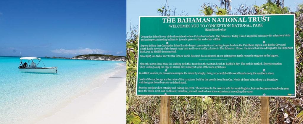
The Bahamas National Trust installed new signs around Conception Island to help cruisers enjoy the island, stay safe and respect the wildlife. The three moorings in West Bay have been reset and inspected. Boats over 100 feet are strongly encouraged to use these moorings; the southernmost mooring is a 3,000-pound Danforth for vessels up to 200 feet.

Sea Turtle Network

Sea turtle nesting season runs roughly from April to September. Reports of nesting activity are especially important in The Bahamas because there are so many nesting beaches scattered throughout the islands and only a few people regularly monitor them. The Department of Marine Resources has partnered with several non-governmental organizations (NGO) to form the Sea Turtle Network, the purpose of which is to reduce the illegal harvest of sea turtles that continues despite the complete ban in 2009. The Network also provides an important means of disseminating information and receiving important sea turtle observations. All cruisers are asked to report sightings of mating or nesting turtles, injured turtles, turtles found with tags, and any violations of the ban on the harvest of turtles. Reports can be made on Facebook: Bahamas Sea Turtle Network.

The Island School

Parents and grandparents interested in a rewarding experience for high school students should visit the Island School in South Eleuthera. The school and its partner, the Cape Eleuthera Institute, are located within walking distance of the Cape Eleuthera Marina.
Founded by Chris Maxey, the Island School offers full semester programs for about 50 students and offers special scholarships for Bahamians. The organization also runs a middle school in Deep Creek for local children. Spend time investigating the school’s extraordinary opportunities at islandschool.org.
The Cape Eleuthera Institute is a research facility where senior scientists conduct important oceanographic research and involve the Island School students in their projects, including ongoing studies of sharks, rays, sea turtles, lionfish, conch, and bonefish.

Left to right: Maria Cartwright, Molly Dean and Hermie Cartwright talkin’ Bahamian at the Outer Edge in Clarence Town

Talkin’ Bahamian

The Bahamas’ linguistic treasures are part of a rich culture. Here are a few of our island-lingo favorites we’ve learned over the years:
• Day clean: first light, dawn
• Me-one/you-one: by myself. “Who sailed here with you?” “Nobody. Just me-one.”
• I ain’ know, you know: answer to any question with an unknown answer.
• God spare life: answer to remarks like “See you tomorrow.”
• Done reach: has arrived, “The mailboat done reach.”
• One time ago: sometime in the past
• Tief: steal, “Someone done tief ma boat last night.”
• Owned: used with the name of the owner, “That Pam-owned car.”
• Next: another, “You want a next beer?”
• Tingum: all-purpose designation of an object the listener is supposed to know. “Fetch me another tingum.”
More Talkin’ Bahamian by Patricia Glinton-Meicholas has an excellent collection of words and phrases with good explanations of meanings and usage. Glinton-Meicholas’ How to Be a True-True Bahamian explains much of the context of these gems.

Stolen dinghies

Dinghy theft continues to rise throughout The Bahamas. There is no absolute way to prevent your dinghy from being stolen, but basic seaman’s preparedness may surely help especially as the season of thunderstorms and hurricanes is upon us. At the end of the day’s activities it is good practice to secure the boat for the night and ensure that all equipment is stowed, anchor is holding, dinghy is on deck, and so on. Be ready to react quickly to surprises that may come in the night. If you tow a larger center console boat, invest in an alarm/tracking system such as the SeaTrax II from AtlasTrax (atlastrax.com). To report theft and other crimes to the Bahamian Police, dial 911 or 919.

Dean’s Blue Hole

Dean’s Blue Hole just north of Clarence Town, Long Island, is one of the most exciting natural features in The Bahamas and is now a major location for freediving training and competition. At the annual Vertical Blue competition on Saturday, April 30th, William Trubridge broke the world record in the free immersion category of freediving. More incredible is that on Monday he went down again and added another 2 meters to his record; he reached 124 meters on a single breath lasting 4 minutes 34 seconds.
NOTE: Freediving to extraordinary depths is dangerous and should not be practiced without considerable instruction and extensive safety precautions. verticalblue.net

Navigation and safety

As everyone knows we are now well into hurricane season and the season of severe thunderstorms and water spouts. Be extra careful when selecting your anchorages as sudden squalls with shifting winds can ruin more than a good night’s sleep. Choose marinas that have good protection, always keep a short list of hurricane holes on hand, and make sure that you pay close attention to forecasts to access one of these holes in plenty of time if need be. Be sure to call these protected marinas well in advance as many marinas do not allow boats at their docks if there is a hurricane threat.
Remember how much trouble it was for meteorologists to predict Hurricane Joaquin last year? That hurricane was expected to be a category 1-2 but quickly became a category 3-5 and caused as much or more devastation than many memorable hurricanes. As the English proverb goes, “Prepare for the worst and hope for the best.”

By Stephen Connett, Southern Boating Magazine July 2016

The magic of Eleuthera

Long-time resident of Governor’s Harbour Katie Black Frost is the author of Eleuthera, a beautiful work about the island with photographs from Marc Coeffic and Harry Paungger.

Eleuthera has a long, fascinating history starting with the arrival of the Eleutheran Adventurers—a group of English Puritans and religious Independents—in the mid-17th century. The island is known for its livestock and agriculture—eat an Eleutheran pineapple in season, and you will not want to leave. With more than 200 miles of coast and miles of pink sand beaches, Eleuthera is a gift to fishermen and tourists. On her website, Frost invites readers to “Come immerse yourself in Eleuthera… lose yourself in her magic.” The book is available online at eleutherabook.com, at the Haynes Library or at Tippy’s/Pineapple Fields’ gift shop in Governor’s Harbour. Read the book and feel the magic of this island for yourself.

Birds of a feather
What better way for a birder to get around than by boat? Birding can be a family activity or a full-on academic profession, and The Bahamas is one of the world’s great places to see birds.

The repopulation of the flamingos in Great Inagua is hailed as a conservation success story. Other birds like the Bahamas parrot have also been saved, and the effort continues. Birding is constantly growing in popularity throughout The Bahamas, and the National Audubon Society has recently trained 80 Bahamian bird guides.

The Bahamian government has designated The Jolters north of Andros as a protected area. Hundreds of migratory piping plovers are now seen there every winter. The Jolters has an anchorage that can be reached with a 4′ draft on the high tide. You can also anchor outside Morgan’s Bluff and run out in your tender.

Birding tours are available throughout the islands and most have websites. Carolyn Wardle (bahamasoutdoors.com, 242-362-1574 or 457-0329) leads the Bahamas National Trust Bird Club, and her organization Bahamas Outdoors has run birding and nature tours for many years. Contact Wardle, who has worked throughout the islands and has innumerable contacts, for more information.

Yet you don’t have to wait for a guide to get started. Just grab your binoculars, camera, bird book, and go for a walk or get in your dinghy to cruise the mangroves. A recent newcomer, Linda Cooper, in West End, Grand Bahama, identified more than 130 species in her first year alone.

Rum Cay, Crooked Island, Acklins
Electricity and communications have been reestablished in these islands that were devastated by Hurricane Joaquin, though rebuilding will continue for many months. The citizens of Rum Cay have scheduled their annual homecoming for February 26th—try and make it down there for the event to provide moral support and help the hurting local economy. To find out more information and how to help call Bobby Little at (242) 525-0184. Homecomings are great occasions for relatives and friends to reunite and an opportunity to welcome new friends.

Reach down to the anchorage north of Landrail Point from Rum Cay and if you need help with anything, go ashore and ask for Willie Gibson or Michael Carroll. Cruise east from Landrail to Lovely Bay, which has an anchorage inside the reef or go on to Atwood Harbour. This is a natural cruise track for boats headed for the Turks and Caicos, but it is easy enough to cruise to Crooked-Acklins and return downwind to Clarence Town, Long Island. The citizens of all these islands love visitors, and anything you can do to return the hospitality they have extended throughout the years will be much appreciated.

Little Harbour, Abaco
Little Harbour is a harbor with exceptional charm. The Johnston family, winter residents and yachtsmen provide alluring art, good fellowship and the must-go-to Pete’s Pub Beach Bar. Those entertaining a visit would do well to read Randolph Johnson’s autobiographical Artist on his Island: a Study in Self Reliance and check out petespub.com for general information.

There is now controversy over a proposed new marina in the harbor that could use up some of the limited mooring space, put added pressure on the environment and change the ambience. It’s the age-old tension between developers, environmentalists and those who want to protect a way of life. Friends of the Environment is monitoring the process and will surely act if there is a serious threat of long term environmental impact, but change may well come to Little Harbour, so the time to visit is now.

Old Bahamas photos

“Tee Time” courtesy of Bahamas Country Club Golf Tournament. Photo: oldbahamas.com

If Bahamian history piques your interest go to oldbahamas.com, where there’s a large archive of historical Bahamian photographs. The images range from the sponge fishery to colonial architecture and the development of Grand Bahama in the 1950s. The website is instructive and a lot of fun.

Navigation notes:
Northwest Light has finally been replaced. This is an important aid to navigation for those cruising from Cat Cay and Bimini to Chub Cay and Nassau. The light, however, has been reported out, so don’t depend on the marker at night—find it with your radar.


by Stephen Connett  – Southern Boating Magazine, February 2016

Tips for Anchoring in The Bahamas

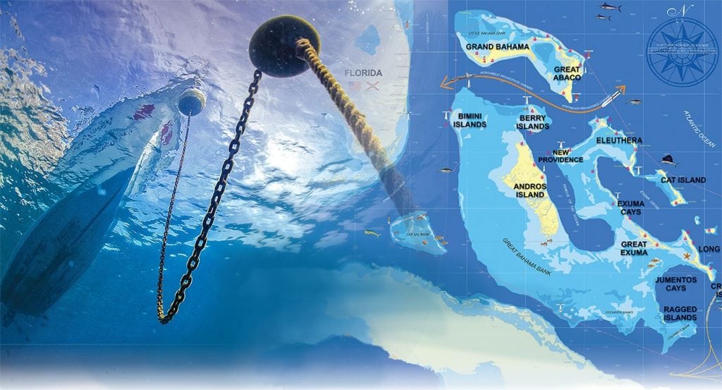
An experienced couple shares their favored routes and their tips for anchoring in the Bahamas.

No matter how many times we cruise The Bahamas we cannot wait to return to its pristine beauty. Like many cruisers, we have our favorite routes and islands. Anchoring in the islands offers some unique challenges since bottom conditions vary widely—there is excellent sand but also scoured-out rocky channels, heavy grass, and thin sand over rock. Here our some of our best tips for anchoring in The Bahamas. 

Heavy grass fouls the anchor, and thin sand over rock doesn’t give the anchor a chance to dig in, but we generally find good holding. Entering some anchorages requires complete vigilance and attention to depths, but the payoff is well worth the effort of time and attention. Here our some of our best tips for anchoring in The Bahamas. 

1.  Our preferred route from Florida to The Bahamas is via Bimini to clear Customs.

The most preferred spot to anchor is off the docks of the Big Game Club in Alice Town, where the marina offers dinghy access to town. The second is at the northern end of the harbor near the new resort and casino, Resorts World. As with any anchorage in The Bahamas, check to be sure the anchor is well set and be aware of strong currents in Bimini Harbor.

2. Upon departing the Bimini area, you’ll either head north to North Rock or south to North Cat Cay to cross onto the Great Bahama Bank.

Deeper-draft vessels will find better depths on the northerly route across. From Bimini, we head north to North Rock and then almost due east to Great Harbour on the northern end of the Berry Islands. Leaving at daybreak and heading across the banks puts you close enough to anchor and finish the trip the next morning (for slower vessels) or a long day to anchor at dusk for trawlers. The anchorage at Bullocks Harbor gives easy access to the settlement and the town dock for landing the dinghy. There is thick grass on the bottom, so look for a sandy patch to drop the anchor. Inside Hawksnest on the east side of Great Harbor Cay is a spectacular anchorage with miles of white sandy beaches. Soldier Cay, Hoffman’s Cay, White and Fowl Cay offer more solitude and exploration possibilities. Cruisers can easily spend a month or more just exploring the many anchorages throughout the Berry Islands.

3. Nassau on New Providence is the next port of call.

Anchoring in the harbor can be difficult since the current has scoured it clean, but there are a couple of sandy patches with fair holding just west of the bridge to Paradise Island or off the eastern channel near the Nassau Harbour Club. Be aware, however, that currents are strong and boat wakes are a problem. If you don’t need provisions or have already cleared in, we recommend anchoring at Rose Island located northeast of New Providence. It’s far away from everything but a good place to stage to head south into the Exumas.

4. Your next destination will be the Exumas.

Anchorages are plentiful and each should be considered based on the how much wind protection you need and from what direction. The trip from Nassau or Rose Island to Allen’s Cay is about 28nm and takes you across the “dreaded” Yellow Banks. The banks, however, are not as formidable as some would suggest. Ensure you have the sun high overhead and someone positioned on the bow, flybridge or the mast for a good view of your path ahead. The coral heads are easily negotiated.

5. As you travel south in the Exumas your daily runs will be short.

Don’t miss any of the wonderful anchorages in the 100 or so miles to George Town. Some of the highlights are Allen’s Cay with its greedy iguanas, Norman’s Cay with its cozy inner anchorages, Warderick Wells—possibly the most beautiful place on earth—, Staniel Cay with its Thunderball Grotto of James Bond fame, and the swimming pigs of Big Majors Cay. Farther to the south is the settlement of Black Point, another friendly outpost, and Farmer’s Cay with its yacht club festivities. Between there and George Town are any number of remote locales to drop the hook. Deep-draft boats will likely exit at Galliot Cut to make for George Town, while shoal-draft vessels can travel along the inside to Rat Cay, Square Rock or Glass Cay Cuts before heading out into Exuma Sound for George Town at Conch Cay.

Many boats just make for George Town and plant themselves there for the duration. Once you get there, it’s easy to see why. There are activities every day on the beaches on Stocking Island, places to provision ashore and new friends to make. Anchor off Stocking Island in the various locations—Church Bay, Volleyball or Sand Dollar Beaches—or just off the town in Kidd Cove for provisioning or laundry. Or, try Red Shanks behind Crab Cay on the south side of the harbor. Settling in Georgetown is one of our favorite tips for anchoring in the Bahamas

6. Departing George Town, head back north in the Exuma chain to Warderick Wells again as it deserves two stops.

From there exit Warderick Cut and make the run northeast to Powell Point on Eleuthera. Head around and into Rock Sound and anchor just off of the settlement.

7. From Rock Sound north there are any number of great anchorage stops.

This includes South Palmetto Point, Governors Harbour, Hatchet Bay, and Spanish Wells. None of the anchorages are very far apart making for easy trips. The area around Spanish Wells is deserving of at least a few days at exploration due to its interesting history. Take the ferry to Harbour Island to explore Dunmore Town.

8. From Spanish Wells make your way north to the Abacos.

The crossing to Little Harbor from either Spanish Wells or Egg Island ranges from 45 to 50nm. Enter through the reef between Little Harbour and Lynyard Cay; head north for the anchorage behind Lynyard or south to the wonderful Little Harbour. The harbor is for shoal-draft vessels only and will be your key to rich Abaco history and of the Johnston family who settled this area. Lynyard Cay is close enough to anchor and dinghy to Little Harbour, and provides good holding and protection from prevailing easterlies.

9. As you work your way north, on the north end of Elbow Cay is Hope Town, a must-see.

Anchor outside of the harbor and dinghy in—anchoring inside is now prohibited. The hub of the Abacos, Marsh Harbour, is only about 10nm to the west and Man O’ War is just to the north. These are all wonderful places where you could spend months.

10. Moving on to the Sea of Abaco, two of our favorites are Treasure Cay and Green Turtle Cay.

We also love the anchorage at Manjack Cay. Powell Cay is a short hop north of Manjack with Spanish Cay just beyond.

11. Once you reach Crab Cay head west toward Hawksbill Cay and Fox Town.

Your exit from The Bahamas will take you past Great Sale Cay. Anchor in the cove on the west side or on the east side for those occasional westerlies. Then, head beyond Mangrove Cay to anchor near West End.

12. Cross to Florida’s Lake Worth Inlet, a distance of about 56nm, or to St. Lucie Inlet, about 67nm.

Wherever your destination in The Bahamas might be this time around, there will always be more anchorages to explore on your next trip.

Helpful Tips for Anchoring in the Bahamas:

Anchors & Equipment
During our last journey through The Bahamas, the “next generation” anchor proved itself to be the best all-around anchor we’ve used—there are brands with very similar designs and characteristics that perform well. The prudent skipper will carry a second anchor for those severe weather conditions and the few times a second anchor is needed to deploy a Bahamian Moor.

The Bahamian Moor is two anchors set off the bow at a 180° angle from each other, used to keep the boat’s swinging circle limited to a small area. It’s good for strong reversing currents like those found in cuts, or where there is limited space. In many of our anchorages, good holding in deep sand is the norm. Even in a sandy bottom, small patches of rock and coral are often present.

You should also have a sufficient amount of the correct size chain as a primary part of the anchor rode. Most anchoring will be done in 10 feet or less, so a minimum of 100 feet is recommended, but the more, the better. Nylon anchor rode can and will chafe through very quickly when rubbing back and forth on a piece of rock or coral.

Finding the Right Spot
Anchoring in The Bahamas offers some unique challenges. Often heavy grass will blanket large sections of some of the better anchorages, which prevents the anchor from setting properly. Look for sandy patches seen as white patches within the grass. Pull forward to the edge of the sandy patch, drop the anchor and back down slowly until the anchor has set about in the center of the patch. Once the anchor rode is stretched out, back down slowly until you are comfortable the anchor has set. It’s a wise idea to snorkel over the anchor to be sure it is indeed set.

Beware of what might look like a sandy bottom but is actually a thin layer of sand over rock or coral. If the anchor appears to be set, it may only be in a narrow crevice and will release as soon as the boat shifts on the rode. Many times the anchor will simply skip across the bottom. In this situation, it’s often best to try and relocate to another spot.
Weather conditions and wind strength and direction will play a very important role in where to safely anchor. Make monitoring the weather and knowing what conditions to expect part of your regular anchoring routine.

By Chuck Baier, Southern Boating May 2015

About the Author: Chuck Baier and Susan Landry have cruised for almost 25 years, first on their Mariner 40 Ketch Sea Trek, and currently on their Marine Trader trawler Beach House. Chuck and Susan are owners of Beach House Publications, publishers of The Great Book Of Anchorages series of anchorage guides, which cover the Chesapeake Bay; Atlantic ICW from Hampton Roads/Norfolk to Key West and include the St. Johns River; The Bahamas-The Route Most Traveled; and the Gulf Coast from Cape Sable to Mobile, including the Okeechobee Waterway.

Additional tips for anchoring.

Go for the grand on Grand Bahama

While the majority of yachtsmen enter The Bahamas through Bimini, Cat Cay or simply clear in at West End and cruise on to the Abacos, Grand Bahama Island is a great place to spend a few days or a whole season—or even to own a second home.

Cruising to Grand Bahama and then on to Moore’s Island and Sandy Point is a wonderful way to enter The Bahamas if you plan to visit north Eleuthera or Nassau-—or cruise from Sandy Point around Hole in the Wall to Schooner Bay, Cherokee and Little Harbour. Coming from Florida, clear Customs at Old Bahama Bay (West End) and stay a while to explore the area. On Sandy Cay, Keith and Linda Cooper now have eco tours for diving, fishing and birding. weefca.com 

If you need work done on your boat, Bradford Marine in Freeport is an excellent, full-service yard and a safe place to leave your boat if you fly home for a while.

In Lucaya, stay at Port Lucaya Marina or the Grand Bahama Yacht Club, where you’ll want to buy fuel as prices are usually the lowest in The Bahamas. portlucayamarina.com; grandbahamayachtclub.com

The Port Lucaya Marketplace has shopping, entertainment and several restaurants. Go to Zorba’s for Bahamian breakfast or lunch, Cappuccino’s for excellent Italian dinners, and Flying Fish for haute cuisine. UNEXSO runs a famous dive operation near the marina and the Dolphin Experience further down the waterway. unexso.com 

Grand Bahama’s three national parks—The Rand Nature Center, the Lucayan National Park, and Peterson Cay—are well worth a visit. Go to the Bahamas National Trust website for more information. bnt.bs

Moore’s Island

Moore’s Island (Mores Island for the locals) does not cater to tourists but is a useful anchorage on your way along the southern edge of the bank or a good stop going north or south across the Bight of Abaco. There is decent holding in grass off Hard Bargain; go into the northern creek if there is a cold front but be sure to check the entrance and the creek by dinghy before venturing in. Two important things you must do when on Moore’s Island: visit Mrs. Jones for some fresh baked bread, and take your boat or your dinghy out to Lily Cay, where the shelling and snorkeling are outstanding—there is always a good chance of spearing a hogfish.

Abaco Park Warden Marcus Davis helps with Sea Turtle Research.

Sandy Point

Sandy Point is one of my favorite anchorages. It’s also a fun place to visit by road from further north in Abaco. Whether you come by land or sea, enjoy a couple of sundowners and a delicious supper at Nancy’s Sea Side Inn (242-366-4120) or the Sunset Bar and Grill (242-699-0249) while watching the sunset light up the sky.

The anchorage is only protected from the east, but if a cold front approaches go up the creek north of the settlement if you draw 5′ or less. Anchor bow or stern, or tie up to the government dock among the fishing boats. The local people will help you find your way into the unmarked creek and help you moor your boat.

Diesel, gas, and free water are available at Lightbourne Marina, where there is a good grocery store. It’s also a great spot to fish and snorkel for conch. While in southern Abaco visit the Abaco National Park, home of the Bahama parrot. Call Marcus Davis, Park Warden for information and a tour; (242) 367-6310.

Back in business

Staniel Cay Airport re-opened to air traffic in mid-November after months of closure for refurbishment that led to a newly paved runway 3,000-foot long and 75-foot wide. Safety concerns prompted the Department of Civil Aviation and the Ministry of Works to close the airport in April 2015.

Navigation notes:

The Grand Lucayan Waterway is still in very good condition. The Sir Charles Hayward Yacht Club (242-727-7245), just inside the southern entrance, has been refurbished and now has a growing youth program and a few slips for visiting yachts. Going all the way through the waterway is lovely, and you can look for property to purchase as you go. The lowest bridge has a 27.3-foot clearance. If you have a draft of 5′ or less, go out through the well-marked Dover Sound channel on the tide—the high tide is about 2 hours later than on the south shore. Proceed up to Mangrove Cay, Great Sale Cay and on to the Abacos. If you are towing a speedboat it is possible to explore Hawksbill Creek and Water Cay. The bonefishing on the north side is as good as anywhere in The Bahamas. The east end of Grand Bahama is seldom visited, and there are no detailed charts of the area. But a shallow draft vessel can get into Deep Water Cay (deepwatercay.com) and go gunkholing in the cays to the southeast with a little help from the local fishermen. The snorkeling and fishing are spectacular.


Words and photos by Stephen Connett, Southern Boating Magazine January 2016

Coral Reef Sculpture Garden in New Providence

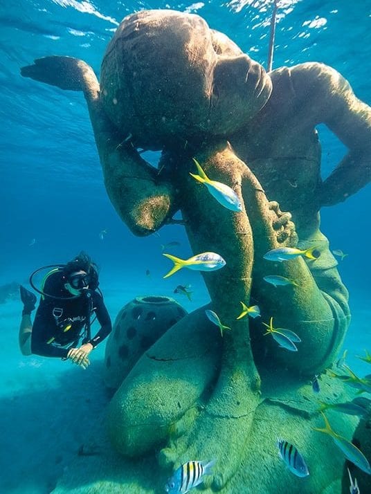
The Bahamas Reef Environment Educational Foundation (BREEF) has recently established a spectacular Coral Reef Sculpture Garden just off Clifton Bluff in southwest New Providence (25–00.5N/77–33.0W). If you stay at Albany or Lyford Cay or anchor in West Bay, it is an easy dinghy ride to the Garden in settled weather.

BREEF calls the garden “a perfect fusion of art, education and marine conservation.” It will promote the growth of new coral, provide fish habitats and relieve some of the pressure on the natural reefs in the area. The garden is already a regular dive site for Stuart Cove.

The impressive sculptures by local and international artists are all built of concrete, which provide a substrate for new coral. Scattered around the artwork are reef balls which are excellent artificial habitats for fish. The garden is in about 20 feet of water so is easily seen from the surface while snorkeling. breef.org

Sandy Point, Abaco
Some additions to the cruising life are just plain fun. Brad and Ceril, residents of Abaco, have built a floating bar in Sandy Point. In the summer months their barge is anchored just off the beach and has a small raft on a line that gets people back and forth from shore. The bar supplies a basic choice of beverages out of a cooler, and music is provided from a boom box plugged into a car battery. There is room around the barge to tie up your dinghy. From personal experience, drinking a cold beer in the midsummer heat while semi-submerged on the edge of the barge is delightful.

Aids to Navigation
The list of aids to navigation that are malfunctioning, abandoned, or missing continues to grow, so it is best not to rely on any of them. Gone are the days when you could depend on Great Isaac and Great Stirrup lights to guide you down the Northwest Providence Channel. The government simply hasn’t the money for maintenance. Thankfully, modern charts and electronics compensate for the loss of reliable buoys and lights. Be sure your paper and electronic charts are up-to-date and your GPS and radar are functioning properly—it is advisable to have a backup GPS. If you are not an experienced navigator you might consider traveling only in daylight, and it is never a bad idea to call ahead to a marina and ask for local knowledge and advice.

Cape Eleuthera Marina
The facility now sports a new swimming pool, the beach has been enlarged, docks are still in excellent condition, Pascal’s restaurant is open at the T-dock, and the staff are as helpful as ever. The showers and laundry are air-conditioned and clean, and the store has a good supply of snacks, liquor and bait. An added plus, the fuel dock never seems to run out of diesel and gas.

Westerly winds cause a miserable surge in the marina, but the staff will try to place you in one of the slips with minimal movement. Regardless, you will be safe even if you are in a slip with a lot of surge, and you will be happy when the wind clocks around to the east and sad to leave.

For fresh Bahamian food call ahead to Sheryl’s Inn (242-334-8111) in Deep Creek for supper. Sheryl’s does not serve alcohol but you can bring your own or go across the road to Friendly Bob’s bar and liquor store and carry beverages back to Sheryl’s.

Stone Crab Fishery, Eleuthera
A stone crab company is now operating in the Bight of Eleuthera. Bahama Biters (bahamabiters.com) has invested in hundreds of stone crab pots so Styrofoam buoys are everywhere. Keep a good lookout wherever you go in the Bight, and if you run at night know that you might snag a buoy.

Staniel Cay, Exumas
The Staniel Cay Yacht Club building has just finished a major upgrade. The kitchen, dining room, gift shop, and restrooms are completely rebuilt. The new dining room is lovely, overlooks the channel and is open to the fresh air or air-conditioned when that is more comfortable. There is a new chef with a good menu and prices are fair. The restaurant is open for lunch and there are two seatings for supper—reservations are strongly recommended. Breakfast is still served in the old dining room, which has been redone. For those who relished the sailors’ charm and controlled chaos of the old club, the bar has only replaced overhead lights and is still as cheerful as ever. Local residents and cruisers still engage in lively conversation and consumption of beverages and bar food.

By Stephen Connett, Southern Boating April 2015

Fall Brings Seasonal Closings

Seasonal closings begin in September and last until mid-November, causing a noticeable dearth of festivals and events at many venues throughout The Bahamas. This is a traditional time for maintenance, refurbishing, stocking supplies for the winter season’s influx of mariners and visitors, and planning for attendance at the Fort Lauderdale International Boat Show in October. If you’re gearing up to cruise and island-hop this fall and winter and plan for family and friends to visit, keep a check on updates from Travel Bahamas, the official site of the Bahamas Ministry of Tourism and Aviation (MOTA)—especially for the deals and packages on hand. Announcements are frequent with several new air options usually available. bahamas.com/deals-packages

Hope Town
Brigitte Bowyer Carey—one of this quaint settlement’s esteemed, award-winning artists—is giving a watercolor workshop November 10-12 (Monday-Wednesday) from 10AM to 4PM at the Hummingbird Cottage Art Centre in Hope Town. Reserve your space now as Carey’s classes are extremely popular and sell out quickly. Her unusual seascapes, landscapes and travel sketches are collected by the likes of novelist Pat Conroy, Mr. & Mrs. Sean Connery and Mr. Michael Gore, former High Commissioner to The Bahamas. bowyerart@gmail.com.

Grand Bahama
The Bahamas government plans to create two new national parks in east Grand Bahama that will include the approximate 280,000 acres of the North Shore (The GAP) Marine Protection Area, and the 12,500-plus acres of the East End Marine Protection Area (currently East Grand Bahama National Park south of Sweetings’ Cay). Environment Minister Kenred Dorsett recently said the proposed areas would receive special protection to allow fishing, diving, boating, and other recreational and commercial activities. Dorsett also said the Lucayan National Park and the Peterson Cay National Park are under consideration for expansion.

The National Art Gallery of The Bahamas. Photo: Bahamas Ministry of Tourism

Nassau

The National Art Gallery of The Bahamas (NAGB)—the premiere arts institution—is currently showcasing the extraordinary art of Eddie Minnis and family. Over 100 paintings from the 1960s to the present in the collection titled “A Retrospective” will be on display in the main gallery. Cruisers to North Eleuthera (Current) and Abaco (Marsh Harbour) will recognize this talented family because of their well-known galleries located on both islands. The exhibit will close Sunday, November 30th. Gallery hours are by appointment only. NAGB contact: (242) 328-5800/1; nagb.org.bs. Minnis family contact: (242) 322-2605; eddieminnis.com 

Exuma
Staniel Cay Yacht Club (SCYC) has announced major dining renovations that will result in limited facility use. In order to improve service and take advantage of the beautiful view of the water over Jameson Bay, the kitchen is relocating to the back dining room’s current location. Breakfast, dinner and bungalows at the resort will be closed from September 16th through November 1st to complete this project. The marina, fuel dock, lunch (daily grill-out at the marina), ice, garbage, bar (drinks only), gift shop, liquor store, and Wi-Fi internet will remain open. Call (954) 467-6658 or (242) 355-2024. stanielcay.com 

A descendant of the original Abaco Loyalists is reviving the spirit of Hope Town by embracing the history of the Abacos in a throwback to the old days with a new rum company. Photo: Robert Bethel

Abaco
Jacob Adams Rum, an outstanding 10-year-old West Indies barrel-aged, blended rum has arrived in Abaco. This liquor is hand-bottled by the very first Abaco rum company—the Hope Town Rum Company out of Elbow Cay and is now available throughout The Bahamas in fine rum shops and restaurants. Mark your cruising calendar for May 2015 and the Grand Opening of the boutique merchandise store Gillam Street Goods that will offer Jacob Adams rum cakes and custom-labeled bottles. The boutique shop will be housed in a restored, former-Loyalist home circa 1880s, which is surrounded by a white picket fence within the heart of this beautiful settlement village. Contact the proprietor, Robbie Bethel, at (242) 577-8533.  jacobadamsrum.com

Air Updates
For cruisers who expect guests or supply shipments to arrive via air, pay attention to these updates:
• Silver Airways (formerly Continental Connection) is currently promoting outstanding value packages to the Abacos. Call (888) 229-9990. silverairways.com
• Watermakers Air now flies to Great Harbour Cay in the Berry Islands from the Fort Lauderdale, Florida, Executive airport. They also fly to Chub Cay; Congo Town, Fresh Creek, and San Andros in the Andros; and Staniel Cay in the Exumas. Call (954) 771-0330. watermakersair.com
• SkyBahamas has increased flight services between Bimini and Fort Lauderdale (FLL) three days a week—Sunday, Wednesday and Friday. They currently offer flights between Bimini and Nassau, and between Bimini and Freeport every day except Tuesdays and Saturdays, with continued service on to Fort Lauderdale and return flights back on Sundays, Wednesdays and Fridays. skybahamas.net

Cruiser Notes
The U.S. Coast Guard (USCG) reports the following changes to Marsh Harbour Marina Day Beacons:
• Day Beach 1 is destroyed
• Day Beacon 2 marker has improper characteristics
• Day Beacon 4 marker is missing
Visit this link to view improved NOAA Obstructions and Wrecks charts, including Straits of Florida and Approaches: nauticalcharts.noaa.gov/hsd/wrecks_andobstructions.html.

Sandra Davis, Southern Boating September 2014

Exit mobile version