Elizabeth Harbour

IF YOU ANCHOR IN GEORGETOWN, GREAT EXUMA, without fully exploring Elizabeth Harbour, you just might have regrets, if cruising sailors are to be believed. Elizabeth Harbour is an aquatic playground of sailors, and its secrets are tucked away inside the harbor’s coves and creeks; blue holes and reefs; sand bars and obscure channels.

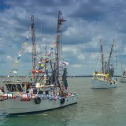
When the boating season peaks in The Bahamas, Elizabeth Harbour turns into a city on the sea. At sunset, the mast lights switch on when the conch horn blows. “It is like a light show on the water,” said Bahamian sailor Reginald Smith, remembering his two years living on a 43-foot Beneteau sailboat in the harbor of his native island. There are so many boats—sometimes 400 strong—and the sea is easily mistaken for a city on solid land.

Reginald started sailing as a boy of five years old learning from his father, a captain, and fisherman. With an additional 69 years of boating experience weathered into his skin, he confidently insists that Elizabeth Harbour is the most spectacular anchorage in The Bahamas. Based on its popularity for sailors, there are many who would agree, citing diverse attractions and amenities and many locations to provide 360-degree wind protection.

Today, Reginald is a real estate agent, community organizer and conservationist. He relishes the days when he can sit back on the balcony of his oceanfront home in Farmer’s Hill and watch what he calls “the migration”: incoming sailboats from eastern ports along North America to Exuma’s great port city. Many cruisers island-hop their way through the northern cays and then hunker down in Georgetown to socialize and enjoy island living.

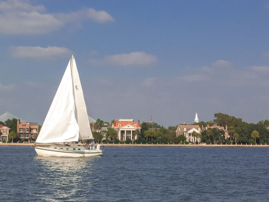
Reginald has a 180-degree view of the boats as they make their way to Georgetown. They emerge from the north toward Rolleville, and cruise past his house toward the most popular harbor entrance, the Conch Cay cut. The sight of white sails gliding along the horizon with a background of sky and ocean blues seamlessly blended is what Reginald looks forward to witnessing every year.

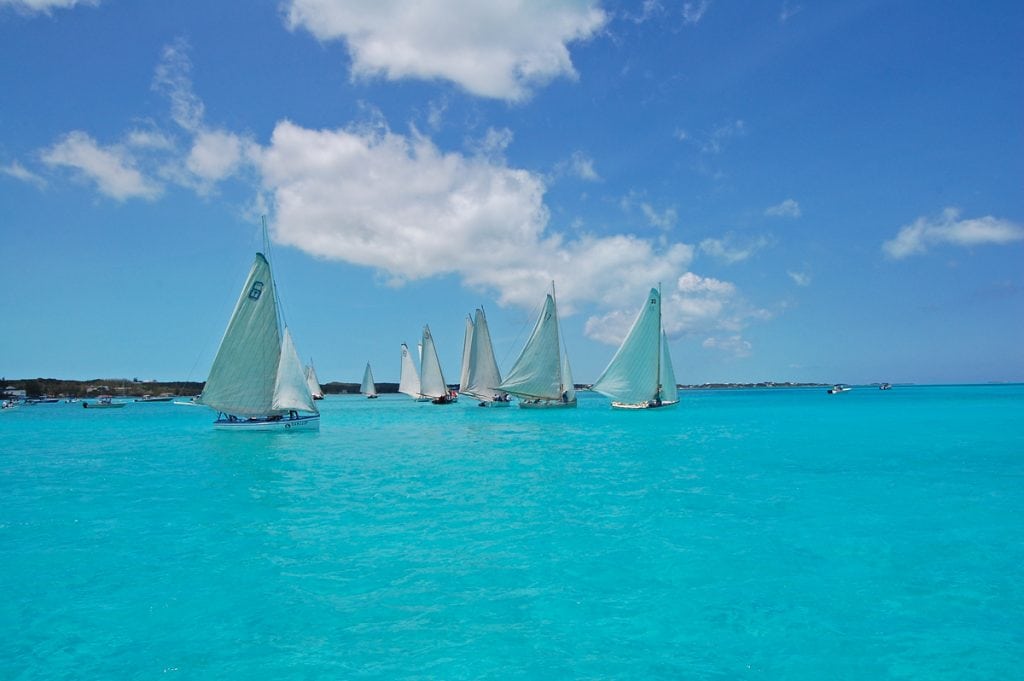
“Boats of all sizes start to arrive around Thanksgiving: 25-38 footers up to 65 footers. They usually come in batches of 1 or 2, or 15 or 20. From as far as your eyes can see, they appear full head sailing, into Elizabeth Harbour. It is the most beautiful thing you have ever seen.”

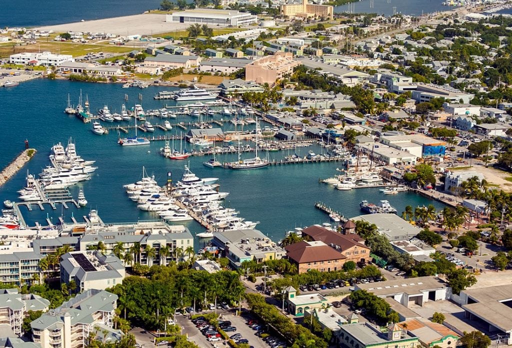
Elizabeth Harbour is protected by mainland Great Exuma to the southwest and the long and narrow Stocking Island to the northeast. There are few full-service marinas in the harbor, Exuma Yacht Club is one of them, so boats anchor in clusters in the main harbor and inside one of the many coves and mooring fields like Hurricane Hole, Turtle Cove, and Red Bays.

When winds kick up, you see them move with synchronicity to different corners of the harbor or tuck inside the protected, nearly landlocked coves. While protected areas abound, inside the main harbor can get windy, causing dinghy rides to be wet and rugged.

Ordinarily, Great Exuma research is not likely to reveal the many things to do right in the harbor. The beach bar and restaurant Chat ’N Chill, a popular watering hole on Stocking Island, is a well-known spot for boaters and non-boaters alike. But other than that, exploring Great Exuma is often about heading in search of swimming pigs, land-based attractions or other parts of Exuma, like the Exuma Land and Sea Park in the northern part of the chain.

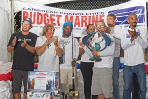
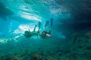
And yet, right in Elizabeth Harbour there is a channel entrance to the Moriah Cay National Park, a 16,000-acre marine ecosystem with river-like mangrove creeks, sand dunes, bird sanctuaries, pristine beaches, and marine nurseries. Reginald says it is a mistake to think of the harbor as only being picturesque. Snorkeling buoys, maintained by the Elizabeth Harbour Conservation Partnership, mark 16 top snorkeling locations inside the harbor, including Turtle Lagoon, Mystery Cave, and Fowl Cay Reef Restoration. There are dozens of beach enclaves, some of which meld into sandbars, like Cocoplum Beach and Man-O-War Beach. The sailing itself is also a harbor attraction and not just at regatta time. Every February, winter residents participate in the George Town Cruising Regatta. In April, there is the National Family Island Regatta, which is the largest and oldest formal regatta in The Bahamas.

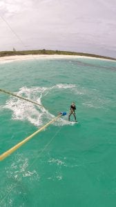
Sailing at night is a favorite pastime for Royston McGregor, a sailor and marine salvager living in Exuma. Once he has more than a half a moon and the waves are not high, he’ll be out in the harbor running sprints or playing in bigger waves near the harbor’s eastern entrance. As a local, he has the advantage of extensive inside knowledge. “The harbor has different sections, different depths and different wind conditions. Between the mainland by February Point and Crab Cay, there is a flat stretch of shallow water that is usually calm even when it’s windy,” says McGregor. “The Exuma Sailing Club uses that to practice. That’s where I like to do sprints. Windsurfers and kitesurfers also like the area for the same purpose. It is shallow enough for kite surfers to stand at low tide, which makes it great for learners.

For all that Exuma has to offer, Georgetown has hidden beauty, and it’s inside its harbor, in case you didn’t know.

By Noelle Nicolls, Southern Boating January 2018

PHOTO: © BAHAMAS MINISTRY OF TOURISM

Upgrades in the Carolinas

New owners purchased the historic River Forest Manor and Marina in Belhaven, North Carolina, in October with renovations in mind. Most of the new owners are cruisers and members of the River Rat and Belhaven Yacht Clubs. All docking facilities will be fully operational during improvements. Visitors will find new bathrooms with showers, marina office and free laundry facilities upon completion. Services already available include diesel and non-ethanol 89 octane gas, 30-, 50- and 100-amp electrical services, Wi-Fi, golf carts, deep water transient slips, and a swimming pool. Belhaven is the birthplace of the Intracoastal Waterway and boasts of several popular eateries. riverforestmarina.com, riverratyachtclub.com, belhavenyachtclub.org

Fernandina Beach, Florida, has been called the “birthplace of the modern shrimping industry.” In 1902, Sicilian Mike Salvador introduced motorized boats to the industry, and generations of the Greek Deonas family helped establish what was the largest shrimping industry in the world for decades. Although tourism now replaces shrimping, Amelia Island remembers its past with a new satellite museum of the Amelia Island Museum of History in Fernandina Beach. Hours are 10AM to 4PM Monday through Saturday, and 1PM to 4PM on Sundays. ameliamuseum.org

After Georgetown, South Carolina’s devastating fire in 2013, debris was cleared and Harborwalk was rebuilt, but little else has taken place due to new construction standards and lack of funds. After some controversy, however, in November 2014 the city applied for a Community Development Block Grant funding for business development purposes. Hopes are that the waterfront will return to its former glory this year.

[photomosaic ids=”6018,6019,6020,6021″ orderby=”rand”]

Cruisers to St. Augustine, Florida, now have a shuttle bus service. The first of three bus routes takes visitors to St. Augustine Municipal Marina and other nearby marinas, Sailors Exchange, West Marine, and other businesses. Two other daytime runs stop at marinas, uptown St. Augustine, the Vilano Pier, Publix, restaurants, offices, and attractions. Evening routes accommodate area dining and entertainment. Updates are available at the St. Augustine Cruisers Net Facebook page. Schedule is available at waterwayguide.com/images/St-Augustine-Shuttle-SCHEDULE.pdf.

An official dog park now adjoins the Vero Beach Municipal Marina in Vero Beach, Florida. The 6.5-acre field is completely fenced in with separate areas for big and little dogs. Private donations and volunteer grunt work made the park with its water fountain, bowls and a safety entryway possible. Seadogs and their masters may access the park with dinghies.

The Miami International Boat Show is headed to Miami Marine Stadium in 2016 and 2017, and possibly into the future. A $30 million renovation is in store for the battered Miami Marine Stadium that closed after 1992 Hurricane Andrew. Changes include replacing asphalt with grass and trees, as well as building a modest marine-exhibit building. The boat show will occupy existing parking lots, temporary structures and a small portion of its water basin with little interference to local rowers and paddlers.

Free pump-outs in the Florida Keys may end in 2017. Monroe County is losing substantial financial support from the state Department of Environmental Protection. The county’s proof of pump-out requirement in larger live-aboard anchorages helps protect Florida Keys National Marine Sanctuary.

By Nancy E. Spraker, Southern Boating March 2015

Classic Wooden Boats grace the shores of South Carolina

October 18-19 marks Georgetown, South Carolina’s 25th Annual Georgetown Wooden Boat Show with 140 classic wooden boats displayed on land and water. Children’s model boatbuilding, knot tying, food, and music make it a not-to-miss event. In the Wooden Boat Challenge, teams of two have four hours to build rowing skiffs to compete in a rowing relay on the Sampit River. Funds raised support the South Carolina Maritime Museum. woodenboatshow.com

North Carolina mariner updates
A fixed bridge will replace the Topsail Island Bridge near Wilmington, North Carolina, at mile 260.7 in the ICW. The existing drawbridge has a 13-foot vertical clearance closed and unlimited clearance opened, with a 92-foot horizontal clearance. The new fixed bridge will have a 65-foot vertical clearance closed with a 120-foot horizontal clearance. Date of construction is undetermined.

A mooring field in Beaufort, North Carolina, costs more than expected. More expensive bar anchors with better hold in less mud are being installed instead of the originally planned screw anchors. Total moorings are down to 41 from 46. Sixteen ready-and-able moorings now await transients in the bend of the Beaufort River.

Sailing on the Charleston Harbor. Photo: Explore Charleston

Charleston, South Carolina navigation news
The original Charleston Harbor NOAA harbor chart 11523 from 1936 does not reflect changes from the deepening projects that have moved the sea buoy and channel entrance nine nautical miles to the east. However, the new NOAA chart 11525 includes these changes, plus an additional 345 square nautical miles. It is now available in paper format from NOAA-certified printing agents, a free PDF digital download, or a free raster navigational chart for electronic display systems with a corresponding electronic navigational chart US5SC25M.

Florida diver/snorkel flags
Divers-down buoys now bob in Florida’s waters since state approval in July. The approved buoys must be three- or four-sided with divers-down symbols of at least 12-by-12 inches, and must be seen from all directions. Flags on a float are still permitted. Divers/snorkelers must stay within 300 feet of their flags or buoys in open water and 100 feet in rivers, inlets and channels. Boat operators should idle at the same distance away from flags or buoys. myfwc.com/news/news-releases/2014/july/01/divers-down/

Key West Bight Marina. Photo: Rob-O’Neal

The city of Key West renamed the Key West Bight to Key West Historic Seaport. Key West Historic Seaport has a 150-slip marina and is a great place to dive or snorkel, enjoy fresh seafood, shop, or take a high-speed ferry to Historic Fort Jefferson or the Dry Tortugas.

By Nancy Spraker, Southern Boating October 2014

Exit mobile version