Nassau Harbour

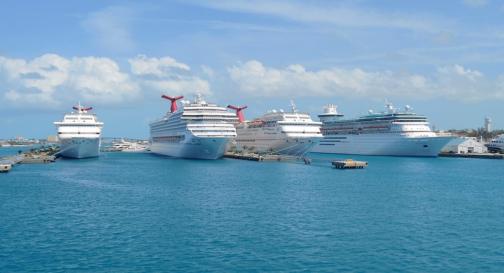
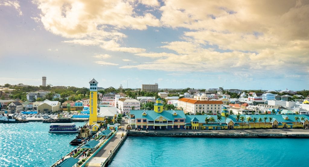
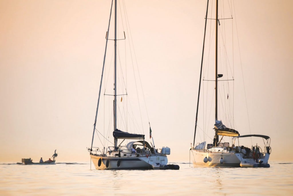
Nassau Harbour

The cornerstone of the Bahamas’ Most Dynamic Port City

Cruising into the Nassau Harbour, you are immediately met with bright, bold, tropical colors painted across the city of Nassau. Everything except the two vehicle bridges connecting New Providence Island to the north and Paradise Island to the south is dwarfed by the mega cruise ships that tower above practically every building in downtown Nassau. Because the islands are so low-lying, the contours of buildings and green vegetation barely separate the sea from the sky across the horizon.

This is the same harbor that gave refuge to pirates and rum runners in the 17th and 18th centuries. It is the same harbor that would receive hundreds of sailboats in a massive sponge fleet bound for the Nassau Sponge Exchange. There, they would drop off boatloads of natural sea sponge from the remote Out Islands to service a booming sponge industry that thrived in the late 1800s through the early 1900s. Nassau Harbour has been a major gateway to usher in many periods of Bahamian history.

Today, Nassau Harbour is still the hub of commercial activity for much of the country. It is a bustling thoroughfare for commerce, recreation, tourism, housing, transport, and public
administration. It features a cruise port, cargo port, restaurant, marinas and docks, residences, and bathing beaches.

Container Port

Just beyond the entrance to the harbor is the 56-acre Nassau Container Port, a general cargo container port for both domestic and international bulk cargo. On average, about two to three sea vessels dock at the container port daily, captained by a local marine pilot.

Cruise Port

The most stunning images of Nassau Harbour feature the world’s largest cruise ships towering over the multicolored city with a backdrop of endless sky. Unique to the Caribbean, the harbor can hold up to six cruise ships at one time, including Royal Caribbean’s Symphony of the Seas, which holds 6,680 passengers and is now the largest cruise ship in the world, dethroning the Oasis of the Seas, which also calls on Nassau.
On any given day, there can be 12 or more ships in and out of the harbor.

The main thing for boaters to know about the presence of mega cruise ships in Nassau Harbour is to give way. Once a cruise ship is entering the port, it is confined to the
narrow cruise channel that’s dredged to 40 feet in order to accommodate its draft. Because maneuverability is so limited, boaters must give cruise ships clearance.

Small Boat Traffic

Nassau Harbour is abuzz with commercial traffic from small boats as well. Water taxis ferry thousands of passengers from the Prince George Wharf to the Paradise Island Ferry dock. Cruise ship passengers often use this route to visit Cabbage Beach on the northern side of Paradise Island, and guests at the various Paradise Island resorts use this route to visit downtown Nassau. In addition to ferries, there are dive boats, party boats and other tour operators that regularly cruise up and down the harbor plus the thousands of motor yachts that head to and from the many marinas.

Hazards

The depth in Nassau Harbour ranges dramatically, so the main hazard is running aground. The area dredged for cruise ships is 40 feet deep, but outside of the cruise channel, the
banks shrink to 10 to 12 feet. Boaters should also take heed of the shallow ridge on the eastern side of the harbor. It runs parallel to shore for about two-tenths of a mile, from the Nassau Yacht Haven to Bay Shore Marina. Depths around the ridge range from about three to six feet depending on the tide.

There is a buoy, known as the danger marker, that appears on charts, but the actual marker is not lit. If you follow the charts, you will avoid most of the navigational hazards, but charts won’t tell you about sailboats that often anchor on the eastern side of the harbor in the main channels. Although they have masthead lights, they often blend into the backdrop of city lights at night and become indistinguishable, so exercise caution when navigating at night and be on the lookout for sailboats.

Also, make sure you have on your own navigation lights and be alert for small boats. Although accidents in the harbor are rare, there have been a few resulting from boats cruising with no lights.

Marinas

Nassau Harbour has over 16 marinas, boatyards and fuel docks accommodating transient and long-term motor yachts. When you combine all the marinas, there are about 500 slips, including the newest megayacht slip to come on stream at Bay Street Marina. They now accommodate 500-foot yachts with a 20-foot draft, a step up from the 200-foot slips at the Atlantis Marina, formerly the largest. These are two of the three high-end, full-service marinas in the harbor, although only Atlantis and Hurricane Hole have their own man-made harbors that provide added protection.

There are five fuel docks, including those located at the Nassau Harbour Club Marina, Rubis Fuel Dock and Brown’s Boat Basin. Harbour Central Marina provides rack storage
but is largely filled with local boats. Mechanic shops are easy to find in the harbor as well.
Harbourside Marine is the Yahama distributor specializing in all Yahama maintenance and repairs. Marlin Marine offers maintenance and repairs as the distributors for Generac Generators, Sea-Doo Personal Watercrafts and Evinrude Outboard Engines. There are also several other smaller operators.

Beaches

There are four main bathing beaches in the harbor: British Colonial Hotel Beach, Junkanoo Beach, Long Wharf Beach, and Montague Beach. These are not boater’s beaches, and they are not even the best in Nassau or Paradise Island. If you want to take the boat, it’s worth being a harbor snob when it comes to beaches. Take the short run to offshore Rose Island and experience premium beaching.

By Noelle Nicolls, Southern Boating March 2019

Southern Exumas

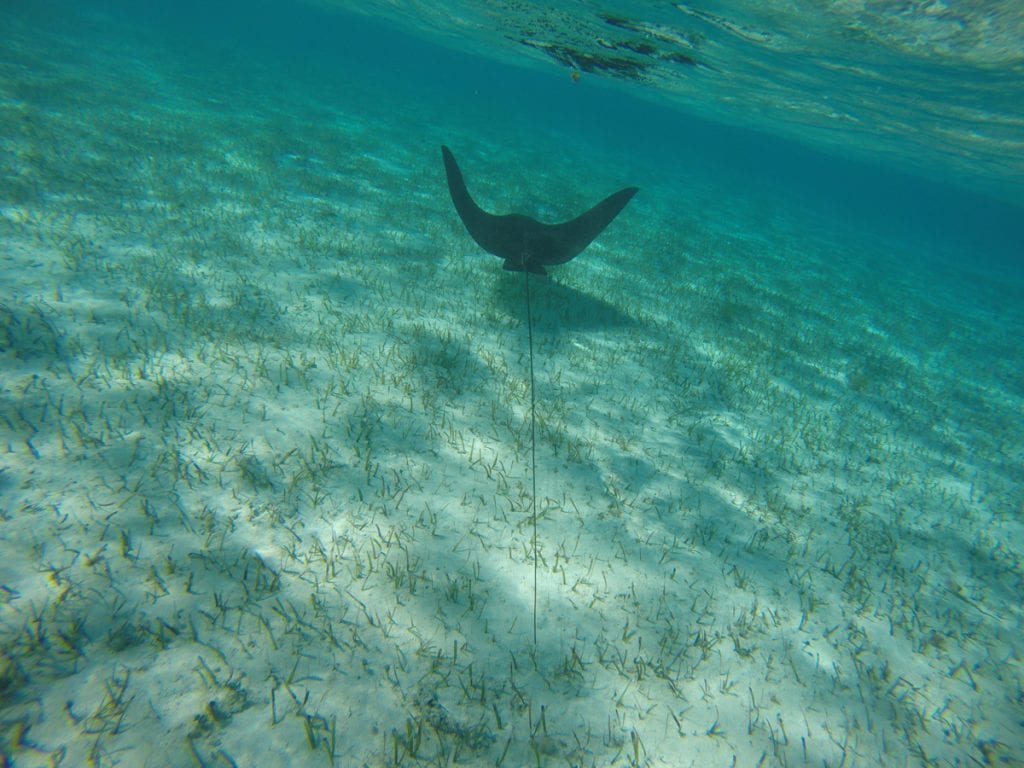
Southern Exumas

An iconic place for beaching and boating in The Bahamas is a string of pearl-like islands —the Exumas. But, if you visit the southern Exumas, Acklins Island, Crooked Island and Long Cay in particular, you’ll find the familiar aquatic landscape more commonly associated with the Exumas to the north.

These three atoll islands encircle the Bight of Acklins, a 500-square-mile lagoon, where you can wade in the water knee-deep for thousands of feet offshore. The shallow seas encasing the islands radiate turquoise light. A tapestry of undulating white sands blankets the ocean floor, peeking out here and there to showcase a collection of elongated sandbars. The meandering coastlines are dotted with countless sandy bays, crescent-shaped coves, and mangrove nurseries. A network of tidal creeks and inlets snake through the land, and from sky high, they appear like saltwater rivers slicing cuts into the coast.

Long Crooked Acklins

Acklins Island, Crooked Island and Long Cay are truly underexplored island gems in the southern Bahamas. Unlike the Exumas, these sister islands are known more for their bonefishing and ecotourism than for their boating and physical beauty. But island-hopping in these islands will turn that perspective completely upside down. Take in the scene at the French Wells  Channel between Long Island and Crooked Island, or cruise around Turtle Sound or Lovely Bay, and the stunning picture will be abundantly clear.

The Bight of Acklins is the “Exumas of the South” when it comes to beaching and boating. Beach Hop the North Coast­ Start in Lovely Bay, where you can comb for shells on the Lovely Beach sandbar or spot iguanas on Snake Cay. Chase stingrays in Chester’s Bay or head beyond the main Atwood Harbour Beach to a cay locals call Saddleback. Saddleback Cay marks the opening of a creek that winds its way down to Gordon’s Bay. Depending on the tides, Saddleback is only connected by the beach.  On the tip of the cay is a large osprey nest. The birds stand watch over this entrance, soaring above to keep an eye on visitors.

Underexplored

Despite its array of offerings, Acklins and Crooked Island are not as accessible as other islands in The Bahamas. There are no marinas or official docking facilities, so boaters have to use the various anchorages. Commercial flights with the national airline, Bahamas Air, originate from Nassau, the capital of The Bahamas, and fly to Acklins and Crooked Island only twice per week on Wednesdays and Saturdays. Long Cay is only accessible by private boat or a ferry from Crooked Island.

­Hotels are limited to a few bonefishing lodges scattered around the Southern Exumas, including Chester’s Highway Inn, Chester’s Bonefishing Lodge, Grey’s Point Bonefish Inn, and Ivel’s Bed and Breakfast on Acklins Island. Also, Acklins only has a population of about 500 people compared with Nassau, which has about half the landmass as Acklins with a population of about 300,000. Acklins, Crooked Island and Long Cay are relatively secluded and rural. The inhabitants fend for themselves and epitomize the simplicity of island living.

There are no gourmet restaurants, although the local food is delicious. Chester’s Highway Inn serves creamy lobster chowder as its welcome meal, and it’s chock-full of flavorful, meaty goodness. There are a few local bars for entertainment. You’ll meet a charismatic (and perhaps pestering) local drunk. You’ll also meet hard-working island people who pass the time by drinking rum and gossiping.

City slickers would likely not survive in Acklins unless they were specifically looking to go off the grid. Boaters, however, with simple tastes and plans to spend their days on the water fishing, snorkeling, diving, beaching and enjoying the outdoors, would find an attractive vacation home in Acklins, Crooked Island and Long Cay.

Launch a Kayak

Atwood Harbour, Relief Bay, and Gordon’s Bay have ample bonefishing flats. But it’s also an ideal spot to kayak. These uninhabited parts of the island hardly have any civilization to speak of. Many areas are only accessible by boat, but they all have at least one inland access point to launch a kayak. They also serve as anchorages. In Atwood Harbor, you can land a dinghy on the beach and walk about two miles to Chester’s Settlement.

Spot Flamingos

If the horizon line is glowing pink, it’s not a mirage, it’s a colony of West Indian flamingos in the distance. Acklins, Crooked Island and Long Cay all have flamingos. Flamingos are The Bahamas national bird. These regal birds are skittish about visitors, but there are three reliable places to spot them in their natural habitat: Mason’s Bay and Chester’s Pond in Acklins and Flamingo Bay in Long Cay.

Bonefishing

There’s tons of fishing in the Southern Exumas, but bonefishing is the ticket. You don’t need a boat for most of the flats. Instead, you can walk off the shoreline, wading and stalking your fish. The peak fishing months are March through November as the weather is more unstable between December and February. However, fishing is a year-round pastime in the south.

In addition to these core activities, sail around the atoll or cave on Crooked Island. There are coral gardens and historic ruins, including the remnants of slave and cotton plantations. Bird Rock Lighthouse sits on the northwestern point of Crooked Island, and Castle Island Lighthouse sits off the southern tip of Acklins. Boaters can also explore the Samana Cays to the northeast and the Plana Cays to the east.

By Noelle Nichols, Southern Boating January 2019

Rose Island, Bahamas

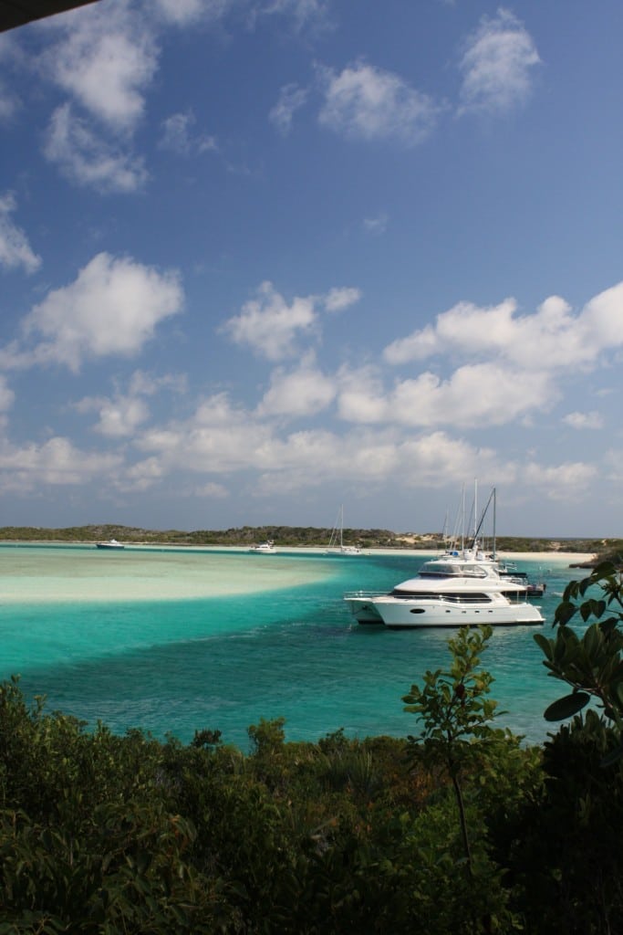
Discover the secluded coves and uninhabited beaches of Rose Island, Bahamas.

If you have the luxury of a boat while traveling in Nassau, don’t bother beaching in the capital or Paradise Island. The best beaching locations nearest Nassau are to the east on Rose Island.

On this 11-mile-long island, you can pick and choose between secluded coves and sprawling stretches of uninhabited beach. There are also a few beach bars and private homes where you can hang out and enjoy relaxed party vibes. First Beach is only 4.4 miles outside of Nassau Harbour and from there, the city will become but a memory. Twenty years ago, you could barely see a house in sight on Rose Island. Today, the island is no longer the best kept of secrets. A few second homes are scattered around and some small-scale commercial developments have begun to pop up here and there. Most are unobtrusive, but one thing has remained constant: The summer still belongs to Rose Island as the most conveniently located boating hub for beaching near Nassau.

If your summer cruising plans include Nassau, prepare in advance and get a better taste of the summer vacation fun to be had. Turn the page to check out Rose Island’s four beaches.

First Beach

Rose Island’s northern coast has a treacherous reef system that runs parallel to the shore. Local boaters call it the “lower-unit graveyard” because many propellers incidents. If you stop at First Beach, there are fewer opportunities for mishaps and you will have more beach time to enjoy because it’s the easiest beach from which to navigate back to Nassau. Named for its location, First Beach is quite literally, the first beach on the western end of Rose Island. Its location is ideal for boaters unfamiliar with Rose Island’s reef systems. Several boat excursions carry guests here, including Party Cat and Flying Cloud, to enjoy the white sand and also the superb snorkeling on the active shoals just off shore. Repeat visits will feel new since the nature of this beach changes due to waves that reshape the beach and its undulating white sand.

MacTaggart’s Beach

This is the most eastern beach on Rose Island and very secluded by virtue of its distance. The large beach attracts groups of boaters for impromptu summer sailaways, but bring whatever you need as there are no amenities here. The safest option is to use a captain with local knowledge to safely navigate the reefs, but in any case, leave well before sunset. You’ll be riding into the sun on the way home, so polarized shades are a must.

Footprints Beach

Footprints Beach Bar and Grill is the newest hangout spot on Rose Island because, in addition to great sand and sunning spots, there are amenities to service guests. Located toward the eastern half of Rose Island, Footprints Beach is a calm, shallow spot that is ideal for lounging in the shallows and hanging at the bar. The atmosphere is casual and down-home, barefoot and open air. Footprints is open seven days a week from noon until sunset. The property will soon feature a few island cottages so you can forget about the ride back to Nassau and stay the night.

Sandy Toes Beach

This beach invites a party atmosphere on Sundays with a bar and grill that caters to local boaters who flock to the island. At other times, Sandy Toes can be a relaxing getaway without complete isolation. On the hilltop, a grove of hammocks is a great place to hang out. During the week, Sandy Toes provisions mainly for guests on excursions.  So, be sure call ahead if you plan to bring your own boat and eat at the grill.

Sandy Toes has a great mooring on the southern side of Rose Island near its dock. It’s why many sailboats and large yachts use this area to anchor. There is also a low tide beach known as Lower Harbour Beach just east of the mooring. Small tenders can pull up here too. When the winds are coming out of the north, this area is totally protected and available for beaching.

By Noelle Nicolls, Southern Boating July 2018
Photos courtesy of the Bahamas Ministry of Tourism

Need more of The Bahamas?

Five Days Fishing in the Berry Islands

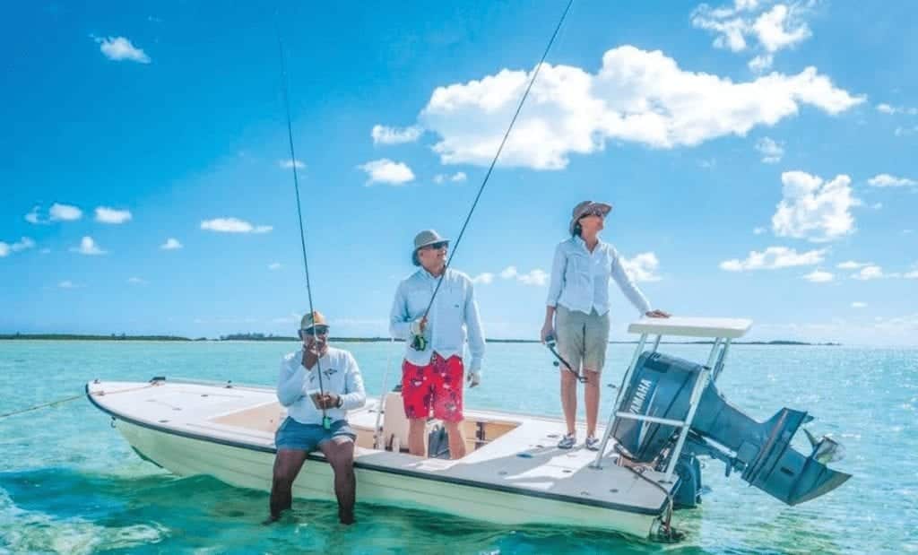
Five Days Fishing in the Berry Islands

Five Days in the Berry Islands is sure to delight.

The Berry Islands hold great historic intrigue owing to their past as a drug transshipment Mecca and a playground for the rich and famous to live out their fantasies. Nevertheless, it’s the championship sport fishing and island tranquility (with their many secluded beaches) that attract leisure boaters.

On a five-day journey with two travel days and three fishing days, you can cover a lot of territory and catch a lot of fish in the Berry Islands. Here is a sample itinerary to spark the imagination.

Day 1: Arrival

Don’t miss a good day of trolling while cruising to the Berry Islands. Stop in Bimini to clear customs and immigration and secure your cruising permit. With permit in hand, take your time and cruise to Great Harbour Cay Marina. Let your lines out as you cross Little Bahama Bank. Troll for yellowtail, bluestripe, jack, barracuda, and mackerel, or along the ocean edge for tuna, wahoo, and dolphinfish (mahi-mahi).

Whether you arrive in time for lunch or dinner, request a complimentary pickup from  Carriearl (pronounced Carry-Earl) Boutique Hotel, which is a cozy and casual resort with only four rooms. The restaurant and cocktail lounge is just over a mile away from the marina and a social hub for hotel guests and boaters staying on the island and cruising in the area.

Their signature appetizer is a “tasty tingum,” a shared plate of lobster, shrimp tempura, calamari, cracked conch, and other samplers. On the international dinner menu, you’ll find conch and lobster meals, both Bahamian classics, and a few elevated downhome favorites like crab and dough. There is a British stamp on the Barefoot Chef’s bangers and mash, a sausage entrée, and a French signature on the restaurant’s Coquilles St. Jacques, a beautifully plated appetizer with scallops and mashed potatoes.

Two minutes away from Carriearl, across the fairway of an unused golf hole and down a walkway of palm trees, a five-mile-long, deserted, white sand beach beckons. At the southern end, Shark Creek is a mangrove nursery ideal for kayaking, and Shelling Beach grows spectacularly at low tide, conjoining the offshore Hawk’s Nest Island.

Day 2: Bonefishing

The Berry Islands have a reputation for very large schools of bonefish. After spending more than nine years visiting Great Harbour Cay, Skip Whitman from North Carolina says the quantity of bonefish still amazes him.

“I have seen schools of two thousand bonefish where you cannot see the bottom. I’ve bone-fished in about seven or eight places between Florida and The Bahamas, and I have never, ever fished a place that has as many bonefish as the Berry Islands,” says Whitman, who loves the thrill of the hunt when bonefishing.

With over 30 islands and cays in the Berrys, bonefishing flats are located across the mini-archipelago. “Lord have mercy. A friend of mine caught about six bonefish in three days and it was his first time,” adds Whitman. “He caught all of these on a fly rod, not with live bait. For someone who has never done it before [and] to be successful on the first trip, that is wonderful. I think he saw ten thousand bonefish in the three days!”

Day 3: Deep Sea Fishing

From Great Harbour Cay, a centrally positioned island, take your pick of these top three deep-sea fishing areas highly recommended by Marina Manager Steve Johnson of Great Harbour Cay Marina: Tuna Canyon near Freeport, Grand Bahama is 40 miles northwest; Hole in the Wall near south Abaco is 40 miles to the northeast; and 20 miles south is the Pocket, a deepwater crossing marked by the northwest channel marker.

There is also a deep drop-off that runs 80 miles from Little Stirrup Cay to Bimini. There’s active fishing for wahoo along the edge, particularly during peak wahoo season between October and February. The banks’ side of this edge is also known as the Ginger Bread Grounds. For a change of pace, fishermen can also test their luck crawfishing.

Deep-sea anglers in the Berrys usually bring their own boat, so the day’s catch is often cooked fresh aboard; however, there are local chefs and caterers who can prepare meals, which local hotels and marinas can facilitate.

Day 4: Bottom Fishing

The water in the Berry Islands is so clear you can navigate by sight out on the boat, and you can locate schools of fish by sight when bottom fishing. “Sometimes in eighty feet of water, you can see the fish with your bare eyes,” says Percy Darville, a seasoned local fishing guide.

On a good day, Darville starts fishing around 30-40 feet and ends up around 90 feet where he’s more likely to catch large groupers and mutton snappers. Sandy bottom is no good for fishing, he mentions, and the smaller the reefs, the better, as they gather more fish than the large reefs. In all of his years fishing in the Berrys, Darville says he’s never been skunked while bottom fishing.

Day 5: Departure

Boaters do not typically hang around long on departure day, although they might troll their way out of Bahamian territory as they head back toward South Florida.

Travel Tips

  • Two full-service marinas are well suited for cruisers: Great Harbour Cay Marina in the north and Chub Cay Resort and Marina in the south. They both serve as ports of entry and fuel stations. Great Harbour sees a lot of Bahama 41 open fishing boats or 40-foot Ventures in their marina. In Chub Cay, you’ll also see large sport fisherman yachts such as Viking and others.
  • There are hundreds of miles of flats, so hire a local guide and head to one of the many uninhabited islands where the bonefish are less stressed and riper for the picking.
  • Chartering in the Berrys? From Nassau, daily flights are morning and afternoon on Le Air’s 19-seater. From Fort Lauderdale, Tropic Ocean Airways offers direct flights every Wednesday, Thursday, Friday, and Sunday.
  • The fish bite better at night according to local fishing guide Percy Darville. When he goes bottom fishing for himself, he usually goes out at night.

By Noelle Nicolls, Southern Boating June 2018

Photos Courtesy of the Bahamas Ministry of Tourism and Dockwa

VIDEO: Droning on in Honeymoon Harbour

Droning on and on takes on a different meaning when you’ve got three models, thirteen amazing products, and the bluest waters. Check out our drone footage for a birdseye view of Honeymoon Harbour!

For more on the products in the video:

Schafer 640

Nautibuoy Marine

Blackfin 272 CC

Photos and videos are Jim Raycroft of Raycroft Worldwide Photography unless otherwise stated.

Elizabeth Harbour

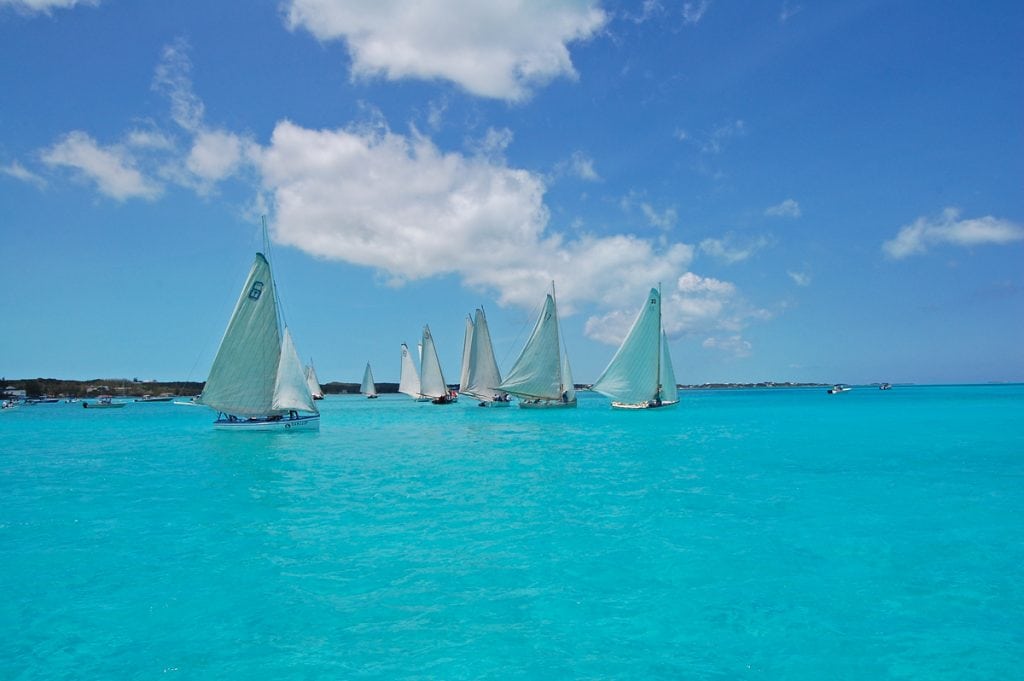
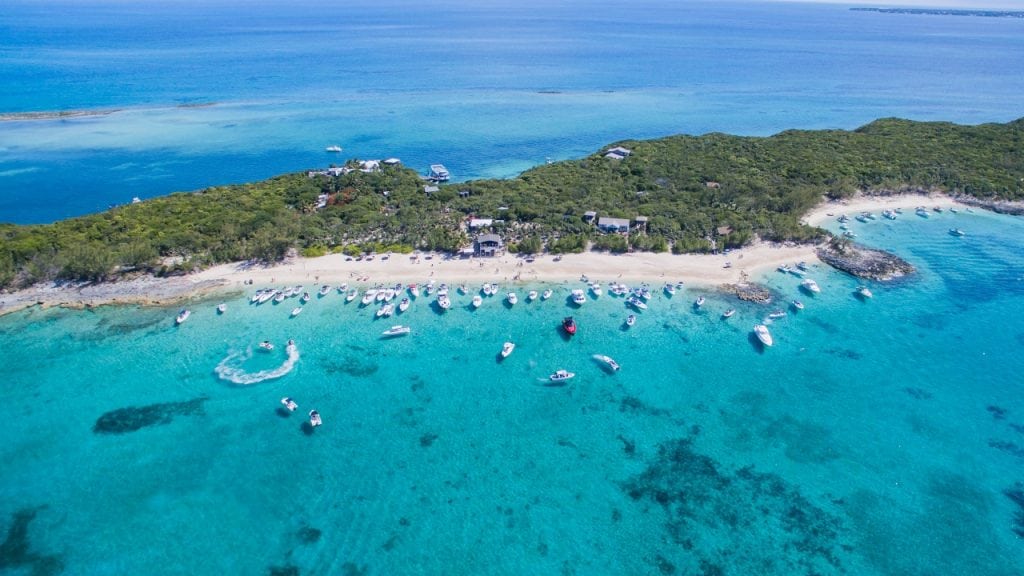
IF YOU ANCHOR IN GEORGETOWN, GREAT EXUMA, without fully exploring Elizabeth Harbour, you just might have regrets, if cruising sailors are to be believed. Elizabeth Harbour is an aquatic playground of sailors, and its secrets are tucked away inside the harbor’s coves and creeks; blue holes and reefs; sand bars and obscure channels.

When the boating season peaks in The Bahamas, Elizabeth Harbour turns into a city on the sea. At sunset, the mast lights switch on when the conch horn blows. “It is like a light show on the water,” said Bahamian sailor Reginald Smith, remembering his two years living on a 43-foot Beneteau sailboat in the harbor of his native island. There are so many boats—sometimes 400 strong—and the sea is easily mistaken for a city on solid land.

Reginald started sailing as a boy of five years old learning from his father, a captain, and fisherman. With an additional 69 years of boating experience weathered into his skin, he confidently insists that Elizabeth Harbour is the most spectacular anchorage in The Bahamas. Based on its popularity for sailors, there are many who would agree, citing diverse attractions and amenities and many locations to provide 360-degree wind protection.

Today, Reginald is a real estate agent, community organizer and conservationist. He relishes the days when he can sit back on the balcony of his oceanfront home in Farmer’s Hill and watch what he calls “the migration”: incoming sailboats from eastern ports along North America to Exuma’s great port city. Many cruisers island-hop their way through the northern cays and then hunker down in Georgetown to socialize and enjoy island living.

Reginald has a 180-degree view of the boats as they make their way to Georgetown. They emerge from the north toward Rolleville, and cruise past his house toward the most popular harbor entrance, the Conch Cay cut. The sight of white sails gliding along the horizon with a background of sky and ocean blues seamlessly blended is what Reginald looks forward to witnessing every year.

“Boats of all sizes start to arrive around Thanksgiving: 25-38 footers up to 65 footers. They usually come in batches of 1 or 2, or 15 or 20. From as far as your eyes can see, they appear full head sailing, into Elizabeth Harbour. It is the most beautiful thing you have ever seen.”

Elizabeth Harbour is protected by mainland Great Exuma to the southwest and the long and narrow Stocking Island to the northeast. There are few full-service marinas in the harbor, Exuma Yacht Club is one of them, so boats anchor in clusters in the main harbor and inside one of the many coves and mooring fields like Hurricane Hole, Turtle Cove, and Red Bays.

When winds kick up, you see them move with synchronicity to different corners of the harbor or tuck inside the protected, nearly landlocked coves. While protected areas abound, inside the main harbor can get windy, causing dinghy rides to be wet and rugged.

Ordinarily, Great Exuma research is not likely to reveal the many things to do right in the harbor. The beach bar and restaurant Chat ’N Chill, a popular watering hole on Stocking Island, is a well-known spot for boaters and non-boaters alike. But other than that, exploring Great Exuma is often about heading in search of swimming pigs, land-based attractions or other parts of Exuma, like the Exuma Land and Sea Park in the northern part of the chain.

And yet, right in Elizabeth Harbour there is a channel entrance to the Moriah Cay National Park, a 16,000-acre marine ecosystem with river-like mangrove creeks, sand dunes, bird sanctuaries, pristine beaches, and marine nurseries. Reginald says it is a mistake to think of the harbor as only being picturesque. Snorkeling buoys, maintained by the Elizabeth Harbour Conservation Partnership, mark 16 top snorkeling locations inside the harbor, including Turtle Lagoon, Mystery Cave, and Fowl Cay Reef Restoration. There are dozens of beach enclaves, some of which meld into sandbars, like Cocoplum Beach and Man-O-War Beach. The sailing itself is also a harbor attraction and not just at regatta time. Every February, winter residents participate in the George Town Cruising Regatta. In April, there is the National Family Island Regatta, which is the largest and oldest formal regatta in The Bahamas.

Sailing at night is a favorite pastime for Royston McGregor, a sailor and marine salvager living in Exuma. Once he has more than a half a moon and the waves are not high, he’ll be out in the harbor running sprints or playing in bigger waves near the harbor’s eastern entrance. As a local, he has the advantage of extensive inside knowledge. “The harbor has different sections, different depths and different wind conditions. Between the mainland by February Point and Crab Cay, there is a flat stretch of shallow water that is usually calm even when it’s windy,” says McGregor. “The Exuma Sailing Club uses that to practice. That’s where I like to do sprints. Windsurfers and kitesurfers also like the area for the same purpose. It is shallow enough for kite surfers to stand at low tide, which makes it great for learners.

For all that Exuma has to offer, Georgetown has hidden beauty, and it’s inside its harbor, in case you didn’t know.

By Noelle Nicolls, Southern Boating January 2018

PHOTO: © BAHAMAS MINISTRY OF TOURISM

Great Inagua’s Salty History

Great Inagua is worth its salt

THE SOUTHERNMOST ISLAND OF THE BAHAMAS, Great Inagua, and its smaller neighbor Little Inagua lie just 50 miles from the eastern tip of Cuba and even closer to the Turks and Caicos Islands. Great Inagua is the third-largest island in The Bahamas, with a hot climate that’s drier than the more northerly islands. This is a forbidding place for small boats since it is mostly surrounded by reef and drops off shockingly fast to the deep-blue ocean depths. There are no marinas here, just an open roadstead at Matthew Town, the only settlement on the Inaguas, and a few spots enclosed by reef but with difficult entrances. Not surprisingly, it is rarely visited by cruising boats. But because it falls close along the pathway to and from the Caribbean, it often serves as a stopover for fuel, rest and limited provisions.

Little Inagua is uninhabited, while Great Inagua has a population of about 1,000 and is largely focused on salt production, as it has been for hundreds of years. Bermudians settled here in 1803, coming via the Turks and Caicos, and began the first commercial salt production, selling to passing ships. Nearly all of the residents live in Matthew Town, and the Morton Salt Company has a huge operation here exporting more than a million tons per year. High mounds of pure, white salt greet the visitor. Morton Salt is the successor to Henagua Salt Pond Company, formed in 1848 and said to be the first formal corporation in The Bahamas. Although this is not a tourist destination in any way, the commercial operation means there are more amenities than at many of the other Out Islands, making it useful as a stop-off in settled weather. Customs and immigration are located at the airport but will provide check-in at the Matthew Town basin.

Upcoming Bahamian Events: 

MARS BAY CONCH FEST
At another off-the-beaten-path location, South Andros hosts the annual Mars Bay Conch Fest October 13-15. The weekend will include conch cracking, skinning and eating contests and competitions for the best conch salad and fastest conch salad maker. A Junkanoo Rush-out and live music events are also popular. For more information, call
(242) 357-2150 or (242) 369-5019 or visit bahamas.com/event/mars-bay-conch-fest.

BACK TO CAT ISLAND FESTIVAL
The same weekend, Cat Island will hold its Back to Cat Island Festival at New Bight Park. This annual homecoming celebration for former and current residents of Cat Island features a weekend of activities, including gospel concerts, live performances by Bahamian recording artists, a Junkanoo Rush-out, family fun and games, and local food and drinks on sale. Contact Ezra Russell at (242) 342-3014 or visit bahamas.com/event/back-cat-island-festival.

ABACO OPEN WATER SWIM RACE
The Abaco Open Water Swim Race will be held in Marsh Harbour on Sunday, October 8th, starting at 8AM. This 5K race for professional and amateur swimmers is a charity event hosted each year by the Abaco Swim Club. The racecourse is located in the waterway near Albury’s Ferry Dock. Participants can also compete in paddleboard and kayak challenges. The post-race party will include music, food, drinks, and the awards ceremony. bahamas.com/event/abaco-open-water-swim-race

NAVIGATION NEWS During his Parliamentary budget speech, the Hon. Frankie Campbell, MP, minister of transport and local government, mentioned that his ministry will improve the country’s aids-to-navigation (ATONS) for safer boating in The Bahamas.

By Rex Noel, Southern Boating September 2017

PHOTOS: BAHAMAS TOURISM, ADOBE STOCK/HARLEQUIN9, YITING SHEN, WIKIPEDIA/MARK A. WILSON

Your Pig Pictures

Once again, the readers of Southern Exposure DELIVERED. Thank you all so much for the pictures and videos of the famous swimming pigs. I had a blast looking through these wildly fun pig pictures and reminiscing about The Bahamas.

So without further ado, your user-submitted pig pics!

Follow the Leader

Coryne, from Intermarine, sent us the first four photos, including this dynamic duo.

Up close and personal

Coryne also sent this glamour shot.

Hate to see you go, love to watch you leave

“As a boat dealer every year we organize trips with our customers to explore different areas of the Bahamas,” said Coryne.

Taking a Dip

“The Exumas was our destination two years ago and we did enjoy swimming with the pigs.”

Come on aboard

“The Exumas remain one of my favorite places on earth- but for the unbelievably gorgeous islands, not because of the pigs!” — Ann Crumpton, Alabama.

Four’s a Crowd.

“Been there, done that,” said Capt. Mitchell of the s/v Vela Navis.

Missed Opportunity

“Too bad no one thought of making t-shirts,” continued Captian Mitchell. ” I would have bought one!”

Real Food

Winston from Southeast Salty Cruisers says, “It was so sweet, that after all the tourists get through feeding their leftovers, the piggy kiddos know where the real food is, with Mom!”

Underwater

Tony Ludovico, artist and conservationist, sent us this unique image.

Does this angle make me look fat?

Does this angle flatter my snout? Thanks to Robin Chesnie of Slipins for this image.

Hungry Pig

This little guy will need to eat a lot more to catch up to his island companions! Another fun shot from Robin of Slipins.

Gimme five

High-fives all around! Another shot from Robin.


Thanks again to all who submitted photos!

Horizon Rendezvous 2017

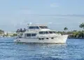
Thirty and Thriving

Horizon Yachts celebrates its 30th anniversary with a rendezvous that will long be remembered.

Most people celebrate birthdays in grand style, but I’ve always felt that anniversaries—especially ones of notable length—deserve to be celebrated with lavish affairs. Based on the extravagant and well-attended Bahamas Bash Owner Rendezvous held from April 26th to May 1st, which also commemorated the company’s 30th anniversary, Horizon Yachts is of the same mind-set.

Horizon Yachts’ four-day 2017 Owner Rendezvous in the Abacos, Bahamas, at the beautiful Abaco Beach Resort in Marsh Harbour, was the luxury yacht builder’s sixth such gathering and marked the largest turnout to date. More than 200 owners and guests attended, with 27 yachts ranging in size from 50 to 120 feet. The company’s first rendezvous was also held in the Abacos, so it was a joyous return to this stunning location for Horizon yacht owners and guests, some of whom traveled from as far away as Australia.

The festivities kicked off with a welcome floating “docktail” reception on the Horizon RP120 followed by hors d’oeuvres at the Promenade on shore, and dinner and dancing in the Resort Marquee. The next day, late-night revelers were able to sleep in before a private ferry took the group to Nippers Beach Bar & Grill for a pig roast, beach fun and the restaurant’s popular drinks. The rest of the itinerary was packed with activities on land—golf cart excursions, games, happy hours, and dock parties—and in the gin-clear Bahamian waters for fishing, snorkeling and sunning. Sunday’s Yacht Hop came with a twist—a “decorate your aft deck” contest that really brought out the owners’ creative sides.

As guests “hopped” from one yacht to another enjoying cocktails and hors d’oeuvres, they were greeted with “President Trump” as a stowaway; Ginger and the whole Gilligan’s Island gang; disco fever at Studio 54, and much more. The Horizon USA team got into the spirit, too, transforming into mermaids, Captain Jack Sparrow, pirate wenches, and other island-inspired characters.

The evening’s farewell Bahamian beach bash included prizes for the best decorated aft deck and a Junkanoo band for an authentic island-style celebration. “Augmented by The Bahamas’ renowned island hospitality, delicious food and gorgeous weather, the Horizon Yachts Global Owner Rendezvous was a great success,” said Horizon Yachts CEO John Lu, who also attended the event. “But more importantly, this event emphasized that having fun in beautiful places and with wonderful people is truly what makes boating so enjoyable.”

Just like all Horizon rendezvous, new relationships were formed between owners, and partying ended much too soon. Veteran yacht photographer Jim Raycroft and videographer Suki Finnerty took advantage of the famous Bahamian blue water as a backdrop to capture the memories, including a Horizon powercat raft-up and a promotional shoot of the new RP120 superyacht, the recently launched E98 motoryacht Do It Now and E88 motoryacht.

horizonyachtusa.com

L.N. Evans Southern Boating August 2017

Where to Dock in The Bahamas: A Cruising Guide

ABACOS

Abaco Beach Resort & Boat Harbour Marina
Marsh Harbour, Abaco
abacobeachresort.com
(242) 367-2158
Accommodations for vessels up to 200’ LOA

Bluff House
Green Turtle Cay, Abacos
bluffhouse.com
(800) 745-4911
46-slip marina with power, water and free TV/Wi-Fi connections; catamaran-specific dockage available

Conch Inn Resort & Marina
Marsh Harbour, Abaco
(242) 367-4000
conchinn.com
80 slips; can accommodate vessels up to 175’ LOA; The Moorings and Sunsail charter bases

Green Turtle Club Resort & Marina
Turtle Cay, Abaco
greenturtleclub.com
(242) 365-4271
40 slips for vessels up to 130’ LOA

Hope Town Inn & Marina
Hope Town, Abaco
hopetownmarina.com
(242) 366-0003
50-slip, surge-free marina; moorings for boats up to 45’ LOA

Schooner Bay
Great Abaco
schoonerbaybahamas.com
(888) 275-1639
Marina, Blackfly Lodge and Harbour Village

Treasure Cay Marina
Abaco
treasurecay.com/marina
(242) 365-8250
Full-service, 150-slip marina with moorings, laundry, showers, duty-free shopping

ANDROS

Andros Lighthouse Yacht Club & Marina
Andros Island
myoutislands.com
(242) 368-2305
34-slip full-service facility

Kamalame Cay Resort Marina
Kamalame Cay, Andros
kamalame.com
(800) 790-7971
Accommodations for vessels up to 65’ LOA

BERRY ISLANDS   

Berry Islands Club
Frazier’s Hog Cay
berryislandsclub.com
(242) 357-5617
12 slips for vessels up to 200’ LOA

Great Harbour Cay Marina
Berry Islands
greatharbourcaymarina.com
(242) 367-8005
65 slips for vessels up to 130’ LOA

BIMINI

Bimini Big Game Club Resort & Marina
Alice Town, North Bimini
biggameclubbimini.com
(800) 867-4764
75 slips for vessels up to 120’ LOA

Bimini Sands Resort & Marina
South Bimini
thebiminisands.com
(800) 737-1007
Full-service marina for vessels up to 100’ LOA; scuba center

Resorts World Bimini
North Bimini
rwbimini.com
(305) 374-6664 ext. 1035
Largest marina in The Bahamas; 200+ slips for vessels up to 180′ LOA

CAT ISLAND

Hawk’s Nest Resort & Marina
Cat Island
hawks-nest.com
(242) 342-7050
28-slip marina with personalized service

NEW PROVIDENCE

Albany Resort/Marina
New Providence
albanybahamas.com
(242) 909-7001
Accommodations for vessels up to 300’ LOA

Bay Street Marina
Nassau, New Providence
baystreetmarina.com
(242) 676-7000
89 slips for vessels up to 150’ LOA; free Wi-Fi

EXUMAS

Highbourne Cay Marina
highbournecaybahamas.com
(242) 355-1008
750 feet of dock space; call in advance for reservations

Marina Emerald Bay
Great Exuma Island
marinaemeraldbay.com
(242) 336-6100
150 slips for vessels 40-240 feet; 24-hour security; pump-out service at each slip

Staniel Cay Yacht Club
stanielcay.com
(242) 355-2024
Accommodations for yachts up to 185’ LOA

GRAND BAHAMA

Grand Bahama Yacht Club
Freeport
grandbahamayachtclub.com
(242) 373-8888
Accommodations for vessels up to 200’ LOA

Ocean Reef Resort & Yacht Club
Freeport
oceanreefbahamas.com
(242) 373-6921
50 slips for vessels up to 120’ LOA; lowest dockage rates in Freeport

Old Bahama Bay Resort & Yacht Harbour
West End
oldbahamabay.com
(888) 983-6188
Full-service marina with 72 slips up to 120’ LOA, 24-hour security, customs and immigration office

Port Lucaya Marina
Freeport
portlucayamarina.com
(242) 373-9090
Online slip reservations; services include catering, babysitting, and more

Sunrise Resort & Marina
Freeport
sunriseresortandmarina.com
(800) 932-4959
Full-service marina with 70 protected slips, 40-ton lift, customs and immigration office

ELEUTHERA

Cape Eleuthera Marina
capeeleuthera.com
(844) 884-1014
Full utilities and accommodations for vessels up to 200’ LOA

Romora Bay Club & Resort
Harbour Island
romorabay.com
(242) 333-2325
Deep-water, full-service marina with 40 slips, 24-hour security and video surveillance

Valentines Resort & Marina
Harbour Island
valentinesresort.com
(242) 333-2142
Can accommodate vessels up to 160’ LOA; open to transient cruisers year-round

LONG ISLAND

Flying Fish Marina
Clarence Town, Long Island
flyingfishmarina.com
(242) 337-3430
30-, 50- and 100-amp power; water, laundry and fuel

Stella Maris Resort
Long Island
stellamarisresort.com
(242) 338-2050
Accommodations for vessels up to 100’ LOA


Anchoring in The Bahamas

Sitting Pretty
Anchoring in strong tidal currents

Many areas in The Bahamas make tricky work of anchoring, especially where reversing currents can break out an anchor and set you adrift. The Bimini Channel, Normans Cay Cut in the Exumas and the North Current Cut near Eleuthera are three notorious places that wreak havoc with anchored boats as the tides turn. If you want to sleep well at night, review your technique, your choice of anchorages and your ground tackle before your next anchoring adventure.

Bahamian Moor

S/V Kai Kanani II Photo credit: Tavis Jacobs

A popular two-anchor technique that works well in reversing currents is the appropriately named Bahamian moor. Two bow anchors are set 180 degrees apart with the bow of the boat as the midpoint. Drop the first anchor up-current, motor back and set it, letting out double the rode you’ll need for a 7:1 ratio of rode to depth. Drop the second anchor down current, then fall back to the midway position and snug up both lines. Take care not to wrap the line in the props when backing down on the second anchor. If nearby boats lie to one anchor, your swinging radius will be different from theirs so give them plenty of room.

A Bahamian moor works best when a consistent wind blows across the current and keeps the bow steady in one direction. Without a breeze, the boat may spin as the current reverses, twisting the lines. You can minimize this in two ways: First, if possible, cleat one anchor line at the bow on one side and the other a few feet back on the other side. The boat will not be able to spin in place with both lines taut. Second, use a swivel with three lengths of chain. The swivel has two eyes or shackles on one side to connect to the chain leading down to the two anchors, and one shackle on the other end connects to a third length of chain that reaches up to the vessel. Regardless of the boat’s dance at the surface, the swivel does all the twisting. Keep in mind, however, that this method takes advanced preparation, extra equipment and more time to set and retrieve the anchors.

Holding Ground

Most Bahamas anchoring is done in less than 15 feet of water, so 100-120 feet of chain or line should be sufficient. A bow lookout can guide the driver to a nice patch of sand on an otherwise grassy bottom and watch for the telltale cloud as the anchor makes contact. When setting the anchor, take care not to pull it out of the sand and into the grass. Hitting a small target with an anchor hanging off a moving vessel requires practice. Don’t be shy about repeating the process until you’re successful—it’ll be worth it.

On a coral pan, there is nothing for an anchor to dig into and it will generally just slide on its side without hooking up. This is a dangerous situation and you’ll recognize a dragging anchor by the chain skipping or jerking in the bow roller. Always try to snorkel on your anchor to check its position and its environment. An anchor painted white is easier to spot underwater and is an easy DIY project.

Of course, the last tip—which arguably should be the first—is don’t anchor in sketchy places like cuts where water gets squeezed and currents speed up. If a mellower anchorage is one bay over from where you’d like to snorkel, use the dinghy to commute, but stay overnight around the corner.

The Best Anchor

Types of anchor are a hotly debated subject. I find at a bar, the opinions grow louder and convictions stronger with each cocktail. The truth is that the best anchor is the one that fits the circumstances: type of holding ground, current, and tides, and the type and size of boat. In a perfect world, we’d have one of every sort just to be safe.

Not having that kind of space or budget, I carry three: a Manson Supreme, an original Bruce, and a Fortress. The first two are on the bow and the last one is used as a stern anchor because it’s aluminum, so it’s light and easy to manage by hand from the stern or dinghy.

My Manson (similar to a Rocna) has dragged only once and that was in the grass, the nemesis of all anchors. I’ve found the advantage of a claw like the Bruce or Lewmar, is that it tends to reset quickly and typically on its own if it breaks out. Fortress and Danforth anchors with opening flukes are excellent in mud and sand and stow easily off the bow roller on smaller vessels. I’ve also had good luck with a Delta and a Spade.

I believe in all chain rode, at least for the primary anchor. The chain won’t chafe through on rock or coral, creates a nice catenary and adds a bit of heft to an undersized anchor. The secondary anchor should have chain equal to at least one length of the boat and another 100-150 feet of nylon rode. My stern Fortress has 50 feet of chain and 265 feet of flat polyester webbing on a Quickline that stows nicely.

Windlass Wisdom

A working windlass is key to any successful anchoring routine. For a Bahamian moor, a windlass should have a chain gypsy on one side and a line winch on the other. If you haven’t serviced your windlass in a while or even used it for that matter, remember that it’s cheap insurance so it should be in working order. Take off the cover, check the pawls, lubricate necessary points, and lay eyes on the wire connections to ensure they’re solid.

Finally, be sure to check the weather before choosing an anchorage, and set an anchor alarm on your GPS. Then, I promise, you’ll sleep like a baby.

By Zuzana Prochazka Southern Boating May 2017

See more: Tips for Anchoring in the Bahamas

Exuma Cays Land & Sea Park

The beauty and inspiration of this national treasure
must be experienced to be fully appreciated.

I grew up in a family that loved camping, especially in the northernmost part of Minnesota known as the Boundary Waters Canoe Area on the U.S.-Canada border. My husband and I raised our four young sons to enjoy camping as well, and some of our favorite camping memories were made in or near one of the country’s many national parks. We especially remember the Badlands National Park and Mount Rushmore National Memorial in southwestern South Dakota. Early one morning we awakened to a thundering herd of buffalo coming down from the hills and crossing the road to drink water from a pond where we had been fishing the evening before. National parks exist in an estimated 100 countries around the world, including our island neighbors to the east, The Bahamas.

The Bahamas’ 27 National Parks are managed by the nonprofit organization The Bahamas National Trust (BNT, bnt.bs), which was founded in 1959. BNT was formed to build, manage, protect, and conserve the natural resources of The Bahamas for future generations of Bahamians and also for visitors. The first of the parks to be established was also the first of its kind in the world to include both land and sea. The Exuma Cays Land and Sea Park (ECLSP) stretches for 22 miles, encompasses 176 square miles and offers outstanding anchorages and mooring sites from which to appreciate its magnificent beauty above sea level and below.

It should be noted that several private islands are within the park’s borders: Little Pigeon Cay, Cistern Cay, South (or Little) Halls Pond Cay (reportedly owned by Johnny Depp), Soldier Cay, Bell Island, and Little Bell Island. Cruisers should take care to stay off these islands and remember that with more than 700 islands in The Bahamas, there are plenty for everyone to enjoy without infringing on anyone’s privacy.

For southbound cruisers approaching the Exumas from Nassau, a stop at Highbourne Cay offers a protected marina and shoreside dining if the chef needs a night off. The office should also have waterproof dinghy and snorkeling guides for Exuma Park’s Shroud and Hawksbill Cays (both uninhabited), with locations of mooring fields, which are on a first-come, first-served basis. Shroud Cay’s meandering creeks will have you feeling like an adventurous explorer as they wind through mangroves and then empty into Exuma Sound. Exercise your legs with a walk on one of the prettiest beaches in the Exumas, though you’ll be hard-pressed to choose your favorite since Hawksbill Cay offers several as well. Plus, you’ll want to explore the ruins of the Russell Plantation from the Loyalist period.

Warderick Wells is, for most park visitors, the highlight of a visit to ECLSP and the home of the park headquarters and visitor center. Call ahead (VHF 16 or 09) for a mooring assignment and if you need help navigating the narrow channel. The mooring field is well protected from all directions, so it’s a great location to ride out a windy squall. The daily or nightly cost is based on the size of your boat and ranges from $20 to $150. If you choose to mingle with other cruisers, they congregate on the beach for a daily happy hour. You’ll know you’re at the right place by the sperm whale skeleton on the beach. Bring bug spray to ward off the no-see-ums.

This was the first location for the ECLSP and was established in 1958 to preserve the fragile flora and fauna. It also serves as a marine, bird and animal sanctuary. Pack a water bottle and good hiking shoes or toe-covered sandals, and take your RIB to the beach to pay for mooring at the office and see the visitor center. Then get ready for a long or very long hike depending on which route you prefer. Either way, you’ll tread on jagged, lava-like rocks, which can be treacherous for any but the sure-footed. The path I took was only 2.5 miles, but adding in the rocky factor made it feel longer. On top of Boo Boo Hill we noticed many small shells and little bits of sea glass on the path from the surf blowing them through several blowholes. Ample signage educates hikers along the path to the many anomalies that are exclusive to this park. For example, in the mangroves we learned about the “sacrificial” leaf on each plant, which takes on all the salinity of the water so that the rest of the tree can live and thrive. If you’re lucky you’ll see a hutia, a small nocturnal mammal found nowhere else in The Bahamas. As everywhere else in the park, take only pictures and leave with only footprints.

Cambridge Cay’s moorings are on a first-come, first-served basis and offer convenient access to several superb snorkeling sites that are described in the ECLSP snorkel guide, including the spot known as the Aquarium for good reason. Bring your stale bread to feed the greedy little fish. There are lovely corals here of all varieties and colors that are well protected and too deep to stand on by inexperienced snorkelers who don’t know the damage they can cause to these fragile creatures. When snorkeling anywhere in the park, it’s extremely important to be aware of the strong currents. Our gracious host on a Horizon powercat charter told us he once rescued an elderly couple here. The woman could not get in the dinghy, which was on a mooring ball, and she had lost track of her husband while snorkeling, who was found gasping for breath several hundred yards away having been carried away by the outgoing tide.

Very close to Cambridge Cay is another small island (unnamed on any of the maps I searched), where you can take your RIB to a tiny (maybe 10 feet wide) beach just inside the cove. There’s a deeper hole that serves as a swimming pool of sorts, and certainly one that claims a preferred spot in my memory bank.

Last, but certainly not least, is a cave-snorkeling experience that’s not to be missed. Though it’s not technically within the borders of the ECLSP, “Thunderball Cave”—named after the James Bond movie Thunderball—is very close. It’s important to time your visit there during low tide so that it’s easier to get in and out of the jagged cave opening. Watch your head when entering as the tide runs fast in the entrance. Once you’re inside the cave, holes in the cave ceiling let in natural light and illuminate the air above and the water beneath.

In a neighboring cave on Rocky Dundas—which is within the ECLSP—when the sun is directly overhead, the illumination is a tunnel of light that the locals call “the finger of God.” I wasn’t fortunate enough to experience this island or cave, but I hope to some day. Like Michelangelo’s painting on the ceiling of the Sistine Chapel in Rome, Creation of Adam, when one can experience the finger of God, in any form, on any island, one should.

Story & photos by Liz Pasch Southern Boating May 2017

Bahamas Fling

This Summer, Have a Fling!

Skip Allen, Sr., the founder of Southern Boating, was widely recognized in boating circles and the marine industry as a pioneer for encouraging, training and leading dozens of cruisers across the Gulf Stream to The Bahamas in the ’70s, ’80s and ’90s. (With more than 700 islands, one would be hard-pressed to visit most of them in a lifetime, though Skip did his best to do just that.) Since then, a few boat dealerships, brokerage companies and boating clubs have organized their own group boating excursions. But if you’re not familiar with one, there’s another option.

The Bahamas Ministry of Tourism has for many years organized and facilitated boating “flings” across the Gulf Stream to The Bahamas on scheduled weekends in June and July. Here’s how it works:

All flings depart for The Bahamas on Thursdays. Pre-registered boats ($75 per boat, per fling for boats a minimum of 22 feet LOA) arrive at the Bahia Mar Yachting Center in Fort Lauderdale, Florida, prior to or on Wednesday, the day before the fling. Captains of the participating boats participate in a mandatory captain’s meeting that afternoon or evening. On Thursday morning, a designated boat leads a caravan of up to 30 boats across the Gulf Stream to the designated destination at a marina in The Bahamas. (Dockage is on a first-come, first-served basis.) On Sunday, the boats return as a group to the U.S.

June 

8 – 12
Grand Bahama

15 – 19
Bimini

22 – 26
Bimini 

July

6 – 17
Extended Fling to Exuma

20 – 24
Bimini

24 – 27

Bimini

*Dates subject to change

Departure Point:

Bahia Mar Yachting Center
801 Seabreeze Boulevard
Ft. Lauderdale, FL 33316
Ph: (800) 755-9558
or (954) 627-6309

Register at bahamas.com/faq/boating-flings.

Registration fees are submitted to:

The Bahamas Ministry of Tourism
1200 South Pine Island Rd., Suite 450
Plantation, FL 33324
Attn: Vertical Markets Department
Info: 1-800-32SPORT

Bahamian Menu

This flavorful menu celebrates the best of The Bahamas!
Each recipe in this Bahamian menu recipes serve 4.

Plantation Rum Punch

8 oz. rum
8 oz. lime juice
3 tbsp. sugar
Pinch of nutmeg

In a shaker, mix rum and lime juice with sugar until it dissolves. Pour over cracked ice into 4 glasses. Top each with a pinch of nutmeg. (The nutmeg elevates this cocktail, so please don’t skip it!)

Bahamian Conch Salad

½ tsp. salt
¾ cup lime juice
1 tbsp. chopped cilantro or parsley (optional)
4 cloves garlic, finely chopped
1-2 jalapeño peppers, minced or
1-2 tsp. of hot sauce
½ cup red onion, diced
1.5-lb. conch, diced (may substitute small cooked shrimp or raw fish—snapper, grouper, mahi, or tuna)
1-2 limes, quartered
Tortilla chips, plantain chips or crackers

In a large bowl mix salt, lime juice, cilantro, garlic, peppers, and onions. Add conch and toss to combine. Chill for several hours if possible. Serve family-style in a bowl along with chips or crackers, or serve individually on 4 plates lined with lettuce and surrounded by sliced tomatoes and cucumbers with a basket of chips or crackers. Garnish with quartered limes and hot sauce on the side.

Bahamian Barbecue Shrimp

¼ cup lemon juice
1 cup Worcestershire sauce
1 ½ tsp. each, onion powder and garlic powder
2 tsp. each, dried thyme, oregano and paprika
½ tsp. each, salt and pepper
¼ tsp. hot sauce, or to taste
3 tbsp. beef base such as Better than Bouillon, Knorr, Tone’s, or Herb Ox
16-20 large shrimp, shelled and deveined
½ stick cold salted butter, cut into 5 pieces

For the sauce, mix the first seven ingredients (except for the shrimp and the butter) in a bowl, cover and set aside for several hours or overnight to allow flavors to meld.

To prepare shrimp, place them in a heavy skillet with 1 cups sauce. Bring to a simmer over medium heat and cook until shrimp is barely done, then remove them from the pan. Remove pan from the heat and begin stirring one piece of butter into the sauce. As one piece of butter melts, add another until all are incorporated into sauce. Add shrimp and heat over low until warm. Serve shrimp on toasted bread or steamed rice to soak up all the delicious sauce!

This barbecue sauce is dark, smoky and well-spiced, but not hot. I suspect it is also delicious with fish, chicken and beef.

Spicy Cucumbers

1 tsp. hot sauce
2 tbsp. lime juice
2 garlic clove, minced
2 scallions or 1 small onion, chopped
4 cucumbers, thinly sliced
Pepper

Mix hot sauce, lime juice, garlic, and onion in a bowl. Toss with cucumbers and then marinate for 1-2 hours. Serve with a sprinkle of pepper.

Coconut Macaroons

14 oz. sweetened condensed milk
2 tsp. vanilla
4 oz. shredded, sweetened or unsweetened coconut (depending on preferred sweetness)

Preheat oven to 350ºF. Combine coconut, sweetened condensed milk and vanilla in a large mixing bowl; mix well until it creates a stiff dough. Roll each cookie tightly in a ball and place on parchment or aluminum foil-lined and greased baking sheets.

Chill for 1 hour. Bake 10-15 minutes or until lightly browned on edges and top. Macaroons will spread out when cooking. Cool and carefully remove from baking sheet.

Store covered in refrigerator or on counter top.

Go to southernboating.com/food for more onboard entertaining ideas!

White Sound and Lubbers Quarters Cay

White Sound and Lubbers Quarters Cay

Hope Town Harbour is one of the most popular destinations in the Abacos for cruisers and tourists. But the harbor and town are only the tip of the iceberg for a visit to Elbow Cay. White Sound is the small body of water near the mid-section of Elbow Cay, just two miles south of Hope Town, which nearly bisects the island. The well-marked entrance channel carries about six feet of water at low tide. Inside the channel there is limited dockage for meals at The Abaco Inn (abacoinn.com). The marked channel continues due south from the inn to Sea Spray Resort and Marina (seasprayresort.com). Both facilities have excellent food at their respective restaurants, along with many other amenities. There is little room to anchor inside White Sound, but in settled weather cruisers can anchor just outside and south of the White Sound channel and take the tender inside.

Continuing south from White Sound between Elbow Cay and Lubbers Quarters Cay to the west, the deepest water is narrow but passable for most cruising boats if you read the water and proceed carefully. As you approach the southern end of Elbow Cay, an excellent anchorage will open up to port of the channel, extending south to Tahiti Beach. Look for a sandy patch between the sea grasses to drop your hook. Tahiti Beach at the southern tip of Elbow Cay borders on Tilloo Cut and provides a reasonably good pass to the ocean. Plan your visit to Tahiti Beach for mid to low tide when the long white sandbar is exposed. Fish the edge of the cut from the beach where you’re likely to spot fish, turtles, rays, and even a large shark patrolling Tilloo Cut. The beach is a popular picnic spot, and the eastern side offers good beachcombing and shelling.

The short dinghy ride from the Tahiti Beach anchorage to Lubbers Quarters Cay is well worth the trip to visit Cracker P’s, one of the best beach bars and restaurants in The Bahamas. There is plenty of room here to tie up a large center console tender; drop a stern anchor and nose the bow up to the dock. Local legend has it that the place is named for Paul John “Cracker Pinder” Simmons, a fugitive from Georgia who settled here around 1915 and eked out a living from fishing and gardening. Today, you will find an elevated bar and deck with great views of Tahiti Beach and Tilloo Cut, volleyball and bocce courts, excellent food, monthly full moon parties and, perhaps, the longest rum list in the area. crackerps.com

Bahamas Yacht and Travel Show

The second annual Bahamas Yacht and Travel Show will be held June 22-25, 2017, at Bay Street Marina in Nassau, Bahamas. Sponsored by The Bahamas Tourist Office (bahamas.com) and Boat4ADay (boat4aday.com), the weekend event will showcase Bahamas-based luxury charter yachts, boutique hotels, private island villas, and travel experiences, plus handmade crafts, art and designer resort clothing. Boat4ADay specializes in day charters with online booking and can arrange yachts in The Bahamas and throughout the Caribbean. The organizers are planning a fun getaway for families with live music, activities and entertainment throughout the weekend.
bahamas-yacht-and-travel-show.com

Exit mobile version