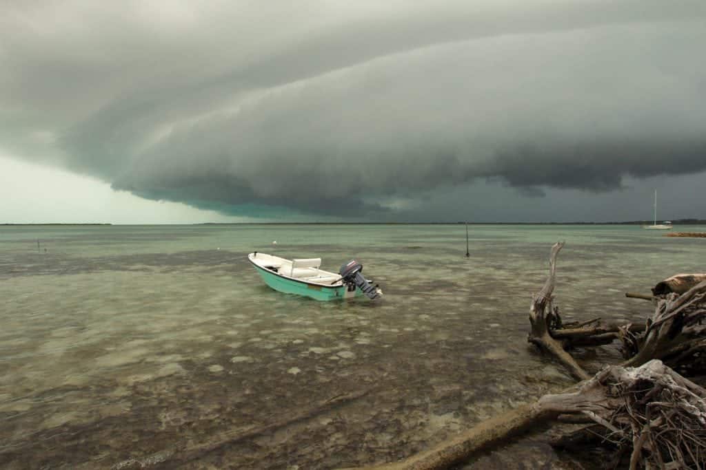
Good Advice for Bad Weather

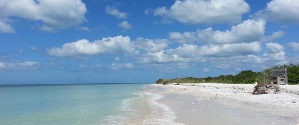
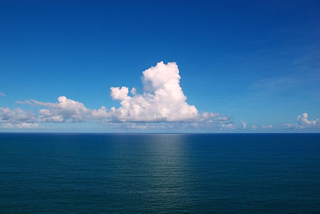
Between the Southern Tip of Eleuthera and Little San Salvador, there is a figurative bridge connecting the two islands: a seven-mile-long overpass of water running east to west, with depths of 50 feet, sometimes less. This relatively shallow body of water is significant because it straddles an otherwise extremely deep ocean channel. To the north and south of the bridge, the sea is 10,000 feet deep.

The upwelling from this deep channel pushes baitfish into the shallows, attracting lots of big fish and boaters. Anglers don’t just pass through this cut; they deep drop or troll for blue marlin. “It is an amazing fishing area, one of the best I’ve seen in my life,” says Chris Morris, general manager of Cape Eleuthera Resort and Marina.

But these same conditions also make for ferocious seas in bad weather, and the Cape Eleuthera Marina provides a safe harbor. “That is a risky area to let bad weather catch
you, no ifs, ands or buts,” says Capt. Shalako Moxey, a Bahamian boating veteran of 35 years. “You have on the northern shore those big seas rolling in, and coming in around that point, you have those tidal changes that create a big rip current. It is not comfortable at all.”

There are a few spots that even the most experienced Bahamian boaters dread when it comes to being stranded out at sea: the Tongue of the Ocean (a deep oceanic trench separating Andros and New Providence) and the Gulf Stream. “If you miss and break down in the Gulf Stream and a bad tide is flowing downwards, you’ll be in Honduras quick, and if you get caught drifting in the Tongue of the Ocean in bad weather, you might end up somewhere in Cuba,” explains Kenny Minnis, a local boater with personal
experience being adrift in international waters between The Bahamas and Cuba.

Jaronn Roberts, a Harbour Island boater and charter operator says his worst experience was fishing on the wall between the Great Bahama Bank and the Gulf Stream. They lost track of the weather forecast while crawfishing in their dinghies, and wicked weather caught them on the edge of the Bank. “It was a critical situation, and we were afraid. A few of the dinghies sank,” says Roberts. “We tried to come home and started to slowly ride the waves, but the waves were breaking over the boat. It was terrible. That’s when we decided to hunker down.” They ducked behind East Isaac Cay, a sliver of rock that gave them some protection to weather out the storm to the next day.

Captain Brian Turnquest, private charter operator and owner of Party Cat Cruises, recalls being caught wrangling 12-foot seas in the Gulf Stream. “The banks were only three to four feet. When we got in the Gulf, we had at least 12-foot seas all the way from Great Isaac Lighthouse to Palm Beach,” he says. “It was so bad [that] we took the six-man life raft out of the hole and put it between us so it was easily accessible.”

The Bahamas might be a traveler’s paradise, but the sea is still the sea, and no matter how pretty it looks over the aquamarine horizon, bad weather in The Bahamas is no
more forgiving than bad weather anywhere else.

And don’t let those friends and passengers with the sad eyes and frustrated scowls make you think otherwise when the sun is shining and the sea is calm. “A lot of people look
at first glance and go out, but they don’t get a forecast to see if it is going to look nice all day. The weather might be good in the morning, but it might be set to kick up in the
afternoon. That is how people get caught in a bad spot,” says Turnquest. If captains don’t do their due diligence, they’re liable to buck into bad weather unexpectedly and risk ending up in distress.

Bad Weather Advice from Captain Shalako Moxey of Yellowtail Fishing Charters:
  • During hurricane season, boaters usually have ample time to buckle down or head back home. However, in the peak season, with all its cold fronts, the weather is more unpredictable. Because of Nassau’s strategic position, there are some good fishing options on at least one side of the island. The northern shore is available for wahoo and mahi-mahi fishing when the southwest trade winds are blowing. The south side is available for yellowtail, amberjacks and barracuda when the cold fronts are blowing in from the north.
  • Dotham Cut, south of Cave Cay, is the preferred cut to exit the banks when heading to Georgetown, Great Exuma on the oceanside. This is a convenient route for large boats, as they can ride the ocean straight into Elizabeth Harbour. However, Dotham Cut can be rough even in calm weather. Southeast winds with an outgoing tide can create a river rapid effect but on a larger scale. In bad weather, Dotham Cut, along with neighboring Galliot Cay cut just north, are perhaps the two most dangerous in the Exumas, and can
    feel as though a real hurricane is blowing through.
Bad Weather Advice from Captain Chase Camacho of Chase ‘n Dreams Yacht Charters:
  • One of the big, bad weather risks in The Bahamas is running aground on the reefs and the Banks. If you anchor out overnight, you can easily get blown off your anchor and run aground while sleeping. One night during the summer, we anchored in by Chub Cay in calm weather. A storm came through that night and the anchor alarm, which we put on,
    rang. We started to slide towards the shallows. There was complete darkness, but with our experience, we were able to reposition the boat in the rain, with gusts and high seas, and anchor back up in safety. An inexperienced person could have been lost.
  • You don’t want to be caught in bad weather if you are inexperienced. Getting into Port Lucaya in rough weather when the waves are rolling over is difficult, for example. You can hit those rocks easily. You can’t just say, “It’s gonna get bad, let’s get back.” You have to plan properly because if you are not getting back to a place that is easy to get into, you could still have problems. In fact, there are a lot of places in The Bahamas where you simply need a pilot to [come] get you. Harbour Island’s Devil’s Backbone is one of those notorious places that even on a good day, if you are unfamiliar, can be treacherous.

By Noelle Nicolls, Southern Boating March 2018

PHOTO: ERIK LARSON

When Hurricanes Come, the U.S. Coast Guard Goes Inland

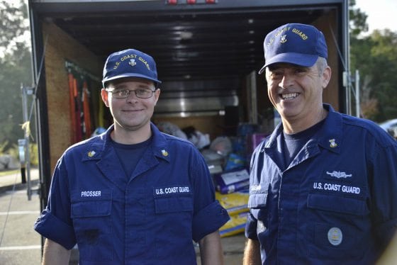
With Hurricane Matthew barreling towards the coastal town of Wilmington, North Carolina, U.S. Coast Guard Petty Officer 1st Class James Prosser and his wife, Nicole, made the seemingly right decision to send their two young children out of harm’s way to the inland city of Lumberton. Little did they know that the small inland town was also going to take a beating.

Feeling confident about his choice (Lumberton is located almost 90 miles from the coast) Officer Prosser resumed his duties at the Coast Guard Sector North Carolina. Imagine his surprise the following weekend when he received news that floodwaters in Lumberton were rising rapidly while his children were at their grandparents’ home without running water or electricity.

U.S. Coast Guard Petty Officer 1st Class James Prosser and Master Chief Petty Officer Louis Coleman load Coleman’s trailer with donations during Hurricane Matthew at Coast Guard Sector North Carolina in Wilmington, Oct. 16, 2016.

“Lumberton has been the go-to safe haven during hurricanes for me and my family for about eight years now,” says Prosser. “But after the town was battered by Hurricane Matthew, following two weeks of unusually high rainfall, it became a dangerous place where water was suddenly filling the streets.” By Monday morning, the levee protecting Lumberton had broken, and Prosser was working feverishly with members of the sector command to determine how to best bring his children home.

“They [local officials] were confused as to why we were headed into town at first, but as soon as we explained why we needed to get in, they let us through,” says Prosser. “Most people were trying to leave town, not get in, and we began to see why. Damage from the hurricane became much more evident the closer we got to Lumberton, but I was blown away by the damage we encountered when we got within city limits.”

It quickly became clear that the area was too flooded to continue by truck. Luckily, Prosser and a fellow officer encountered water rescue teams from New York and New Jersey. Prosser found the town unrecognizable and struggled to get his bearings. “Eventually we approached a church that looked familiar. We saw helicopters overhead with people dangling from cables. They were hoisting people from the flooded waters to safety,” he adds.

Prosser was finally able to reach the children via SUV. “When we got there, my two children came running out the door,” says Prosser. “While it was a huge relief to know they were safe at that moment, I knew we were all still in danger. We needed to get out of there as quickly as possible, before we got trapped by floodwaters.” Meanwhile, Prosser and additional officials strongly encouraged others to evacuate the dangerous area. As part of the North Carolina family, Coast Guard Sector North Carolina personnel will continue their response to Hurricane Matthew’s aftermath and the subsequent flooding throughout the region.

Prosser and his rescued family.

Signs it’s time to head back to shore

Summer brings the perfect conditions for a day out on the water. Whether you’re taking the boat out for a solitary cruise or showing friends and family that perfect snorkeling spot, there are plenty of opportunities to take a step back, grab a drink and soak up the summer sun. However, the start of summer also brings other changes in weather besides the heat—sudden storms can appear unexpectedly, placing you and your passengers in danger.

These days, checking the weather forecast is as easy as taking a quick peek at your smartphone for one of the many weather apps available or checking your onboard radar. However, the time-honored tradition of scanning the horizon can be just as handy when your cruising itinerary takes you outside the realm of cellular service. Keeping track of the cloud cover and how it changes is one of the best ways to make sure summer voyages remain safe and enjoyable for the entire crew. Here are some signs to help you determine if it’s time to head back to shore.

Clouds can appear in almost infinite configurations across the sky but can be separated into manageable groups. Determining which group those looming clouds in the distance belong to can help to ease worries about potential inclement weather. Different types of clouds have descriptive names that depend on their appearance. For example, the common cumulus cloud (which indicates fair weather) has a defined outline and dense texture while its sunlit parts reflect a brilliant white light. Stratus clouds are composed of a thick, light gray base layer. The sun is barely visible behind this type of cloud, which often indicates an upcoming light drizzle. Other clouds are based on their process of formation, so it’s important to keep an eye on their development in order to recognize potential hazards.

Predicting weather patterns can be as easy as asking a series of questions based on cloud formation. While scanning the skyline, ask yourself about the types of clouds you can see. Are they increasing or decreasing in volume and amount? Are they moving higher up into the atmosphere or moving closer to the surface of the water? Watch out for heavy, dense clouds with a vertical formation, such as the cumulonimbus, as these can signal approaching thunderstorms with strong winds. Mariners throughout the centuries have developed a few quick sayings, or proverbs, dedicated to remembering the signs of approaching storms. Here are some of the more popular ones:

Red sky in the morning, sailors take warning. Red sky at night, sailor’s delight.
A red appearance to the sky at night can indicate high-pressure systems and good weather ahead. However, a red sky in the morning can indicate high water content in the atmosphere as well as low-pressure systems moving in, meaning a potential chance of rain.

Mackerel skies and mares’ tails make tall ships carry low sails.
A few high-flying cirrus clouds signal fair weather. However, when they increase dramatically in number they create what is known as a mackerel sky, which carries the possibility of rain.

By Susanna Botkin, Southern Exposure June 2016

Exit mobile version