Check the forecast with marine-centered apps before casting off.
Every cruiser should know to check the weather before leaving the dock. However, there’s more to it than simply seeing if it’s going to be a pleasant trip. Extreme weather conditions pose a very definite threat. Fortunately, there are meteorologists at work 24/7 making forecasts specifically for marine activities. And today, there are many ways of obtaining this information.
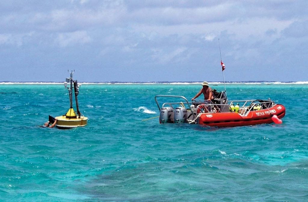
Among its variety of duties, the National Weather Service (NWS) “provides current, accurate information relating to the U.S. coast, coastal and offshore waters, and the open oceans to ensure the safety of life and property.” All NWS offices along the coast have a special marine unit. To check current conditions go to either the NWS homepage at weather.gov or nws.noaa.gov/om/marine/home.htm. On the U.S. map, just click on your location, which takes you to your local NWS office. Next, click on Marine Weather on the menu bar. The NWS maintains a network of coastal stations and offshore buoys that are constantly monitoring sea and air conditions. There are also private ships that take observations and relay them to the NWS. You can obtain the latest buoy reports—a few even have cameras—either from the local NWS office or the source, the National Data Buoy Center at ndbc.noaa.gov. Data includes current conditions in terms of air temperature, wind speed with gusts and wind direction, atmospheric pressure and tendency, and water temperature. Some buoys also report wave height, wave period and wave direction. Don’t forget to check the local radar, which shows precipitation, especially dangerous thunderstorms.
You can also get your weather forecast here, as marine forecasts are prepared by the local NWS Office every 6 hours. Besides basic training in meteorology, all NWS marine forecasters have completed special training specifically targeted for marine forecasting. The “Nearshore Marine Forecast” or “Coastal Waters Forecast” covers a specific given area from the coastline out to 20 nm. A brief synopsis of weather conditions is followed by a forecast that includes wind direction and speed, sea heights, sea condition, and any expected precipitation for the next 5 days.
This is followed by an “Offshore Marine Forecast” or “Offshore Waters Forecast” that goes out from 20 to 60 nm and is “mainly geared to those mariners operating further off shore, a day or more from safe harbor.” These are issued by the Ocean Prediction Center in Washington for offshore New England and the Mid-Atlantic (opc.ncep.noaa.gov/Atl_tab.shtml) and by the Tropical Analysis and Forecast Branch (TAFB) of the National Hurricane Center (NHC) in Miami for the Southeast offshore waters, the Caribbean and the Gulf of Mexico (nhc.noaa.gov/marine/). The forecasts follow the same format as the “Nearshore”. Beyond this there are “High Seas Forecasts” which are “geared to the needs of the largest ocean-going vessels” and emphasize “gale force or worse conditions”. These again are produced by the TAFB and the Ocean Prediction Center.
Besides basic forecasts of weather and sea conditions, the NWS Marine Forecasts include marine warnings for potentially dangerous weather or sea conditions. Advisories and warnings will be headlined in the standard forecast. These include the standard wind advisories and warnings from Small Craft Advisories to Gale and Storm Warnings to Tropical Storm and Hurricane Warnings. The NWS would also issue “Special Marine Warnings” if necessary. These are for “potentially hazardous over-water events, usually of short duration (up to 2 hours), including thunderstorms, waterspouts, squalls, wind shifts, and other short-lived conditions”.
Of course, the NHC is also the source for information on all tropical systems. The Atlantic Tropical Weather Discussion highlights all tropical activity and related weather for the Gulf of Mexico, Caribbean Sea and tropical Atlantic. The Tropical Weather Outlook deals specifically with tropical cyclones. Once a system is deemed to have reached tropical depression strength (a closed circulation), forecast advisories will be issued every 6 hours. Besides forecasts of center location and maximum wind speed, the areal extent of winds exceeding 34, 50 and 64 knots and seas exceeding 12 feet will be given for every 12 hours out to 3 days.
The government provides all of the information described above for free. If, however, you desire weather information specifically tailored for your needs be it a race, a cruise, etc., there are private companies whose services you can hire. They also have teams of trained marine meteorologists who will make forecasts for the specific locations and times you need. Such companies include Buoyweather (buoyweather.com), Weather Routing, Inc. (wriwx.com) and Ocean Weather Services (oceanweatherservices.com).
If you have access to the Internet, all of the government information is readily available, but there are also other sources. NOAA Weather Radio broadcasts the marine information described above continuously and is disseminated by the NWS and the U.S. Coast Guard. NOAA telephone recordings of marine information are also available from many NWS offices.
Of course, today, there are also apps that can provide up-to-date weather information. Buoyweather has its “Marine Weather” iPhone app. “Boating Weather” by Blue Whale Apps, Inc. is available on iTunes as is “OutCast – Weather” and “NOAA Marine Forecasts” by Ardan Studios, LLC. “SiriusXM Marine” is available from Sirius Radio. “Marine Weather” by Bluefin Engineering is an app for all Android, iOS and BlackBerry phones. Much of the information provided comes from the NWS but the data displays are typically customized.
By Ed Brotak, Southern Boating Magazine September 2016
INFORMATION:
-NWS Marine Warnings: nws.noaa.gov/om/marine/cwd.htm
-NWS Marine Weather Services: nws.noaa.gov/os/brochures/marinersguide_coastal.htm
-Map showing forecast responsibilities for Coastal Forecast Offices, NHC, and Ocean Prediction Center: opc.ncep.noaa.gov/marine_areas.php
-NWS Marine Forecasts phone numbers: nws.noaa.gov/os/marine/noaatel.htm


