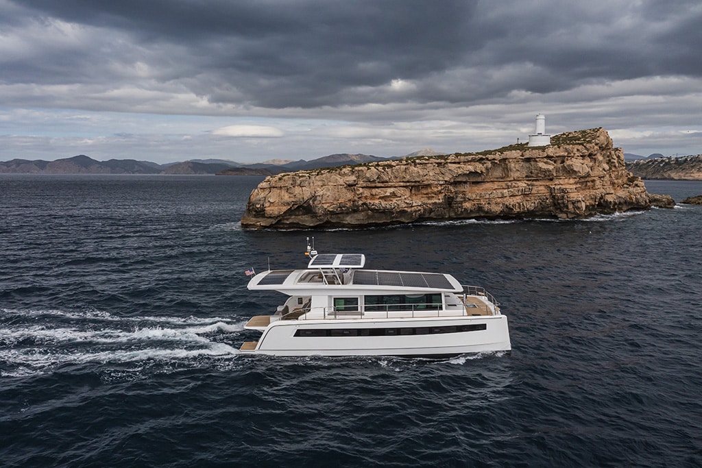
Find a spot along the East Coast to secure your boat if a storm threatens.
Monitoring the weather is a necessity when living at sea, especially during hurricane season. From June 1st to November 30th, the sky may be clear with light winds, but threatening weather may be approaching. If the long-range weather forecast predicts you may be in harm’s way, give yourself ample time to seek safe harbor in a hurricane hole.
What is a hurricane hole? The most simplistic answer is a location that provides protection from wind, waves, and storm surge combined with good opportunities for securing the boat and excellent holding for anchoring. Ideally, this location should minimize fetch from as many directions as possible or at least from the directions from which you expect the wind to be strongest. Additional advisements include the depth and type of seabed. Loose sand or soft mud does not provide the best holding.
What to Consider
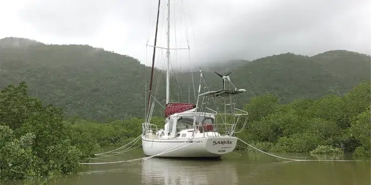
As you might expect, when selecting the perfect hurricane hole, focus on the details. To find a hole for your boat, consider well-protected creeks or mooring fields. Canals and narrow waterways can also be very effective as hurricane holes, especially if secured in the middle of the waterway using long lines tied to trees ashore. Multiple lines to shore will greatly improve your holding. In addition, securing your boat in a narrow body of water should provide protection from the impact of large, breaking waves which can be like battering rams in a storm.
The size of the area is critical. When you seek shelter is as important as where you seek shelter. Contending with other vessels can be extremely difficult. If multiple boats are pursuing the same spot, be sure to consider the swing radius of each boat as well as the captain’s ability to properly fasten the boat. Regardless of how secure you’ve made your own boat, if another vessel breaks free, it becomes an immediate threat to all other boats in the area.
Make a Plan
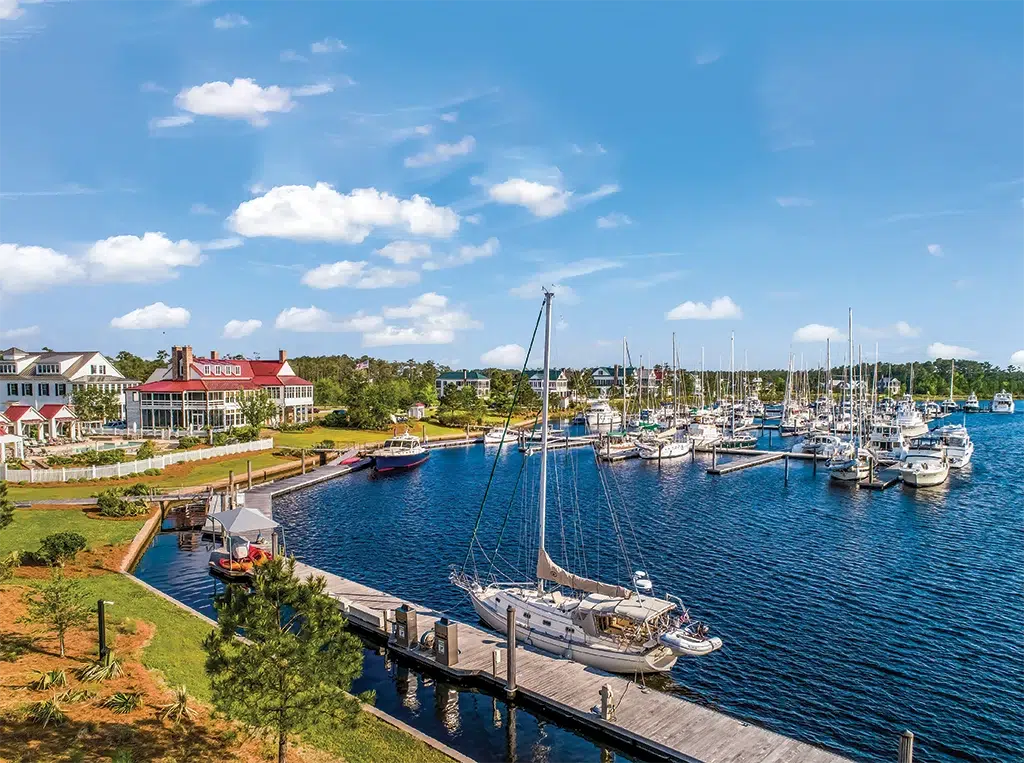
Marinas might also be suitable as a hurricane hole. Should you prefer a marina, it is important to find one surrounded by buildings and/or a local environment that provides wind protection from as many sides as possible. Those marinas must be well-constructed, preferably using floating docks with very tall pilings sufficient to exceed the maximum expected tidal surge. The marina must also maintain and enforce its own hurricane plans. These plans should require all vessels to be properly secured with additional lines and all canvas and exposed objects properly stowed. Without such, your boat is at risk from a less secured boat breaking free or loose objects becoming flying missiles.
Hauling-out your boat is often regarded as the safest of all your choices. Some insurance companies require a haul-out. Choosing this option requires advanced planning. Some marinas offer a hurricane haul-out program. If you have not signed up for such a program, be aware they will give priority to those who have prepaid for this service, leaving you to be the last to be hauled—and only if there is enough remaining space. In all cases, the marina should use heavy chain to tightly fasten all the jack stands to each other. In some cases, the marina will have the capability to secure your boat to embedded Helical eyes screwed into the ground.
Subscribe Here For Regular Boating Content
Bottom line, there are never any guarantees in a hurricane, no matter where you leave your boat. Accounting for storm surge is much more difficult at a dock; lines can be run to more distant pilings, but lines stretch, and pilings and piers will be much closer, typically only a few feet away. Boats that are anchored or moored can rise and fall with the surge. But pennants may fail, and you also face the considerable risk that the anchors (yours or someone else’s) will drag. Boats riding out the storm on land run the risk of one boat toppling over causing a domino effect with other tightly packed boats.
When the forecasters warn you to find a hurricane hole, here are a few locations from Florida up to the Chesapeake you might consider:
Florida – South: INDIANTOWN MARINA
27º 00′ 30.99″N ■ 80º 28′ 05.29″W
Located considerably inland on the Okeechobee Waterway, this marina is not susceptible to tidal surges and provides reasonably good wind protection. Indiantown Marina offers a hurricane plan that reserves time and space in its yard for a haul-out. It also uses screw anchors drilled into the ground to further secure your boat. Hurricane dockage is $3 per foot per night with a seven-day minimum that must be paid upon booking.
RIVER FOREST YACHTING CENTER – Stuart
27º 05′ 37.51″N ■ 80º 17′ 42.74″W
River Forest Yachting Center’s inland location provides convenient access to the Atlantic Ocean, Lake Okeechobee, and the Gulf of Mexico, making it the ideal choice for hurricane refuge. River Forest Yachting Center also offers enrollment in its “Hurricane Club.” Members are guaranteed wet or dry boat storage space. Buildings are hurricane rated for boats up to 90 feet, and the dry storage includes augers to securely strap down your boat.
Florida – North: LAMBS YACHT CENTER
30º 16′ 18.21″N ■ 81º 43′ 08.44″W
This marina is located approximately 25 miles inland near Jacksonville, Florida. It is situated on the Ortega River, which is a tributary off the St. Johns River. The marina is constructed with concrete docks and a concrete roof. Lambs is the last marina on the Ortega River just past Port 32-Ortega Landing and Huckins Marina, both of which may also provide decent shelter.
Georgia: BRUNSWICK LANDING MARINA
31º 09′ 09.85″N ■ 81º 29′ 57.27″W
For decades, this marina’s docks have been considered a hurricane hole. The land mass surrounding the marina provides protection on three sides. Past storms with tidal surges exceeding 15 feet have not presented a problem. Even the U.S. Navy uses this marina during storms!
South Carolina: OSPREY MARINA
33º 40′ 53.10″N ■ 79º 02′ 30.49″W
Located near Myrtle Beach is Osprey Marina. It’s situated at mile marker 373 on the Intracoastal Waterway with a private deepwater channel that’s 9 feet MLW. The marina is surrounded by tall trees which serve as a windbreak.
North Carolina: RIVER DUNES
35º 05′ 01.48″N ■ 76º 36′ 04.42″W
On the Neuse River in North Carolina, about a mile up Broad Creek, is Grace Harbor. This harbor is a manmade 26-acre basin (8-foot depths from shore-to-shore) and is an almost-perfect hurricane hole. If you prefer to tie up, within the harbor is River Dunes Marina. The marina’s floating docks have 13-foot pilings.
Virginia: PIANKATANK RIVER
37º 32′ 42.12″N ■ 76º 20′ 05.52″W
Near Deltaville, Jackson Creek is an excellent choice. Heading south just past Stingray Point, turn into the Piankatank River channel. At the channel junction, turn north and look for the Jackson Creek channel markers. The channel makes a sharp dogleg before it splits. Both branches are well-protected anchorages.
Chesapeake Bay – South: POTOMAC RIVER
38º 07′ 18.13″N ■ 76º 24′ 38.82″W
A tributary just off the Potomac, Smith Creek offers an outstanding location. Smith is six miles inside the Potomac on the north shore. The entrance is winding but easy to follow. Inside, you’ll find protected anchorages a mile upstream in a series of small coves. The best location is the first cove to starboard after Jutland Creek exits to the east. Favor the port side going in and take the starboard fork. This anchorage is surrounded by trees providing protection from every direction.
South River
38º 56′ 21.54″N ■ 76º 30′ 42.15″W
Seven miles south of the Chesapeake Bay Bridge and three miles up South River, you’ll find Harness Creek which holds a small but deep alcove that is protected on all sides. Many bay boaters consider this the best storm hole on the entire bay. Quiet Waters Park marks the eastern entrance to Harness Creek, where a shoal extends from the first point on that side. Follow the creek, staying always to starboard to curl around the next point. Round the point to the south and you’ll find yourself surrounded by trees.
Chesapeake Bay – North: WORTON CREEK
39º 16′ 44.96″N ■ 76º 10′ 10.78″W
There is plenty of room and deep water outside the creek entrance, with north-south protection. Farther in, behind the spit of land, is a large bay with moored boats, several marinas, and places to drop anchor. Well inside, opposite Worton Creek Marina, you’ll find depths of six or seven feet nearly to the Western Shore.
-by Don LaNeve


